The day was very hot and sunny, a big contrast compared to last year which seemed to consist of nothing but rain.
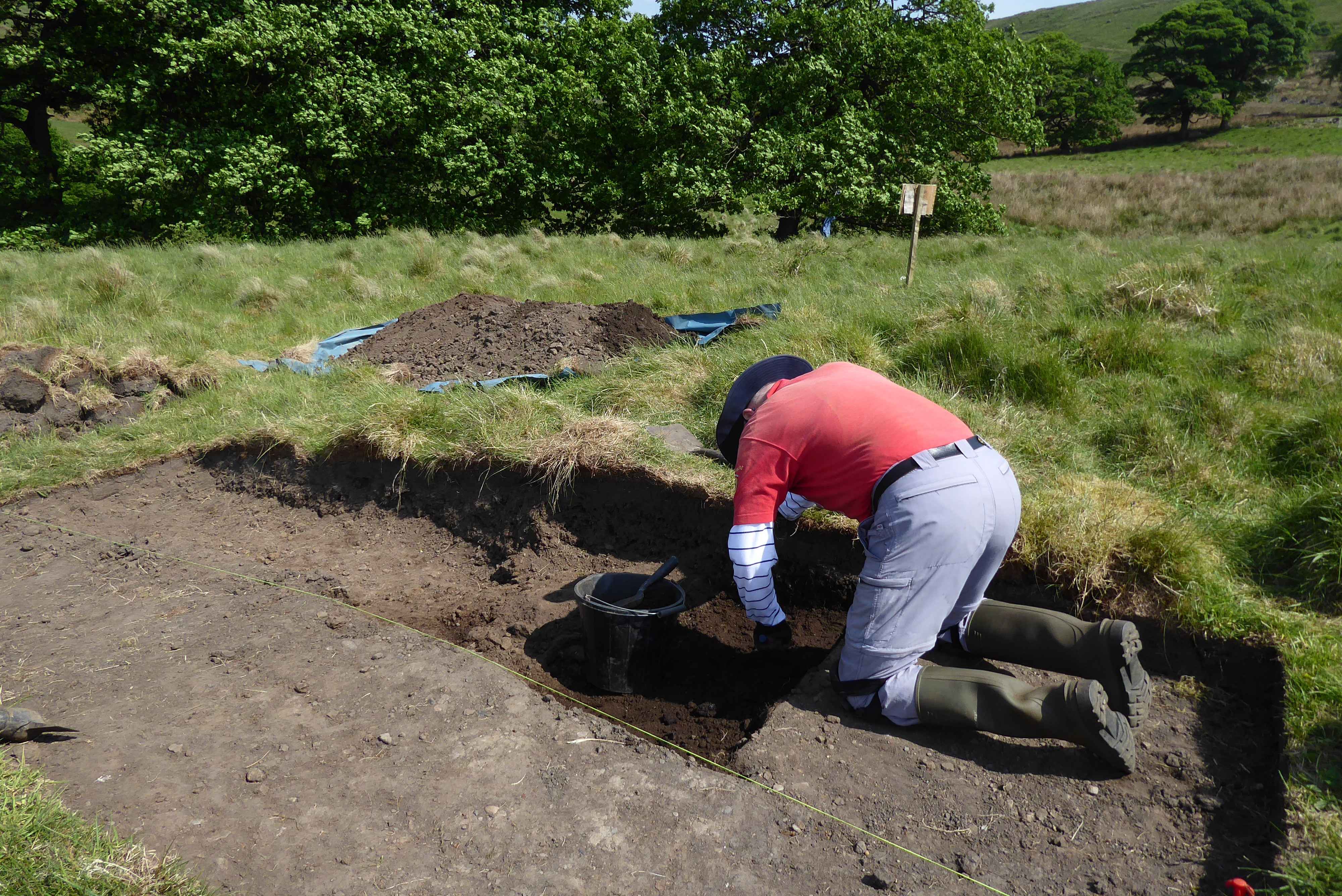
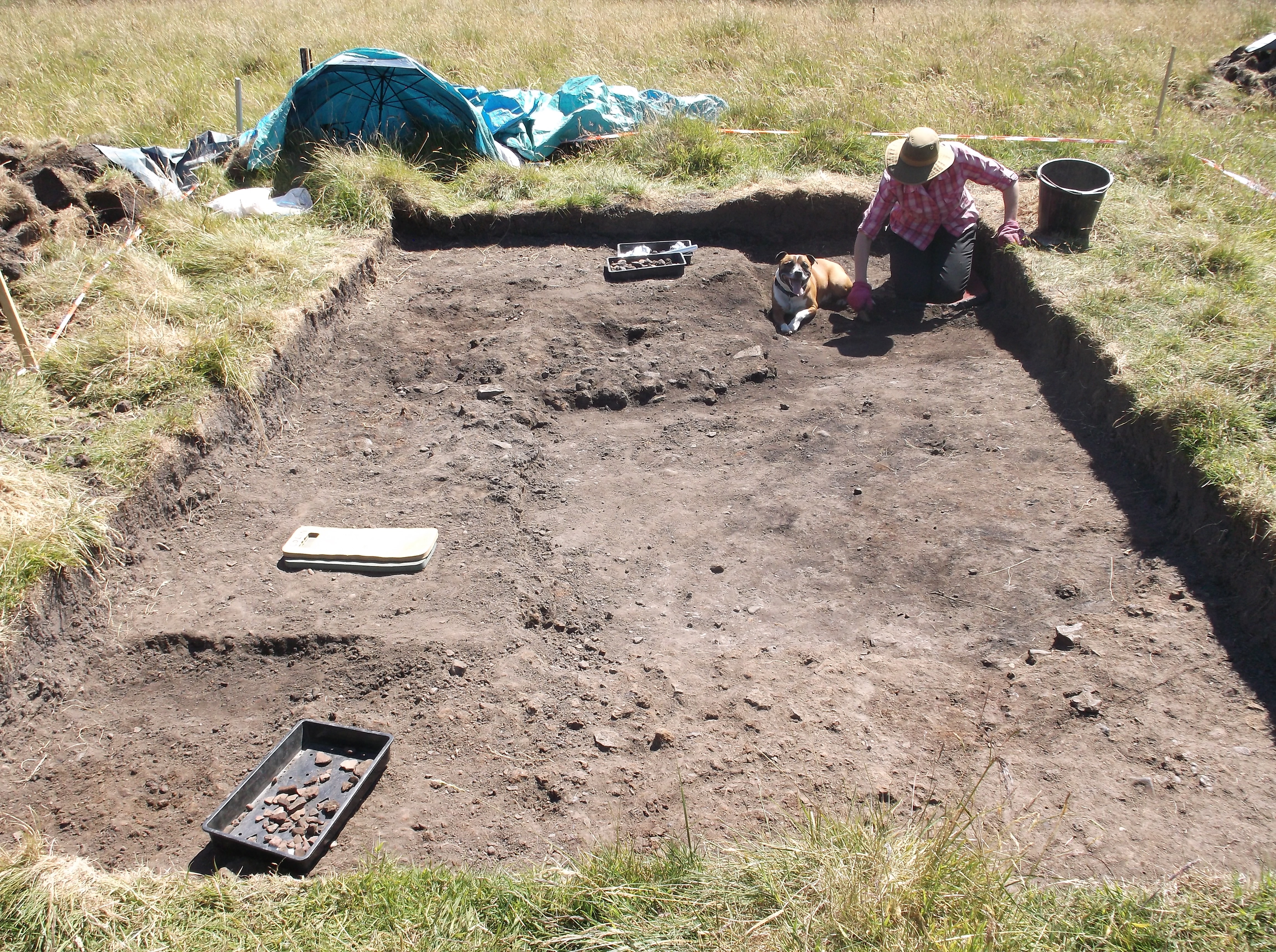
The day was spent surveying the grid, base line and positioning three trenches in areas which Neil is particularly interested in. Trench 1 was centred on a potential bloomery which was conveniently identified during the earlier ordnance sweeps of the area by Neil and the MOD when the metal detector registered a very high metal concentration. Trench 2 was laid out over an area which Neil thinks may have been used to roast the iron ore prior to smelting. Trench 3 was laid out across the edge of the ridge around the site where the ground breaks away to a lower level. Neil is interested to determine the ground composition between the plateau, potential working area and the surrounding ground. During smelting work the unwanted larger pieces of slag would be cleared off the work site, and this ridge could determine the extent of the working area.
The day was very hot and sunny. Commenced work on excavating the three trenches.
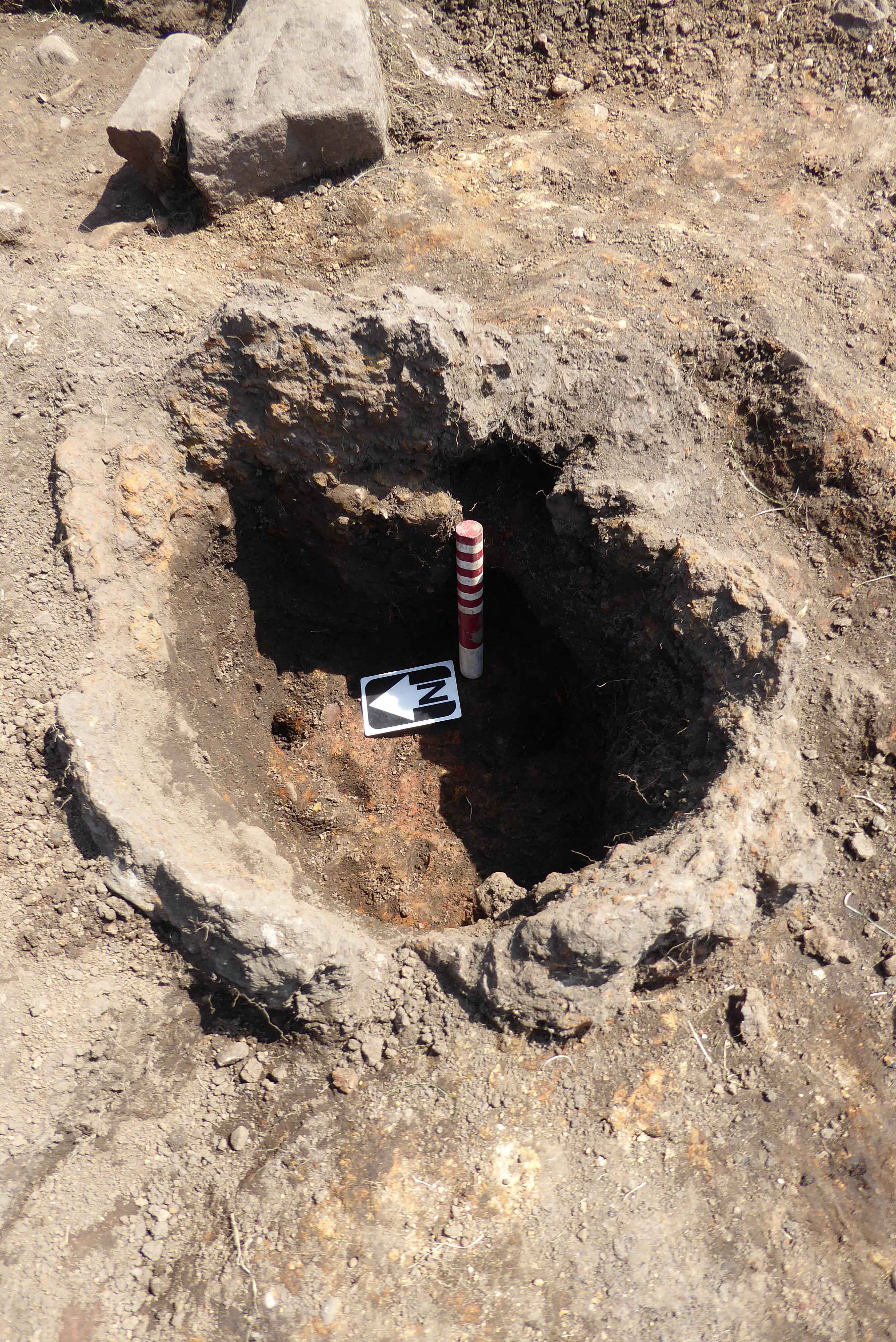
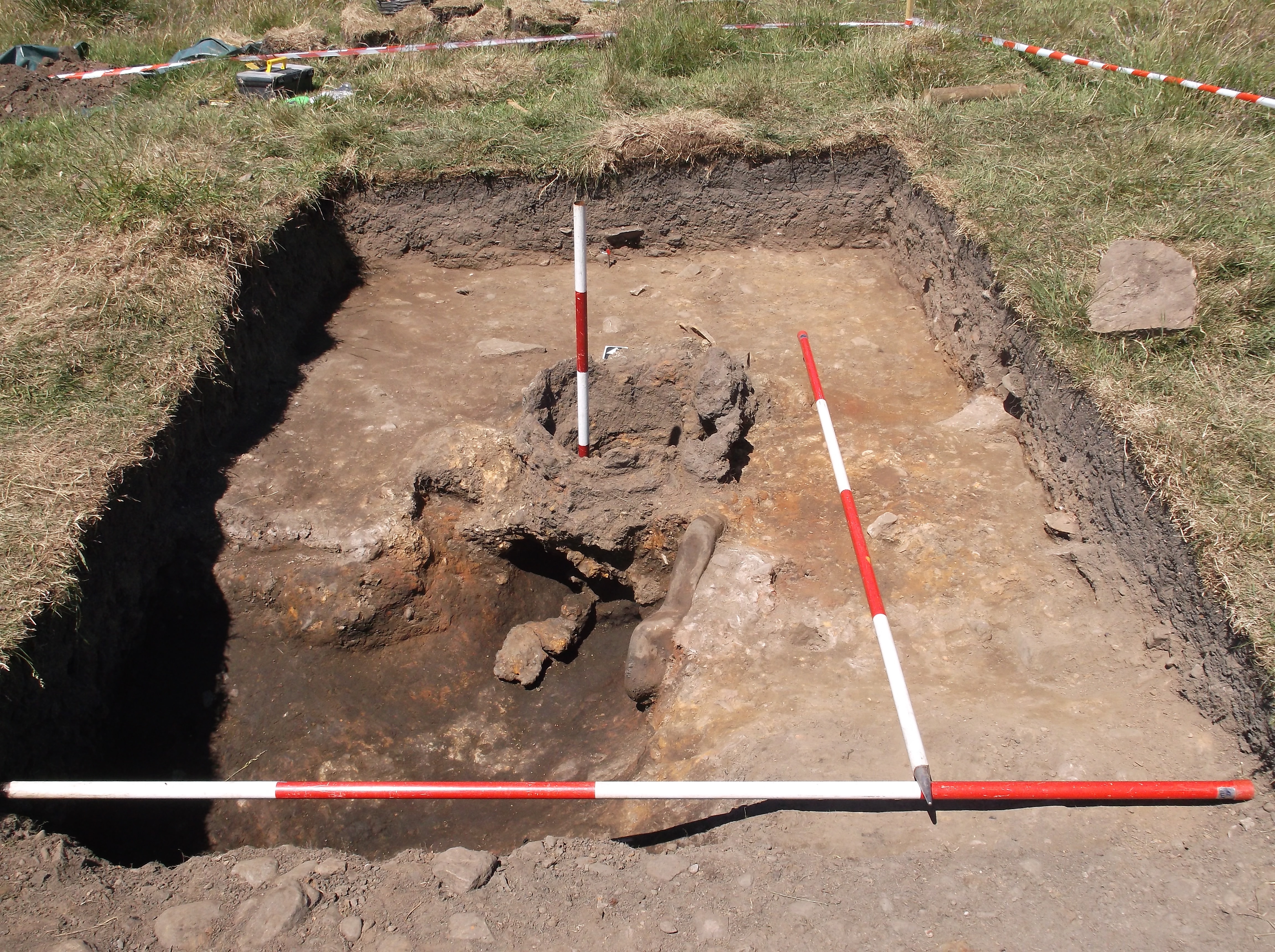
Trench 1. The expectations that the trench would contain a bloomery was soon confirmed as the rough circular outline of the remains of a bloomery started to appear.
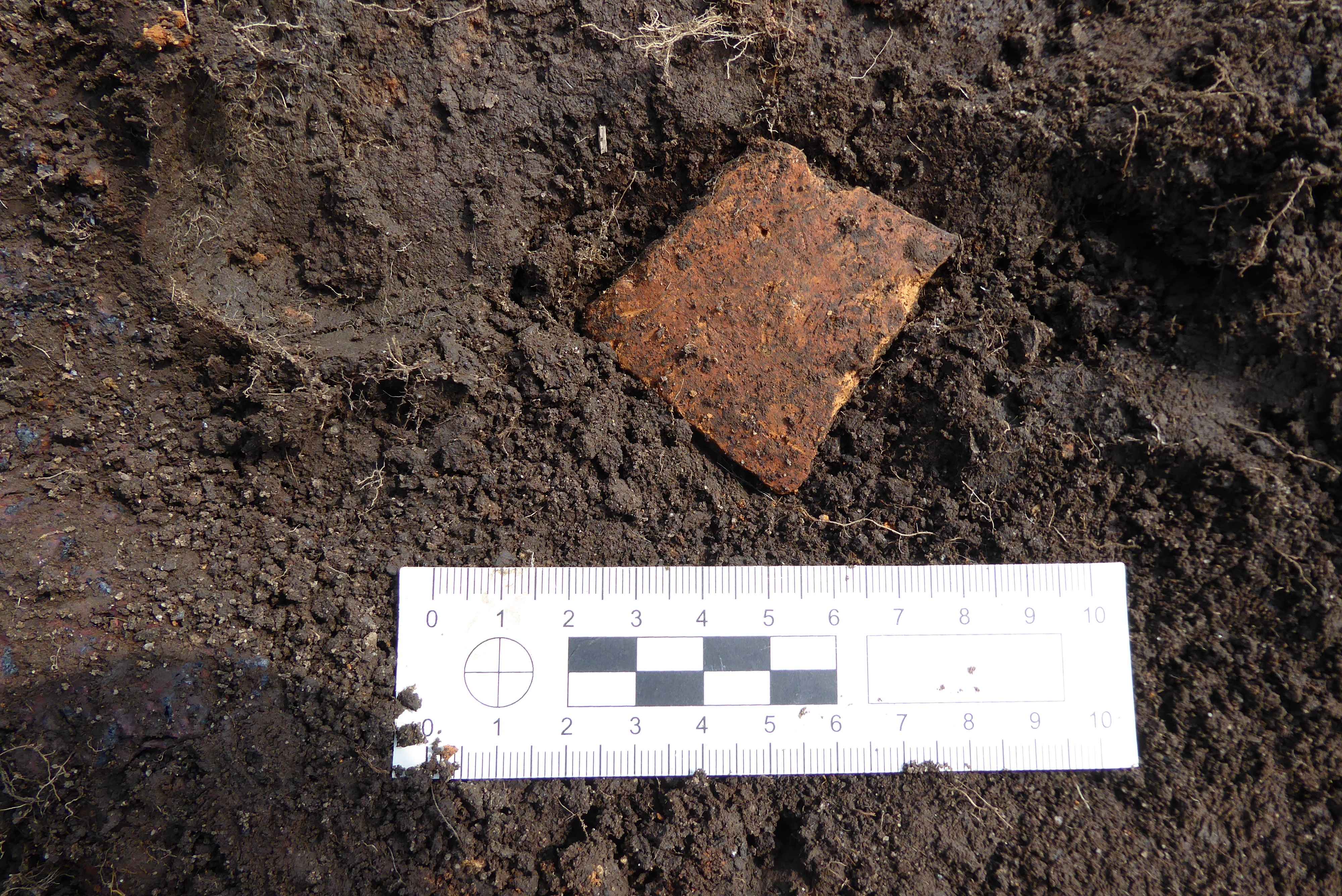
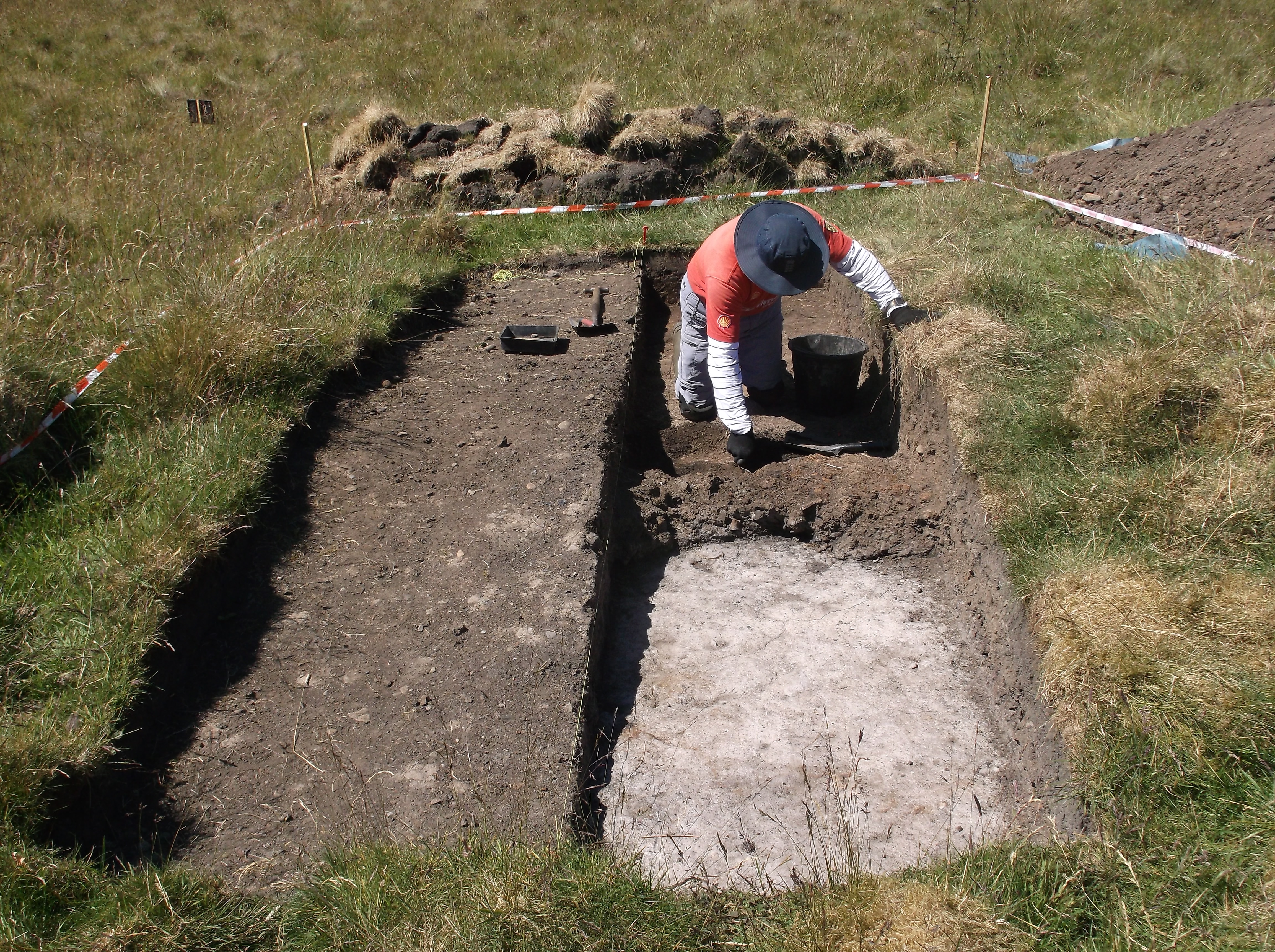
Trench 2. Other than a quantity of slag being uncovered there was only one very interesting find unearthed, this was a small pipe bowl. Neil later advised “The pipe bowl appears to be a Chester made form 48 and dates from 1640-1680. The bowl is burnished and has an internal width of about 12mm with a small spur underneath”. Photo 1
Trench 3. Due to its size, work on this trench was very slow. Other than a large number of pieces of slag being recovered, no finds of any significance were uncovered.
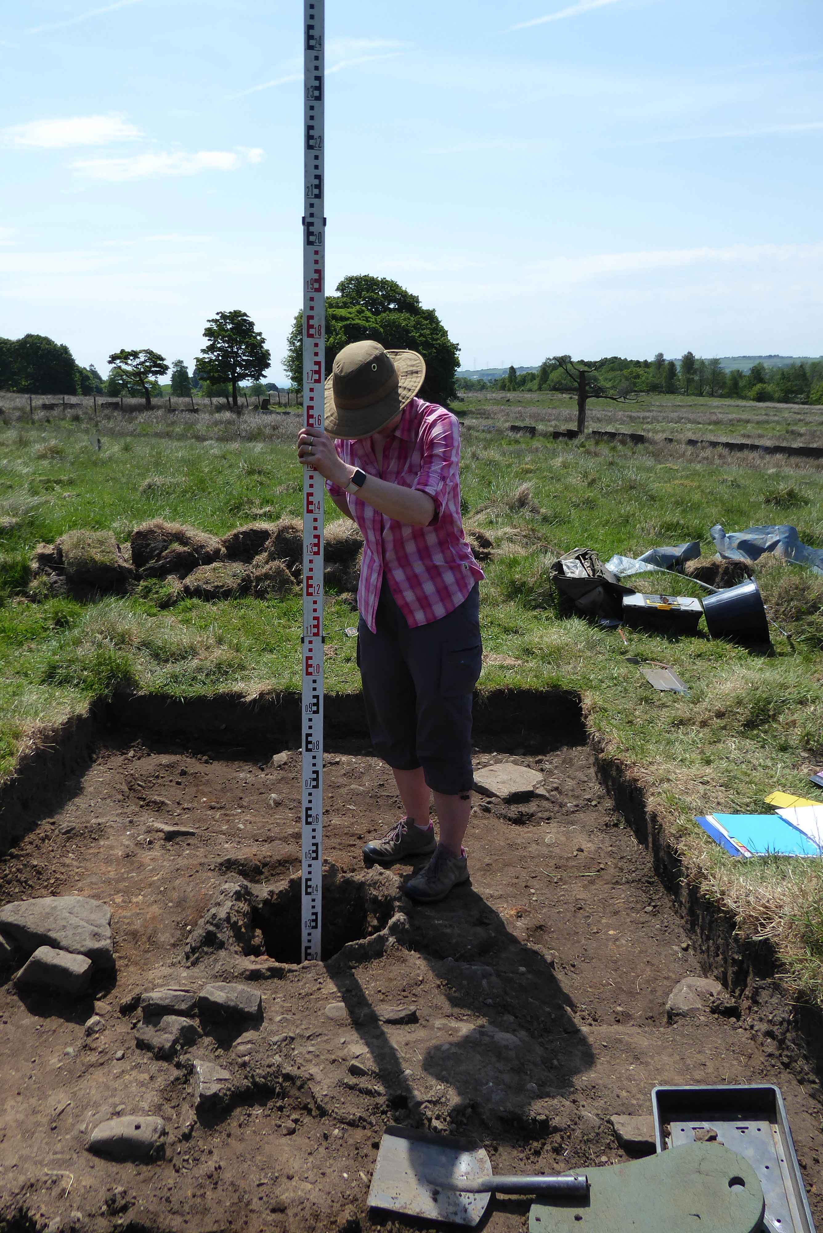
Measuring depth of Trench 1 Bloomery
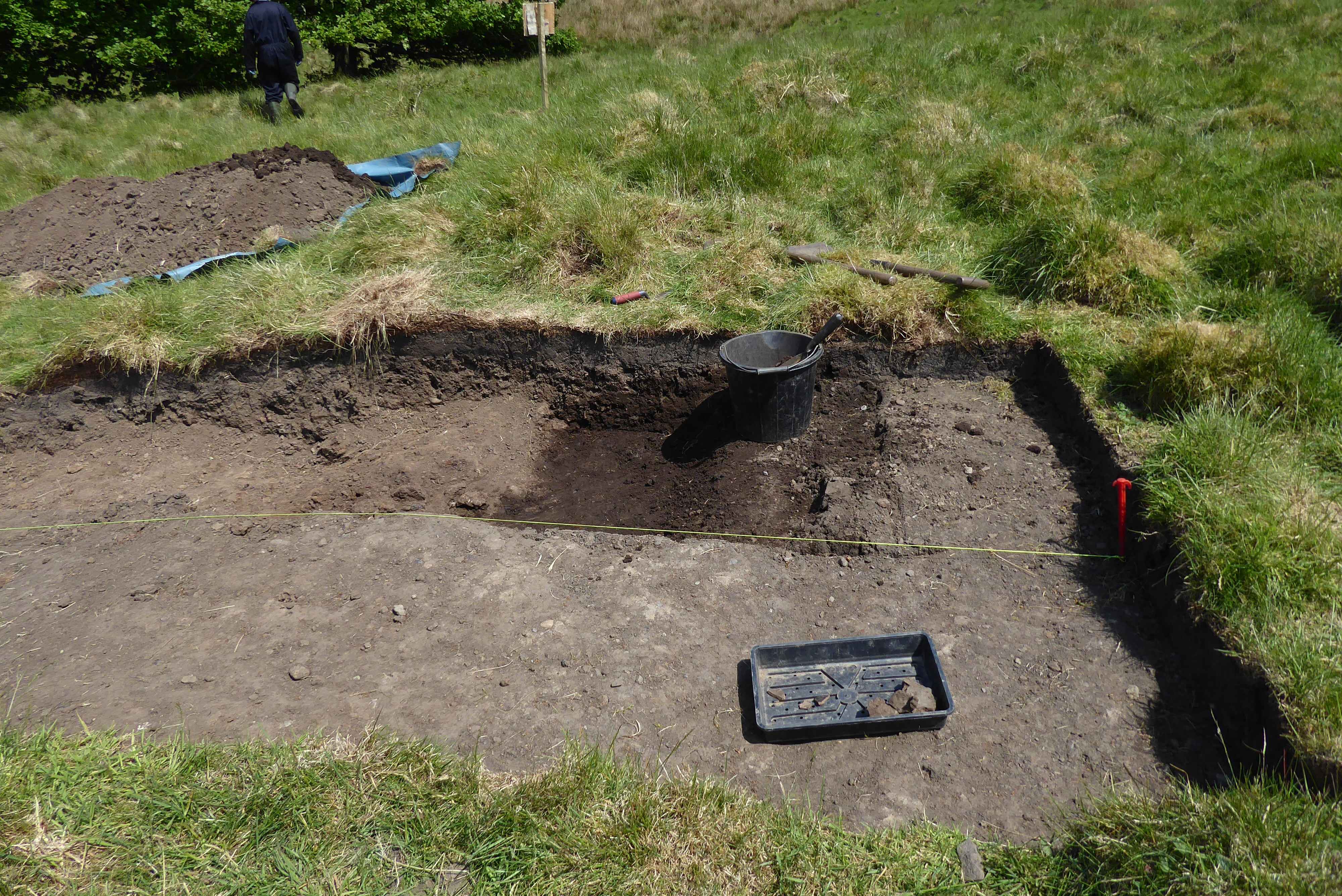
Trench 2 under guard
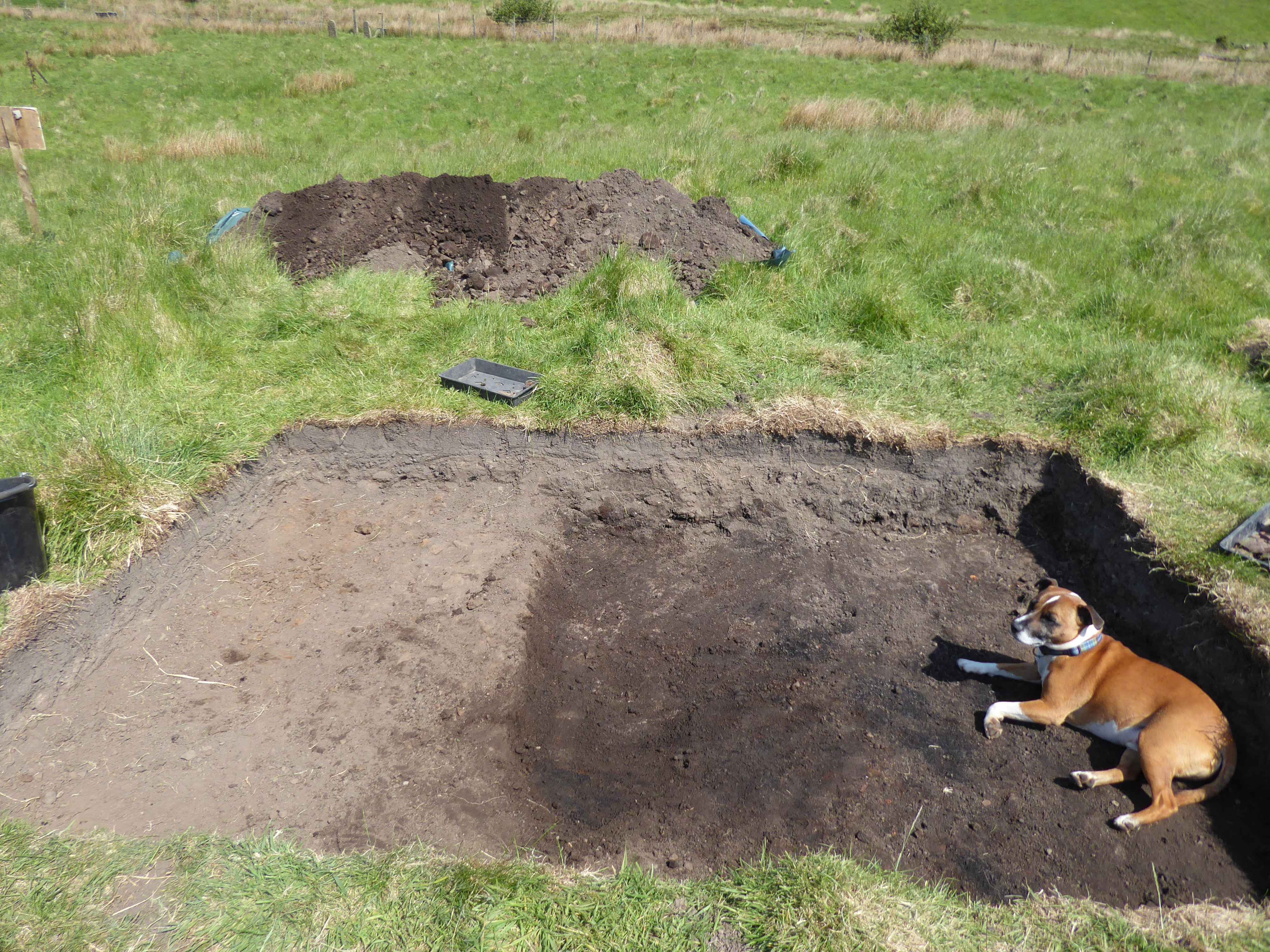
Trench 3
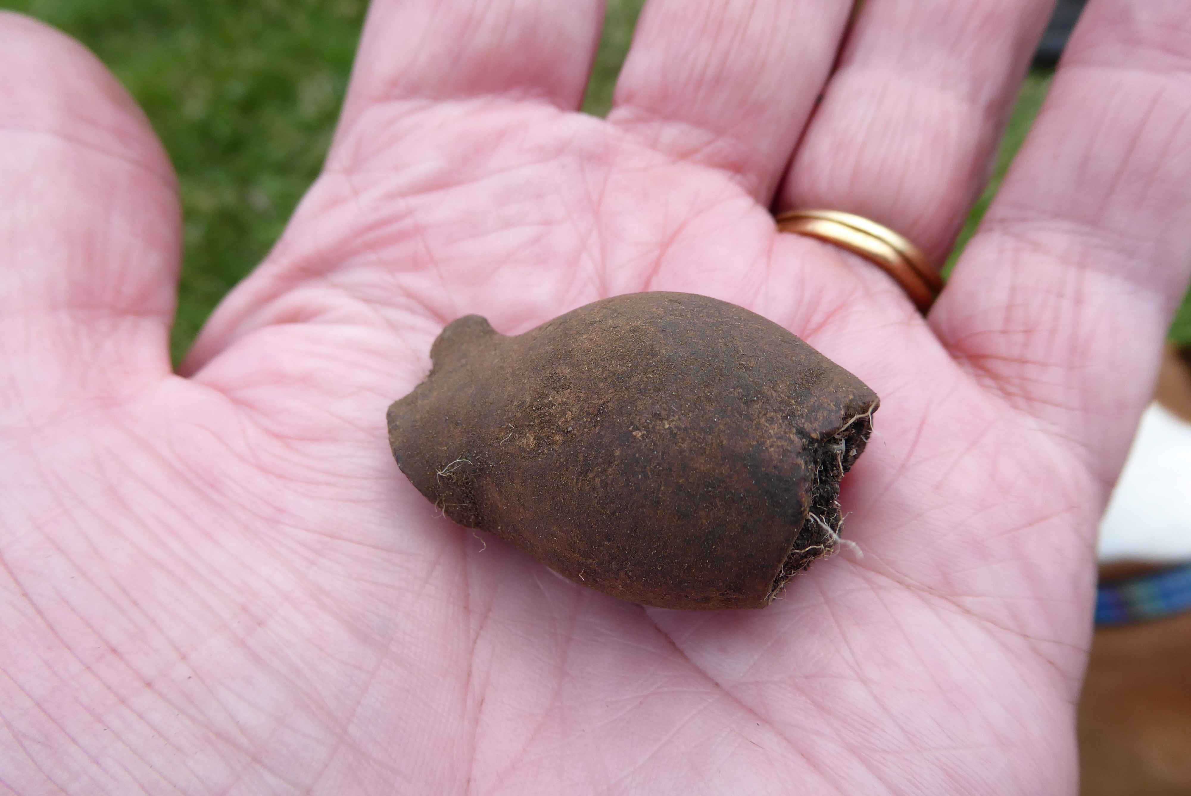
A small 17th century pipe bowl from Trench 2
Saturday 26th and Sunday 27th May
Trench 1. Excavation of the inside of the bloomery continued. Fairly confident the tap hole has been identified but the outside of the bloomery will have to be excavated to prove conclusively this is the case. Until the bloomery is completely excavated it will not be possible to determine its type. If you look at images of bloomeries on Google you will see there are a number of different designs’ although they all work on the same principle.
A single piece of mediæval gritty ware, photo 2, found in context very close to the bloomery, so very helpful in ageing the trench.
A very compact strip consisting of soil, small pieces of slag and pebbles identified adjacent to the south west corner of the bloomery was uncovered, purpose unknown; also a cobbled surface just beyond the thin strip. Trench will have to be extended in south westerly direction to try and identify the purpose of this cobbled surface. It may prove to be a working surface for another bloomery.
Trench 2. Some very large sherds of mediæval gritty ware pot recovered from the eastern edge of the trench Photos 3 and 4. The combination of the various finds are giving very strong indications as to the age of this particular area of the site, as the sherds of pottery found in both trenches 1 and 2 were virtually at the same level. It is very possible that the gritty ware found at Bottoms originally came from Cinder Hill Field having been taken down the hill mixed in slag and cinders, and used for levelling that section of Bottoms.
Trench 3. Work continues on this area, photo 5. The edge of the area consists mainly of largish pieces of slag with soil extending into the flat work area in an easterly direction. It is hoped that further excavations of this trench will unearth some items of interest, maybe even another bloomery.
Information on bloomery’s can be found on line most are very technical however a couple are less technical:
https://anitachowdry.wordpress.com/2014/07/30/the-ancient-art-of-smelting-iron-in-a-bloomery/
http://hist-met.org/images/pdf/hmsdatasheet05.pdf
If you would like further information on slag there is a very interesting article on the subject at http://hist-met.org/hmsslagintro.pdf
Part excavated bloomery
Gritty Ware from trench 1
Gritty Ware from trench 2
Cleaned trench 2 Gritty Ware
Trench 3
Overcast and cool, a few showers dampened the ground during the day. Fortunately the heavens only opened up with a vengeance once we were in the cars at the end of the dig.
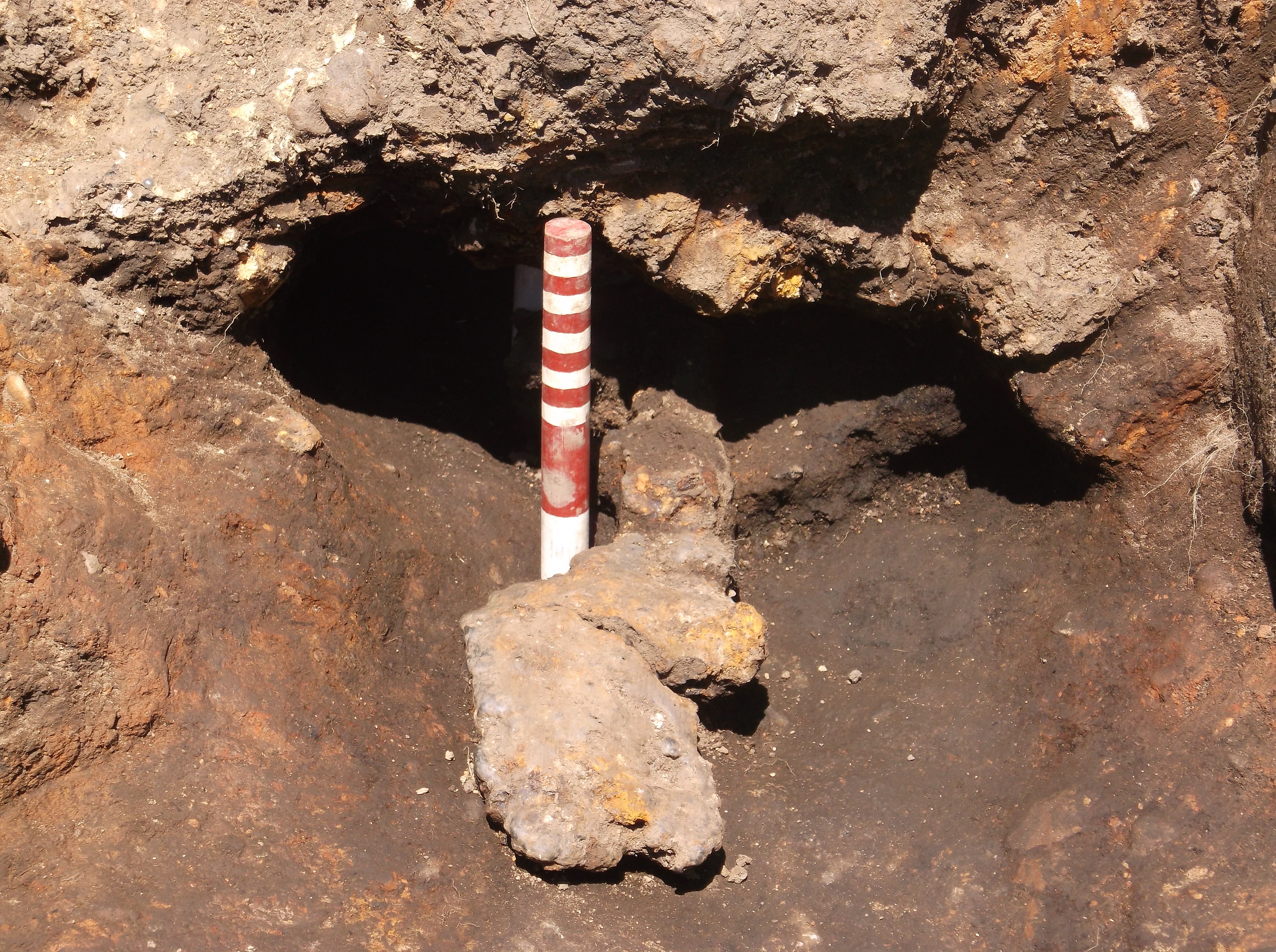
Work continued excavating the inside of the bloomery. There is a shelf of slag on the south side of the inside of the bloomery partially covering the tap hole. This may be the reason why the bloomery was abandoned. With the slag in that position it would have been very difficult to operate the bloomery. Photo 1
The strip of hard compacted soil and stones just to the south of the bloomery was removed, which revealed further heavily heated material. What is assumed to be the tap hole is covered by the same material and there is also a flat stone embedded in the material. The current theory is that once the bloomery was abandoned, the walls were collapsed shown by the heavily burnt material abundant on the west, east and south sides of the bloomery. Photo 2
The trench was extended by a further 2 metres to the south to enable further excavation of the pebbled surface uncovered in May, just to the south west of the compacted strip. Photo 3
Further excavations were also carried out to the north of the bloomery, where there is a distinct lack of burnt material compared to the west, east and south sides.
Work continued cleaning the slag deposit which covers the northern section of the trench. Work also continued cleaning the surface of the southern section of the trench which consists of a flaky grey clay; colouring and composition due to the clay having been subjected to heat. There are patches of black charcoal. There is a distinctive demarcation line between the northern slag layer and the southern clay layer. Photo 4
A very nice piece of medieval pottery was uncovered in the southern section, Photo 5. There is some debate as to whether it is part of the pot unearthed in May, as all the pieces have all been recovered from a small section of the trench, or whether it is part of a different pot. A visual inspection of all the pieces should determine whether different pots are involved.
Further cleaning work on this trench confirms there is a band of slag running through the centre of the trench. To the east of the slag the ground consists of flaky grey clay, clay which has been subjected to heat, as per the clay in trench two. This clay surface is very compact and smooth. Towards the west, on the other side of the slag, the ground dips away and appears to consist of the same heated clay. Further work on this area is needed to confirm this hypothesis. This would seem to indicate that the slag band was deposited on top of the clay in this particular formation. It would be necessary to track the slag band to determine whether this is an isolated accumulation or whether it extends around the perimeter of the site. Unfortunately, due to time constraints, it is unlikely the extent of the slag band will be investigated. Photo 6
The start of the day was overcast and cool, although rain threatened, it did not materialise.
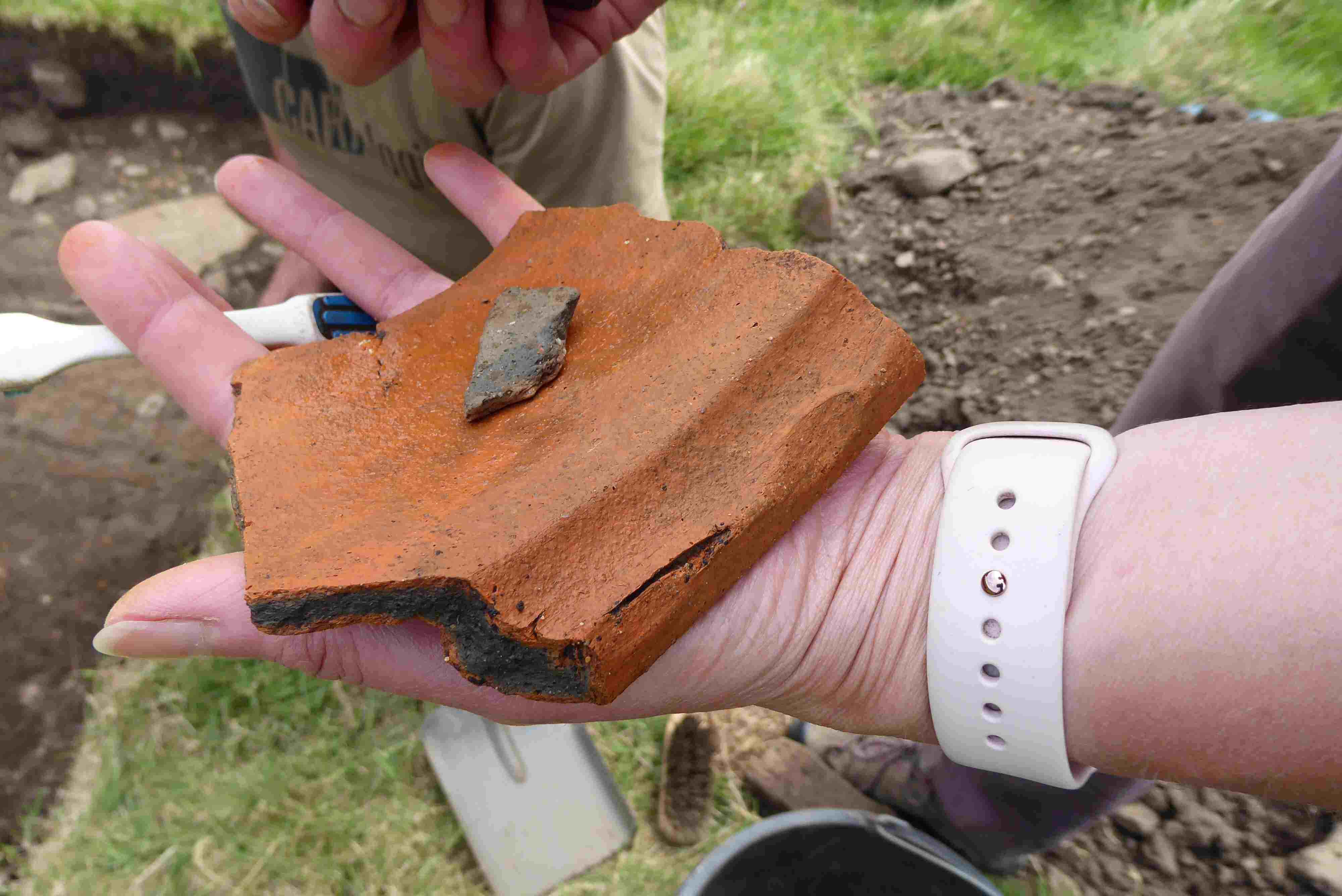
Work continues on excavating the two metre strip which was added to the southern end of the trench on Saturday, 16th June. The excavations revealed a relatively narrow cobbled surface running from west to east, photo 7. The width of the surface makes it too narrow to be a footpath so its purpose, at the moment, is open to conjecture. Further investigations may give some idea as to its purpose. It is very unlikely, however, that time will allow the surface to be followed outside the existing confines of the trench. Two sherds of gritty ware and a sherd of pottery, thought to be 17th century, were uncovered. Photo 8 shows one of the pieces of gritty ware. The picture shows the surface of the pottery and the small pieces of grit embedded in it, from which the pottery’s name derives.
Bloomery
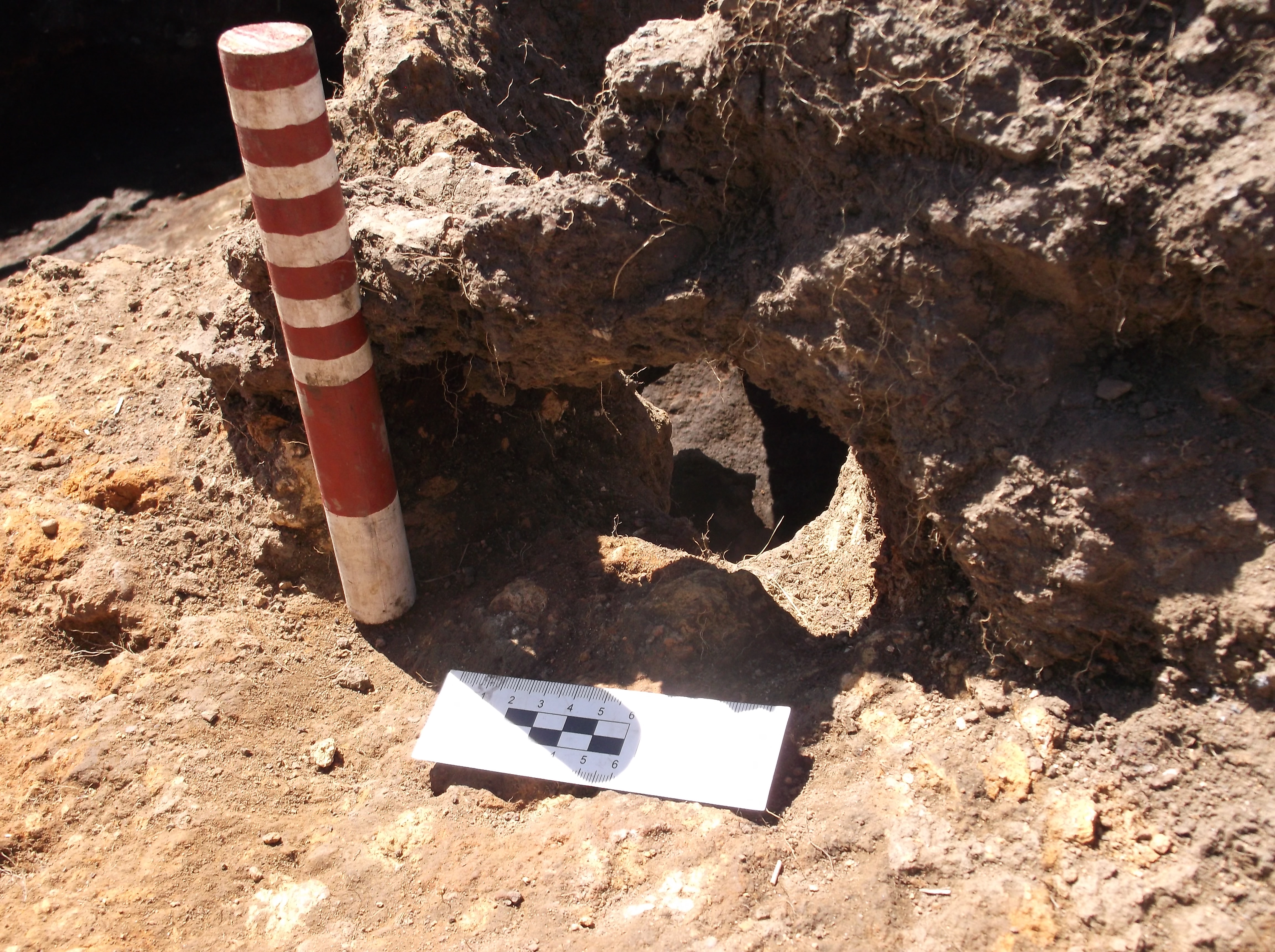
Further excavations of the bloomery has revealed that the tap hole and tap channel are on the south side of the bloomery and not the south west as previously assumed. The heavily heated clay covering the tap channel was removed, as a result the tap hole can be clearly seen. Photos 9, 10 and 11. It is also possible to see slag from the final burn still in the tap channel.
A sizeable piece of charcoal was recovered from under the tap channel which will be sent away for carbon dating. This could provide a possible date for the final firing of the bloomery.
The trench was extended one metre to the east and two metres to the south in an attempt to understand the purpose of the archaeology, photo 12. The slag layer at the northern end, approx. 1 metre wide, ends on a clay surface. Currently it is difficult to understand whether the slag was deliberately laid and terminated at this position or was removed to expose the clay substrate. A piece of gritty ware, photo 13, was found in the newly excavated north east corner of the trench. It has been found that the west to east running layer of slag turns at right angles on the east side of the trench and runs in a southerly direction. At the end of the day’s dig a piece of gritty ware was unearthed in the south west section of the trench.
Further excavation work continued in the west section of the trench, below the slag band. The amount of loose random pieces of slag removed in this section was far less than that removed from the upper section. The same type of clay was exposed on this side of the slag band as was exposed on the upper section, indicating that the slag was deposited on top of the clay, which should indicate that the clay layer is the natural covering for this area, photo 14. Two small pieces of glazed pot were recovered from this section of the trench. These are the only finds which have been recovered from this trench; one would have thought there would have been more.
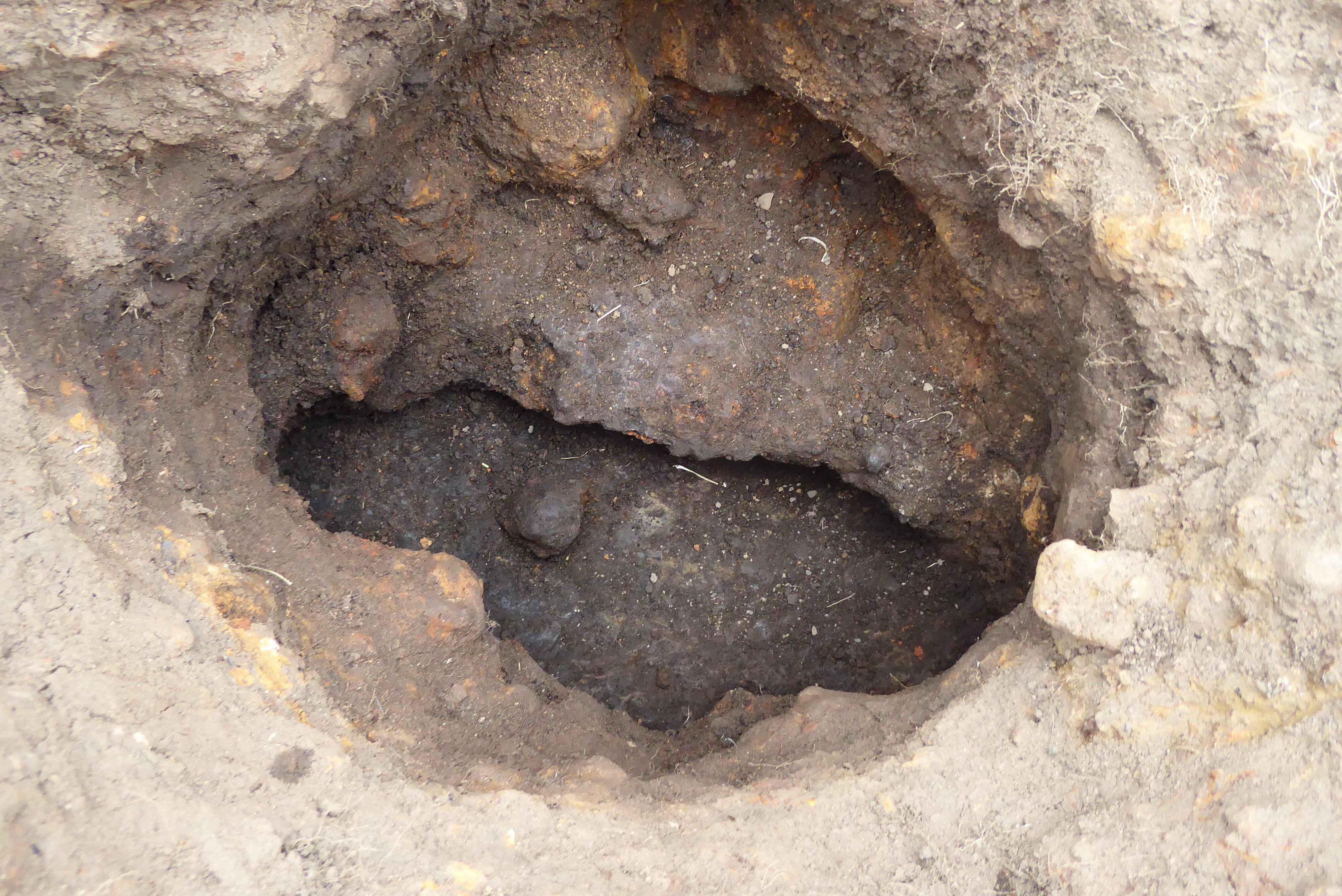
Photo 1
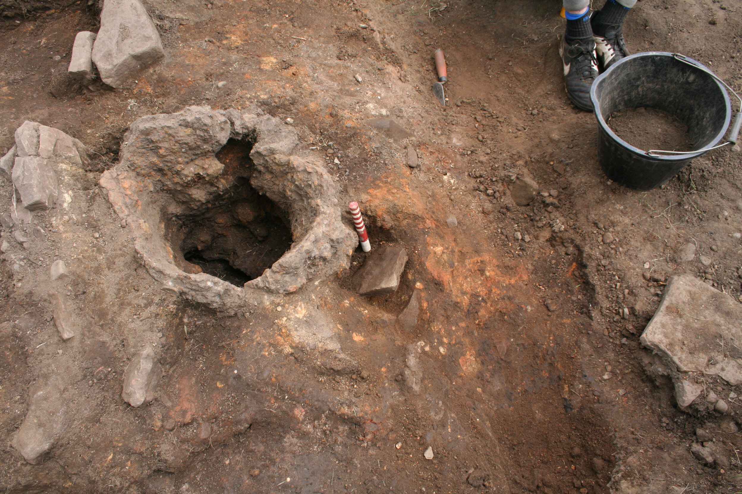
Photo 2
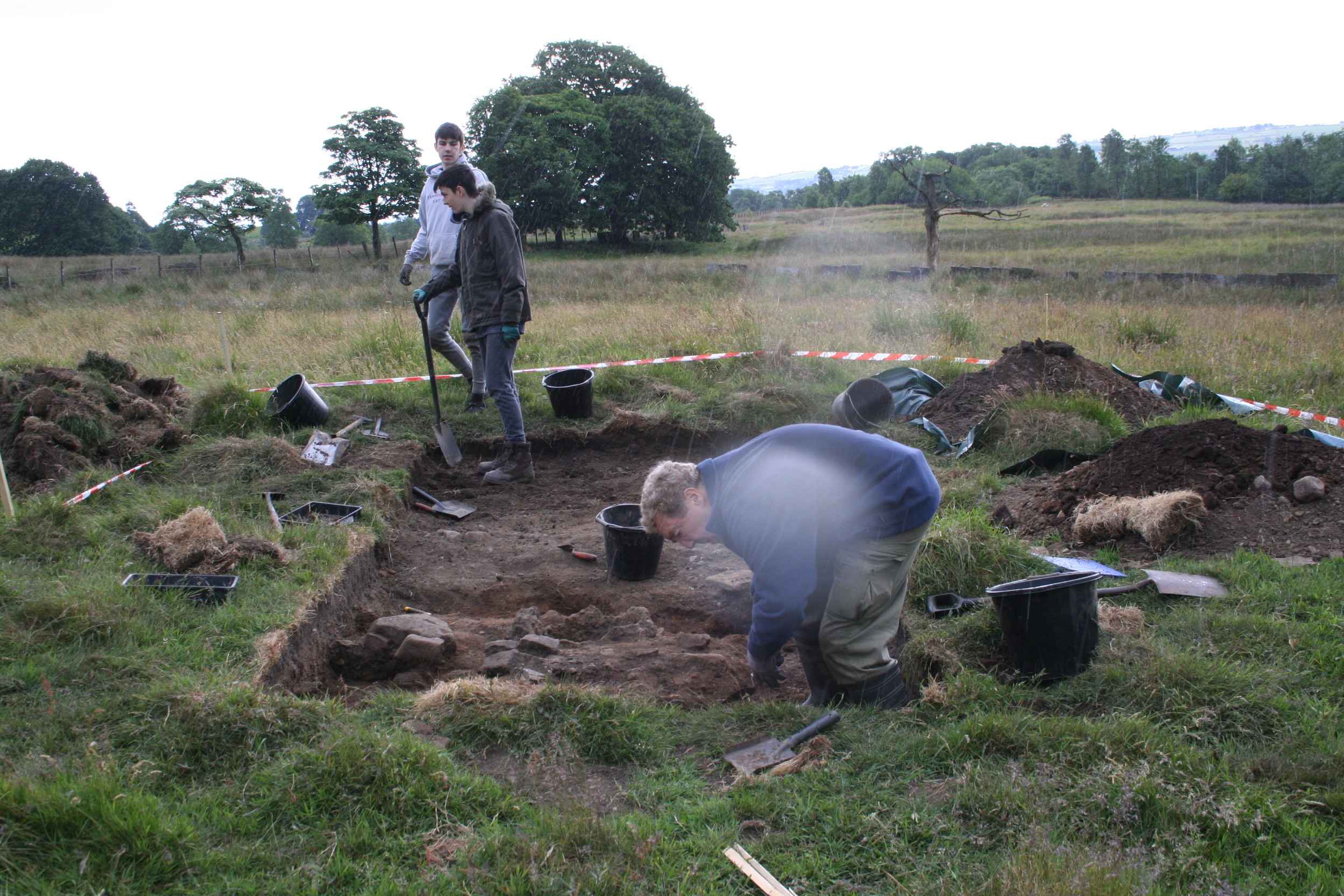
Photo 3
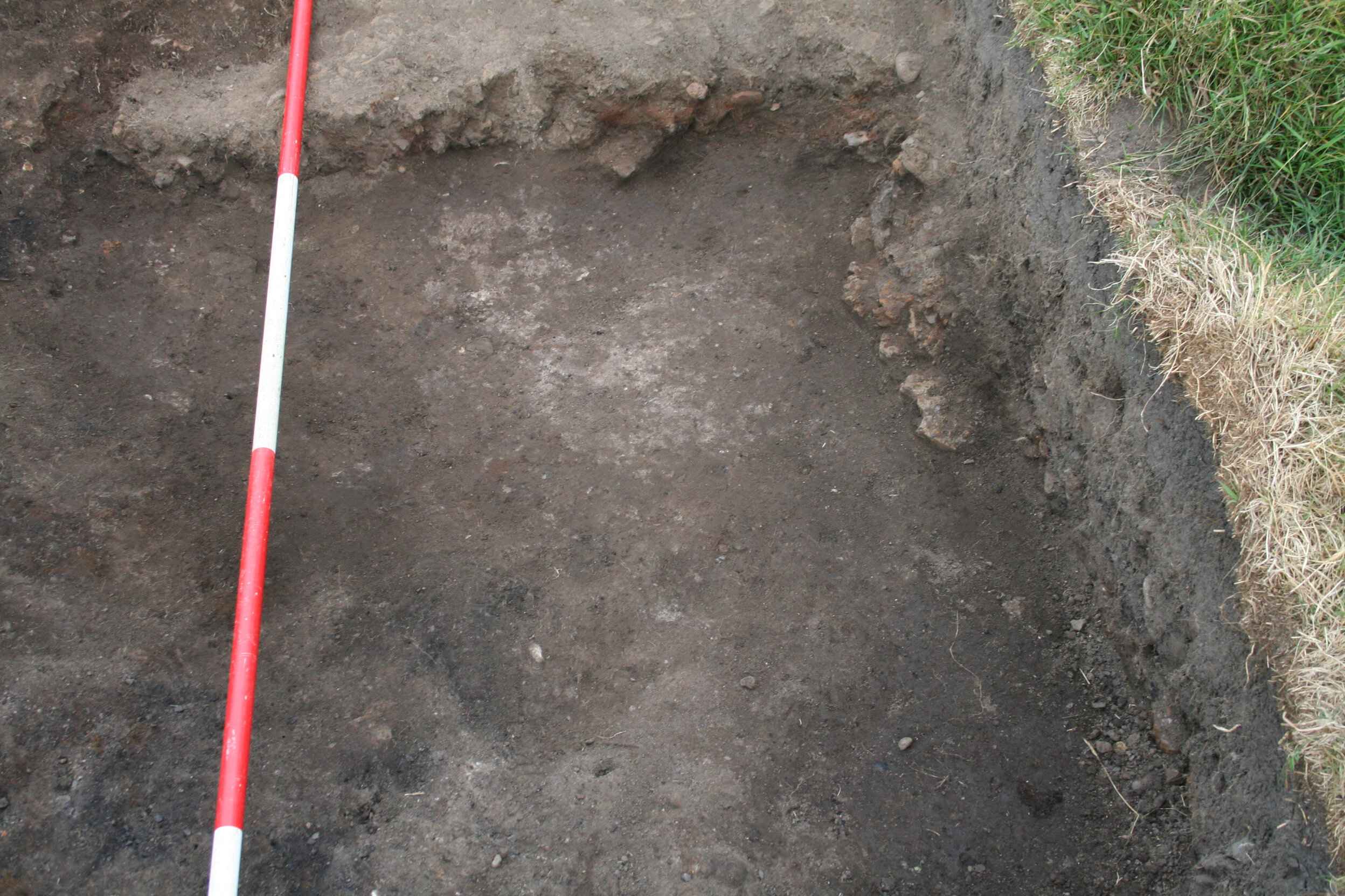
Photo 4
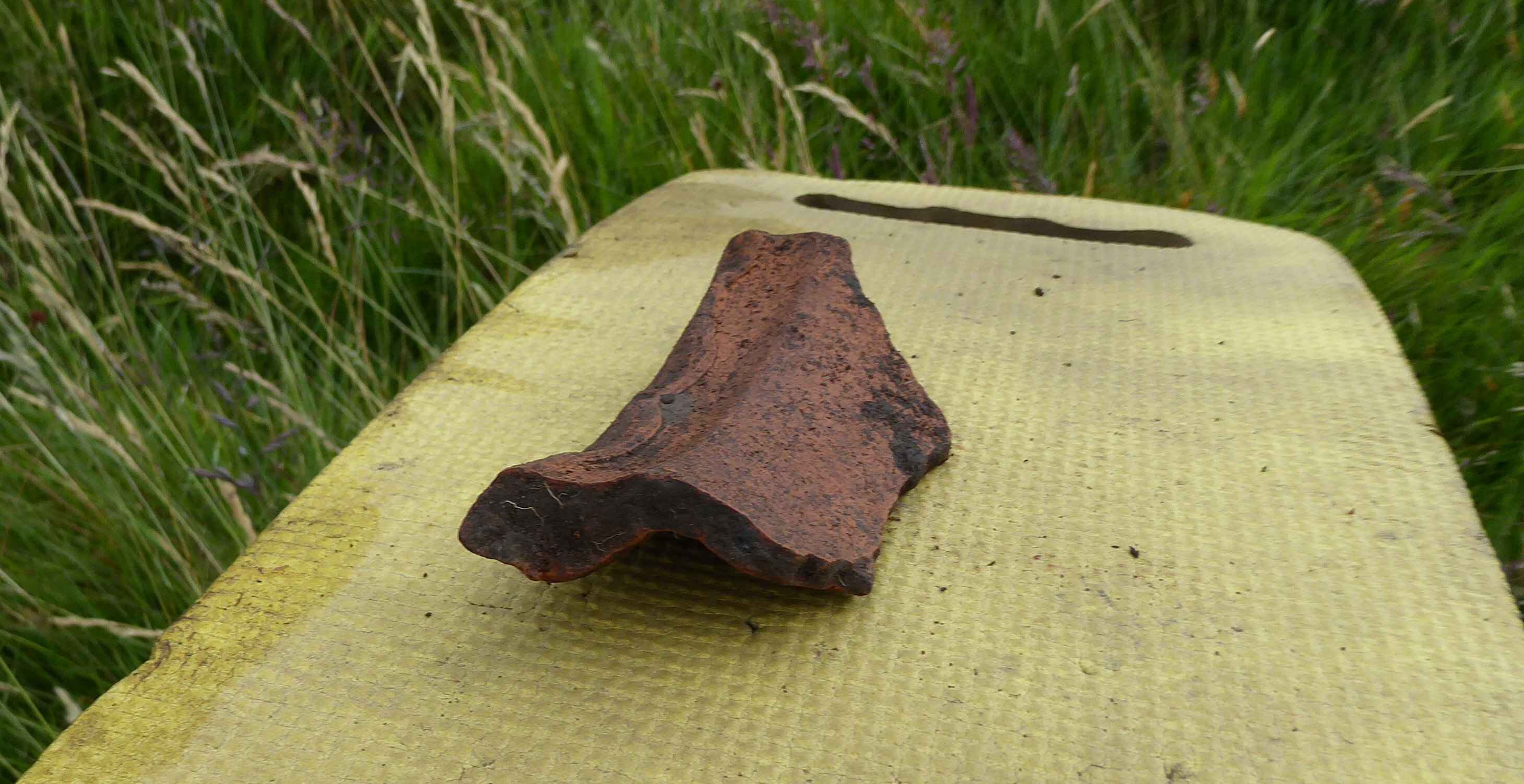
Photo 5
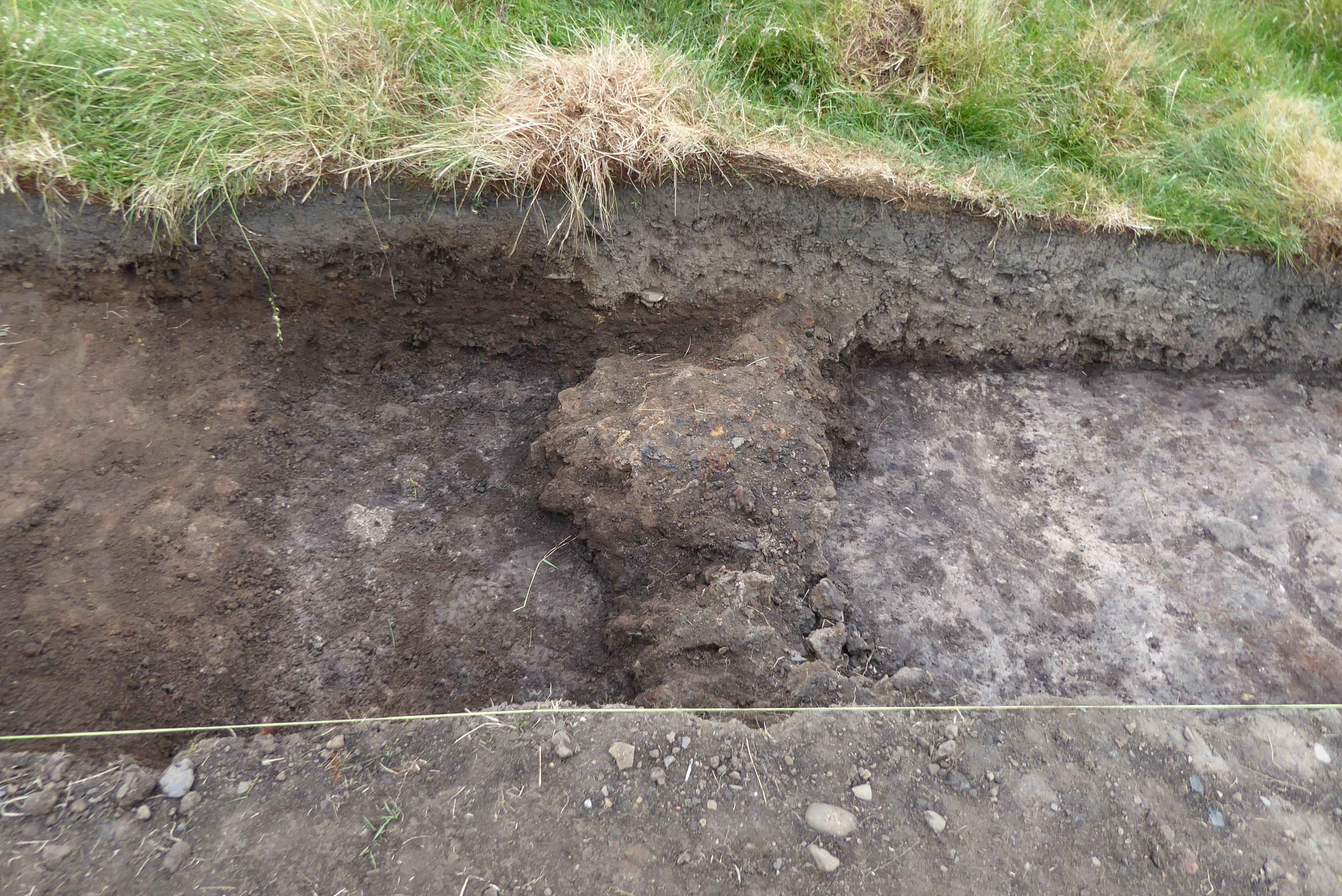
Photo 6
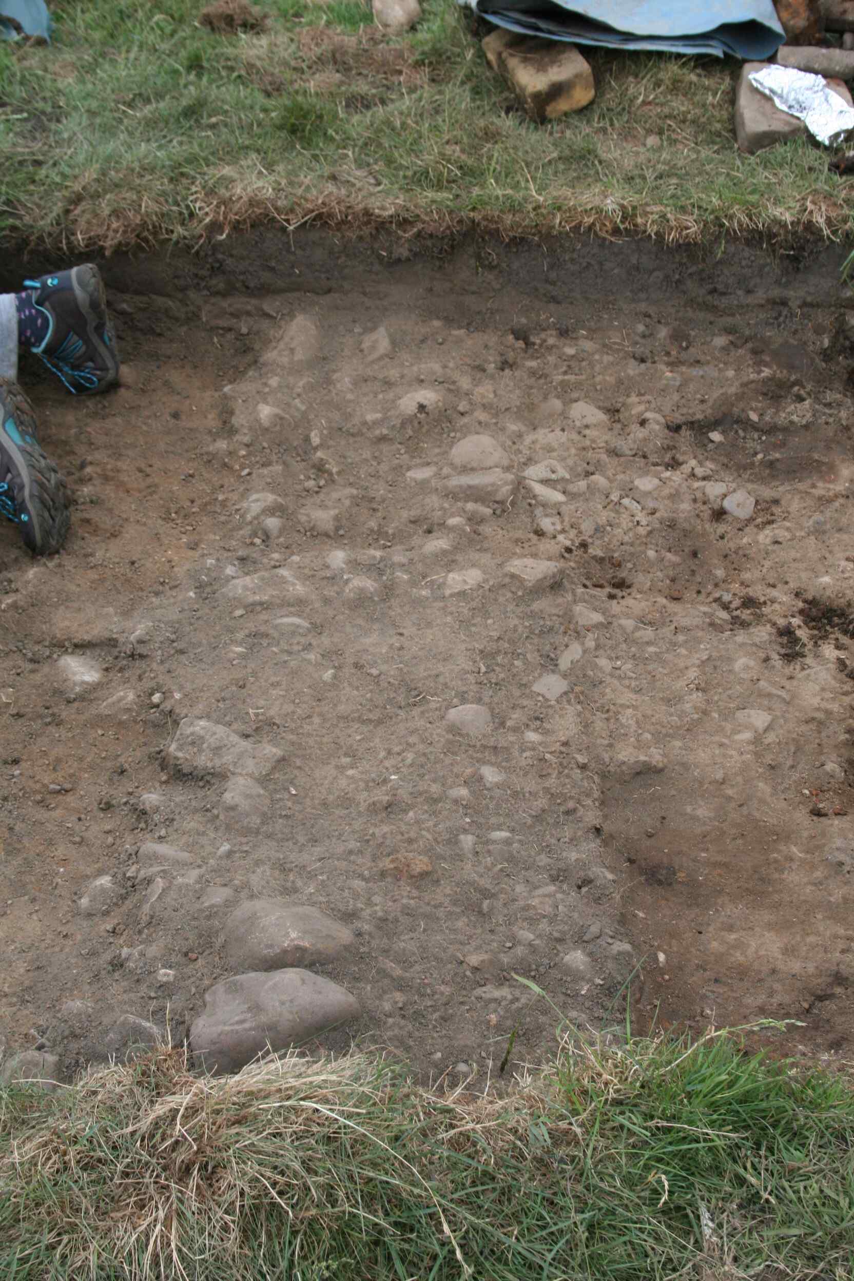
Photo 7
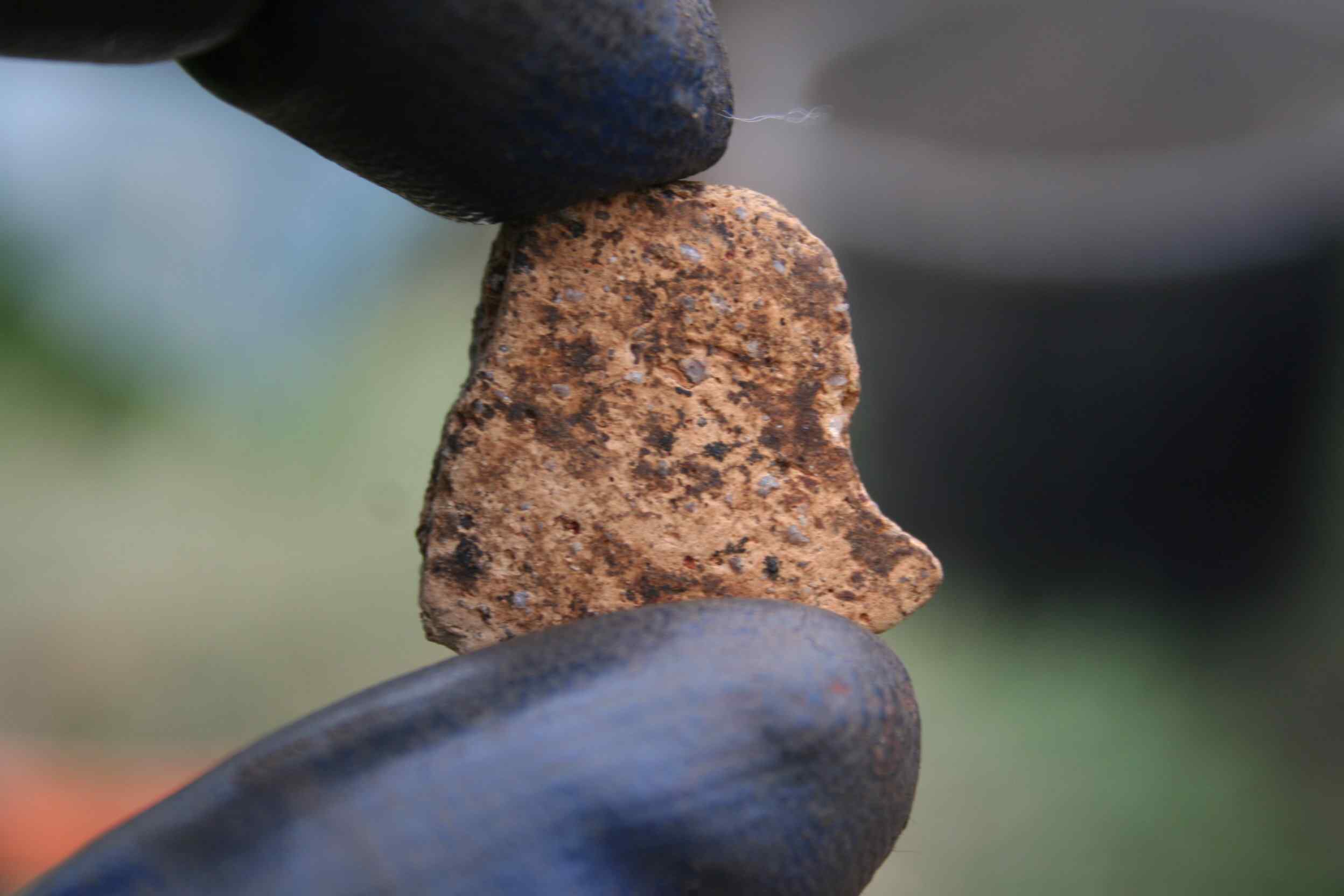
Photo 8
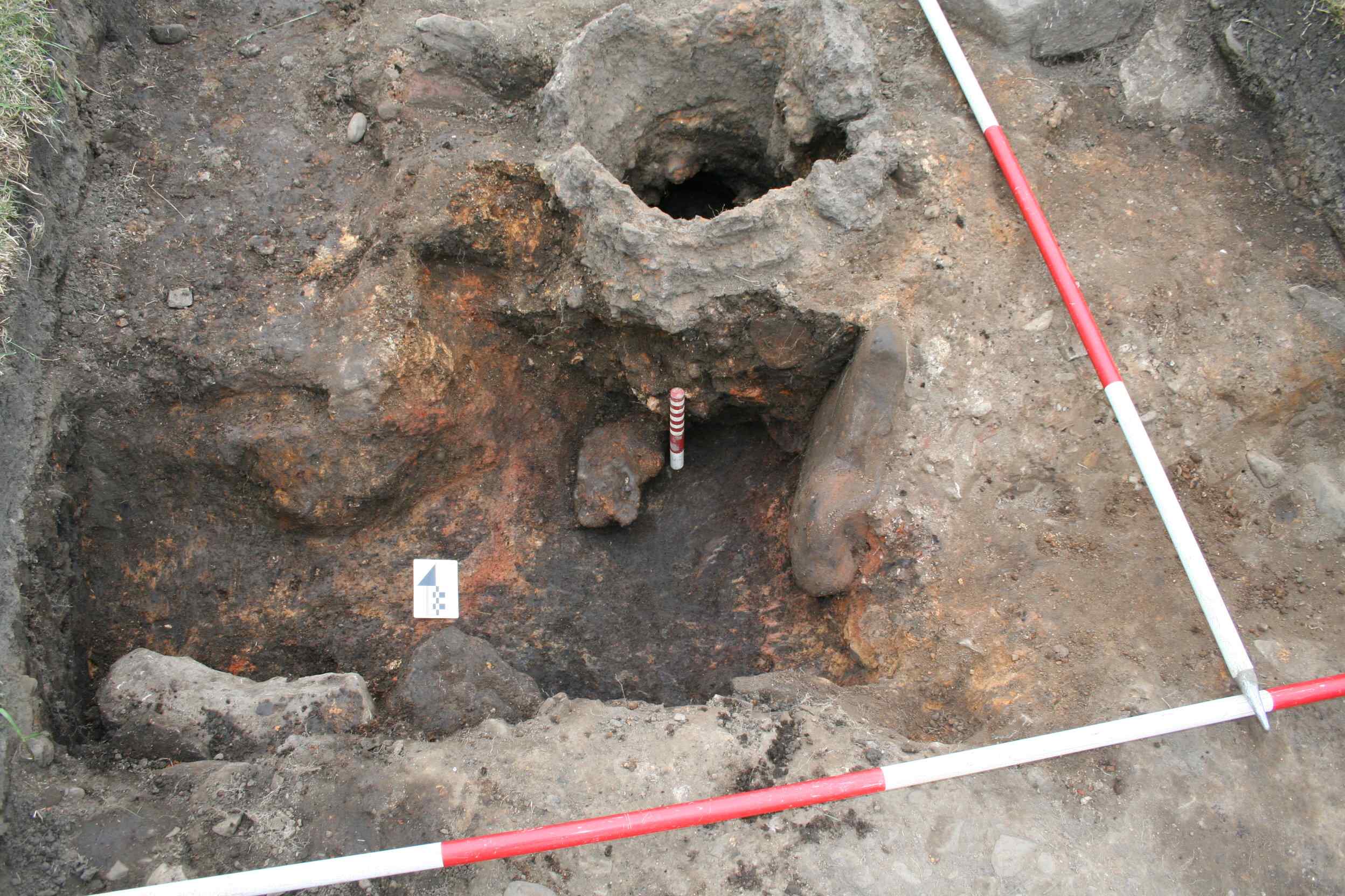
Photo 9
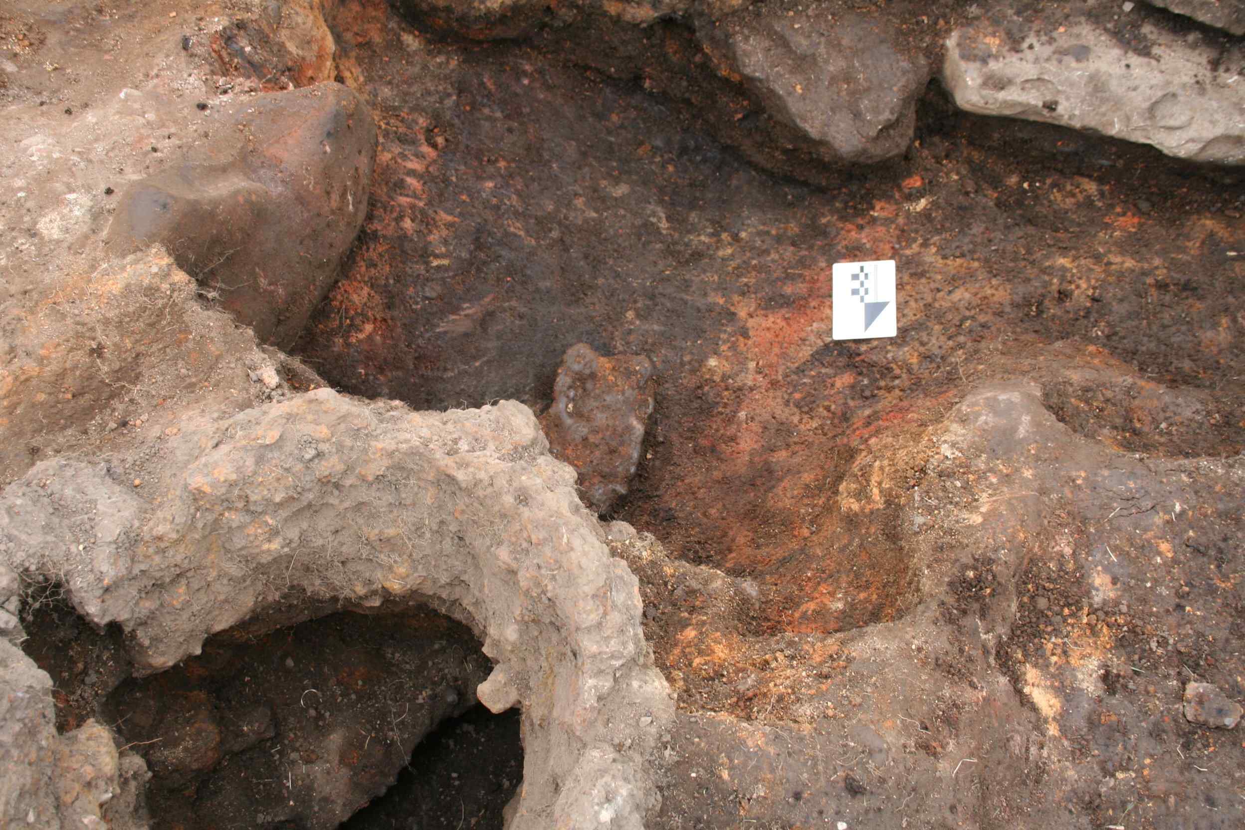
Photo 10
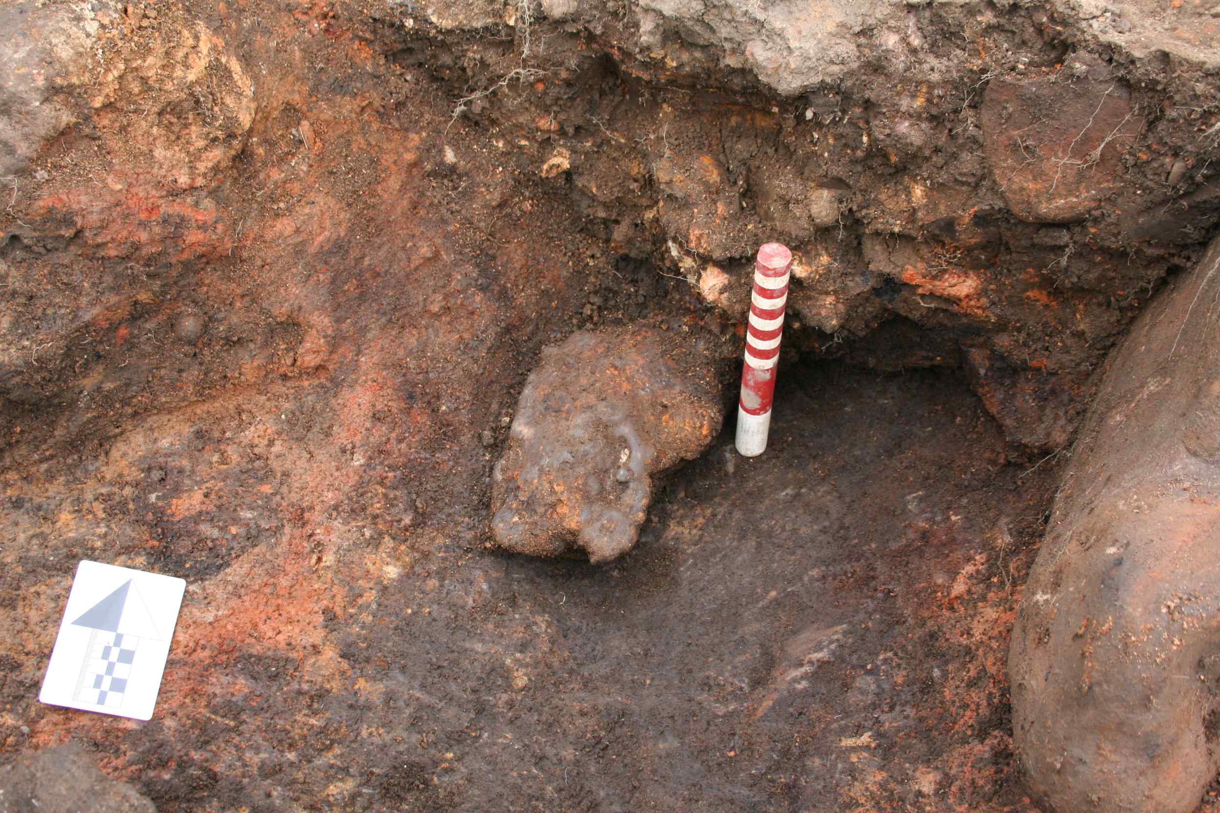
Photo 11
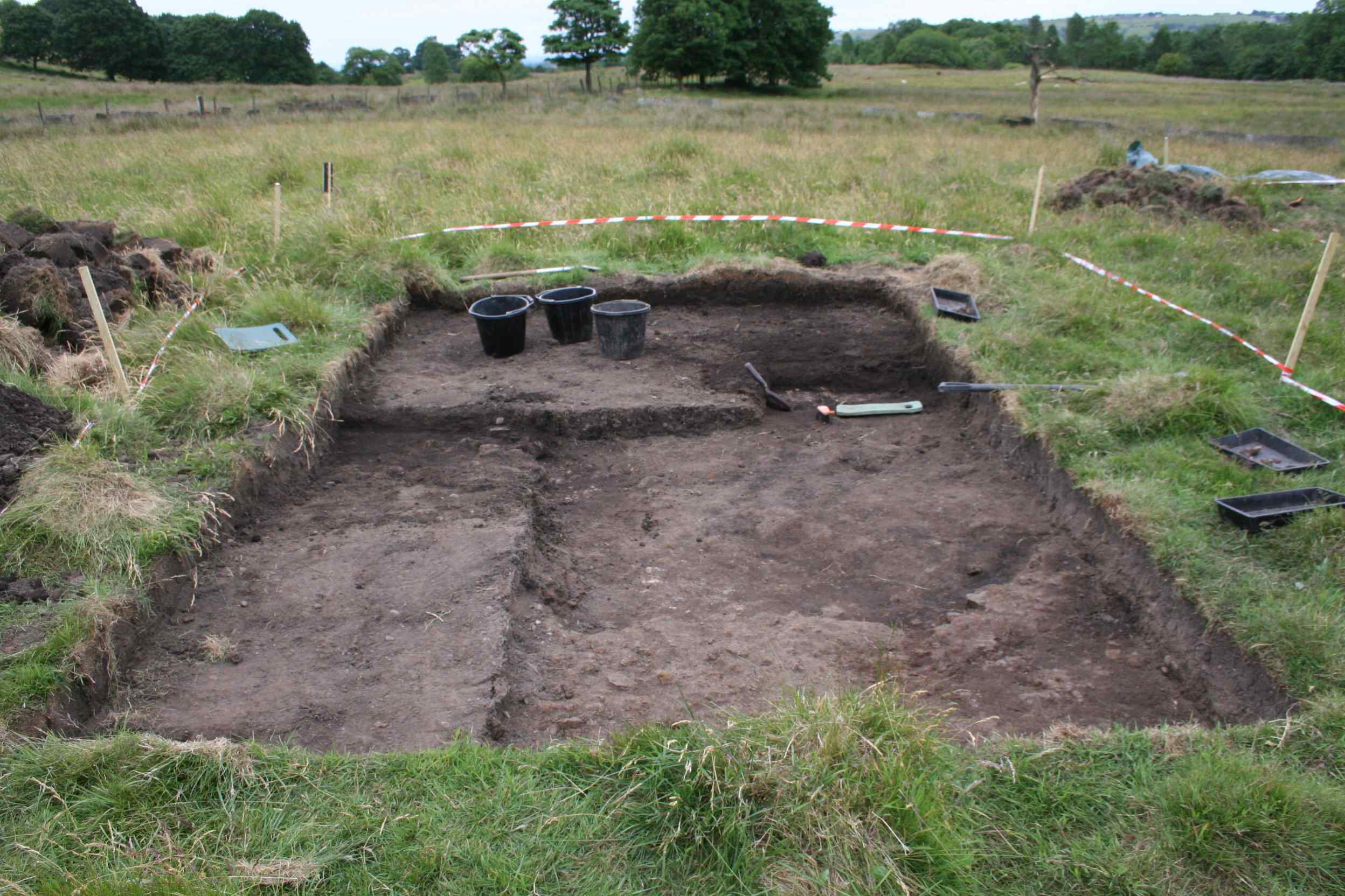
Photo 12
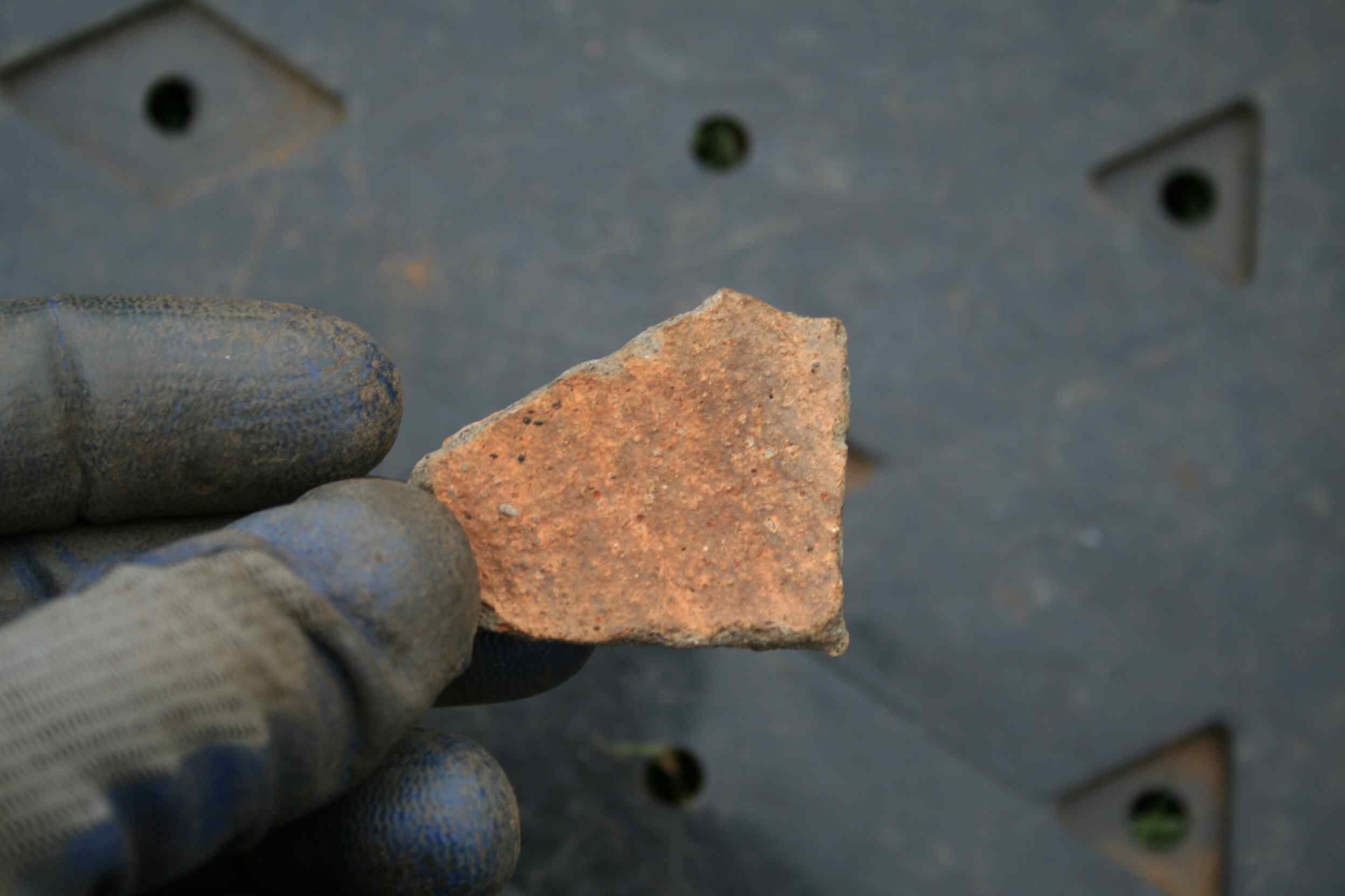
Photo 13
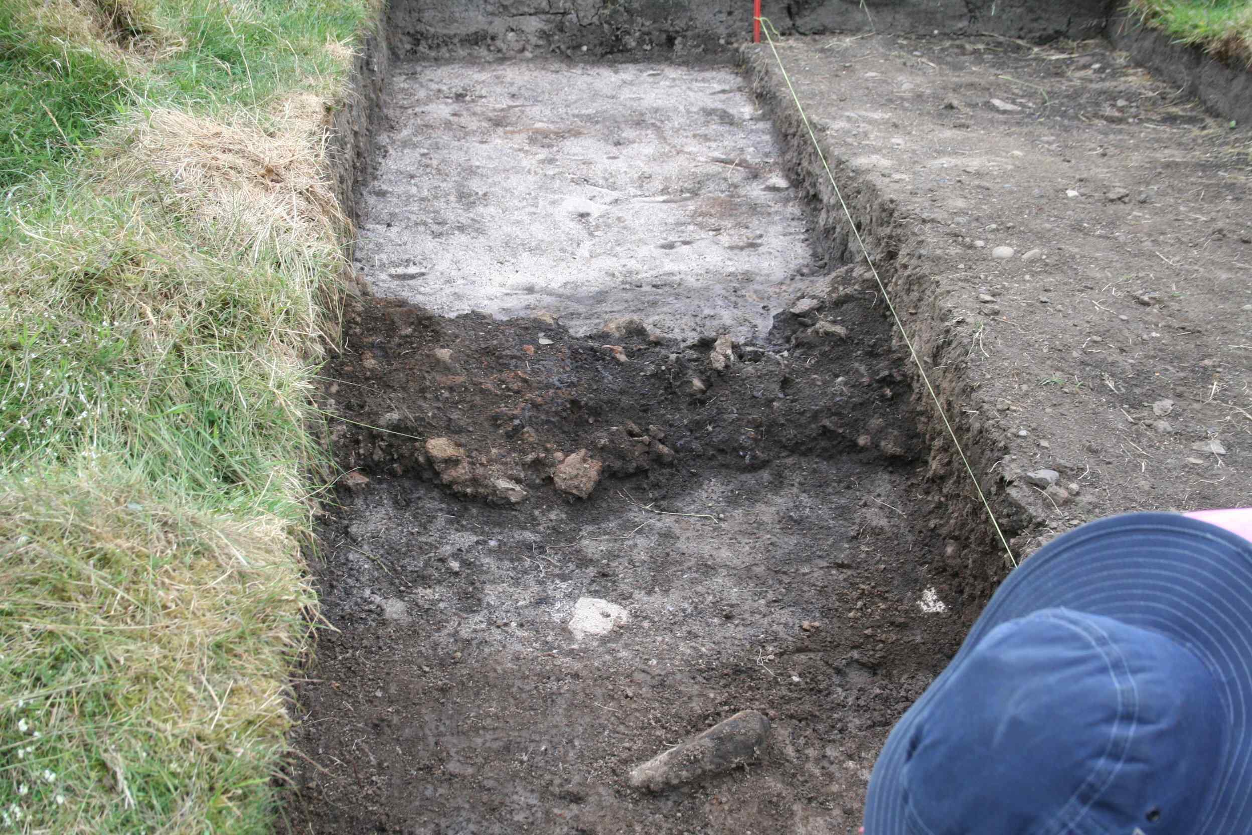
Photo 14
Cinder Hill Field Dig Saturday 23rd June 2018
Day warm and partly overcast with a breeze keeping the temperature down.
Continued to excavate the southern section of the trench to try and ascertain the significance of the narrow cobbled surface which runs west to east through the trench excavations. A significant amount of slag was removed. Nothing, however, was revealed which could shed light on the purpose of the cobbled surface. A small sherd of mediæval pottery was recovered from this section of the trench. Photos 1 and 2.
Work continued on removing the infill of the bloomery tap trench pit. This is the pit at the end of the tap trench where the molten slag is allowed to accumulate to enable the iron bloom to be retrieved from the bloomery. The expectation was that the pit would be fairly deep but this proved not to be the case. In addition, there was very little slag in the pit, which was a bit unusual as its prime purpose was to collect slag. A lot of the infill consisted of damp, fine. black soil. Photos 3 and 4.
Excavation continued on the northern section of the trench. Nothing of any significance was recovered, no slag and no finds. Photo 5. It is interesting that there was virtually no slag in the section of the pit from the north wall of the bloomery to the northern extremities of the trench, while there is much slag in the southern section of the trench.
Work continued exposing the slag layer against the east wall of the trench. Nothing of any significance was unearthed in this section. Work also continued in the southern part of the trench where a pot base sherd of mediæval pottery was discovered and also a sherd of glazed pot. Photo 6. When the mediæval sherd was cleaned, it revealed what appears to be some green glaze where the side wall of the pot meets the base section. Photo 7
No work was carried out on this trench today.
The HMHG Dry Stone Wall Walk took place today, those participating in the tour dropped by to have a conducted tour of the dig site, Photo 8, before continuing down to Bottoms to view the results of the previous dig.
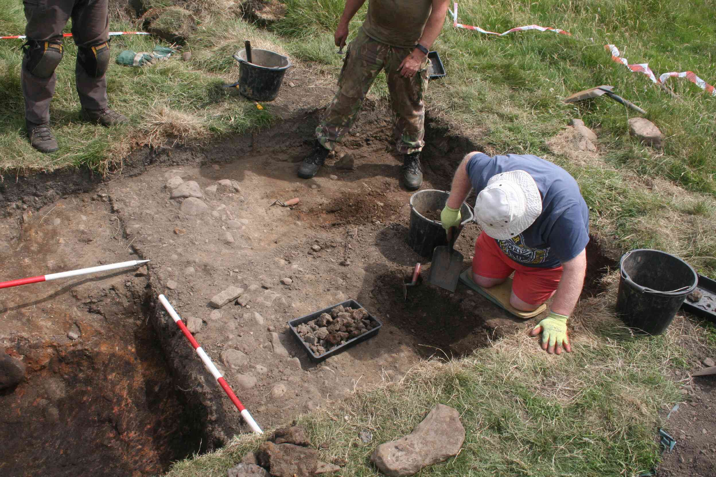
Photo 1
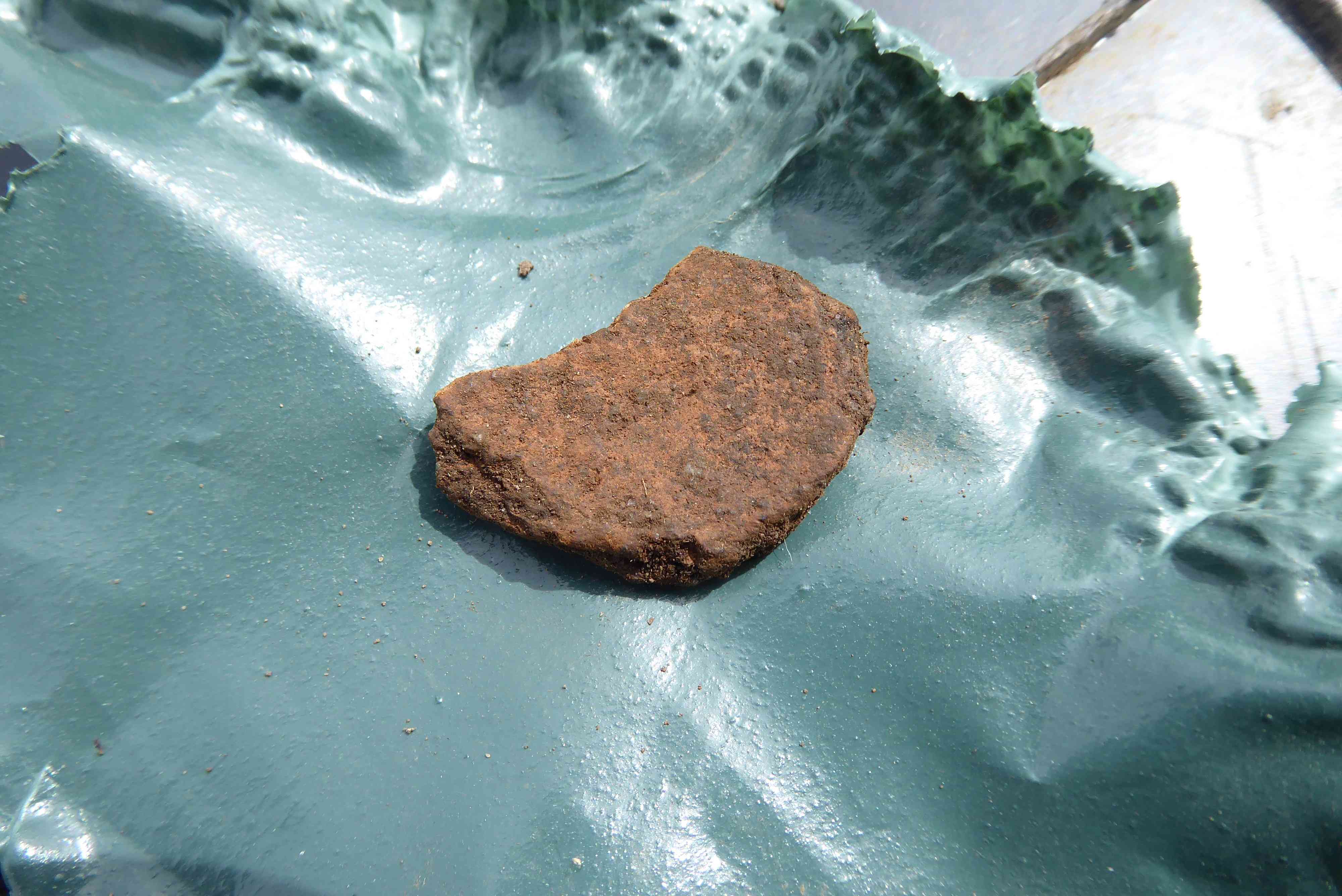
Photo 2
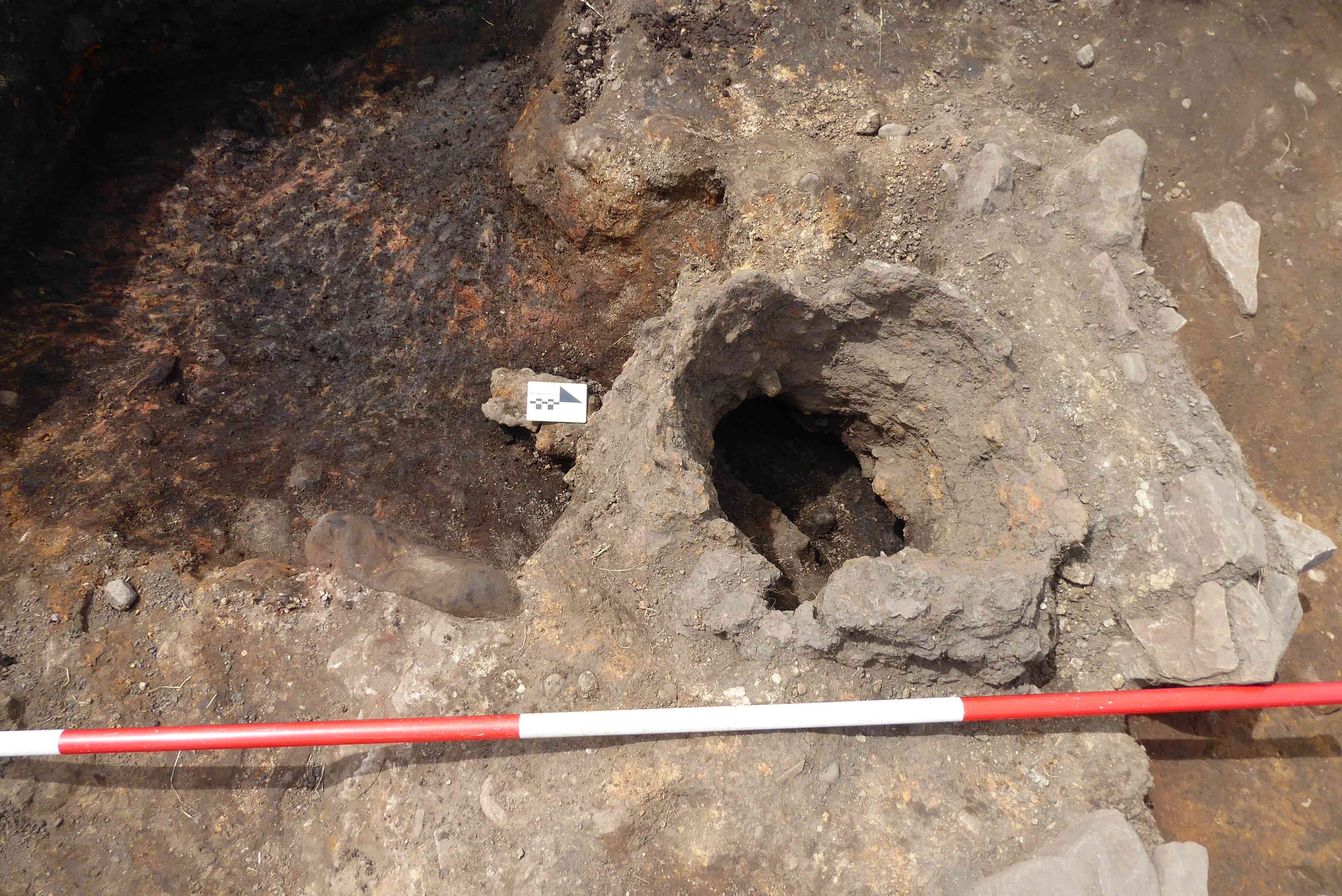
Photo 3
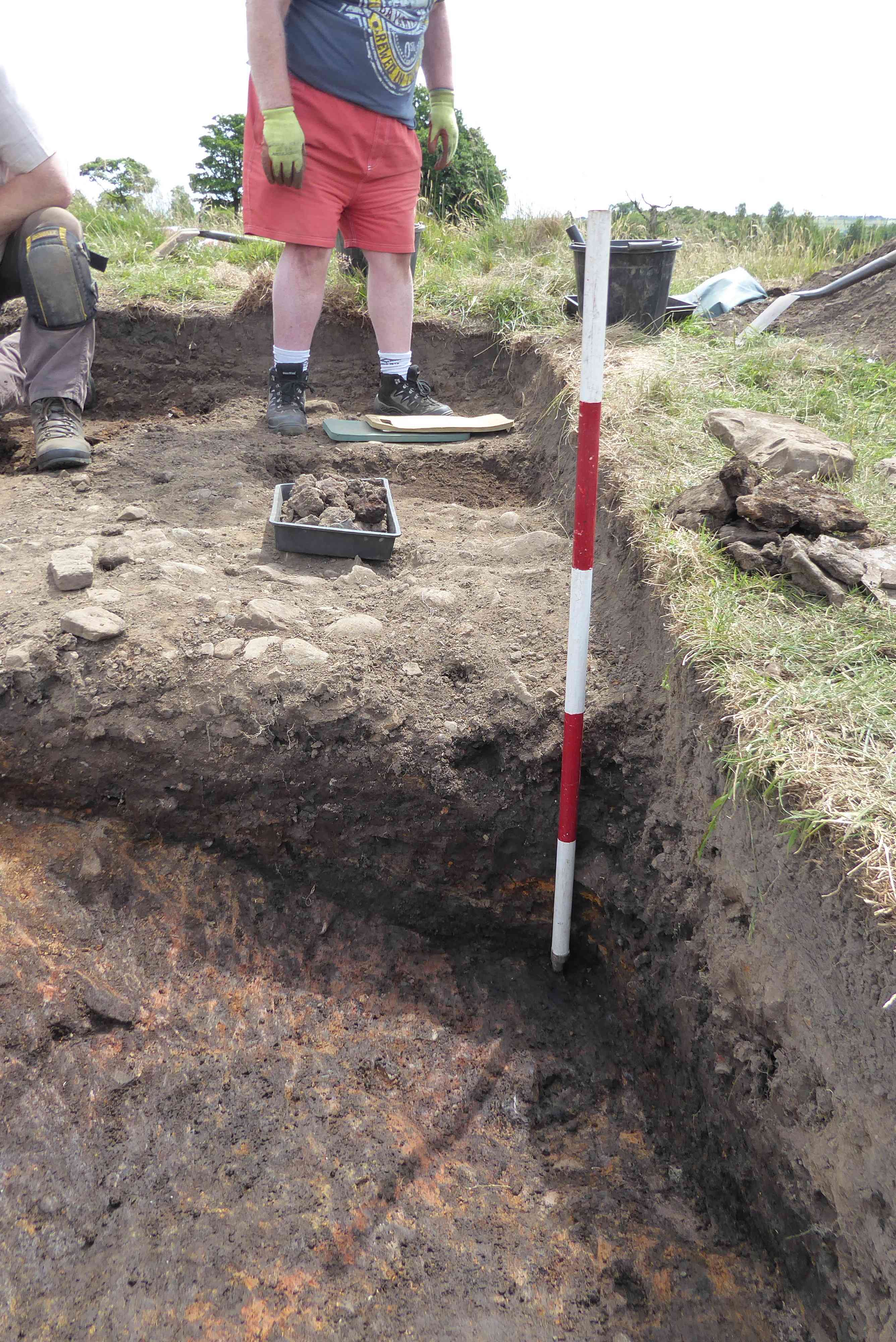
Photo 4
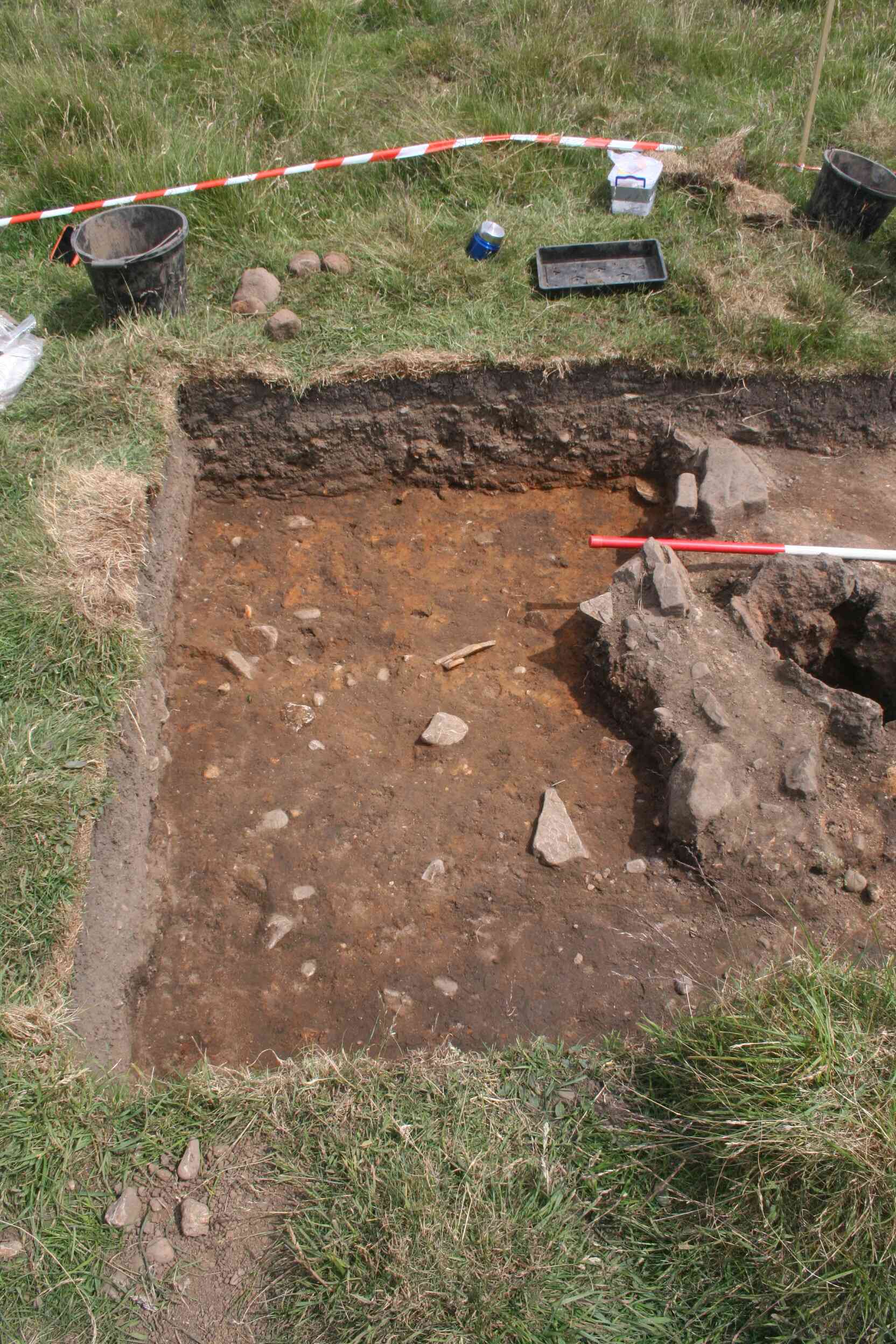
Photo 5
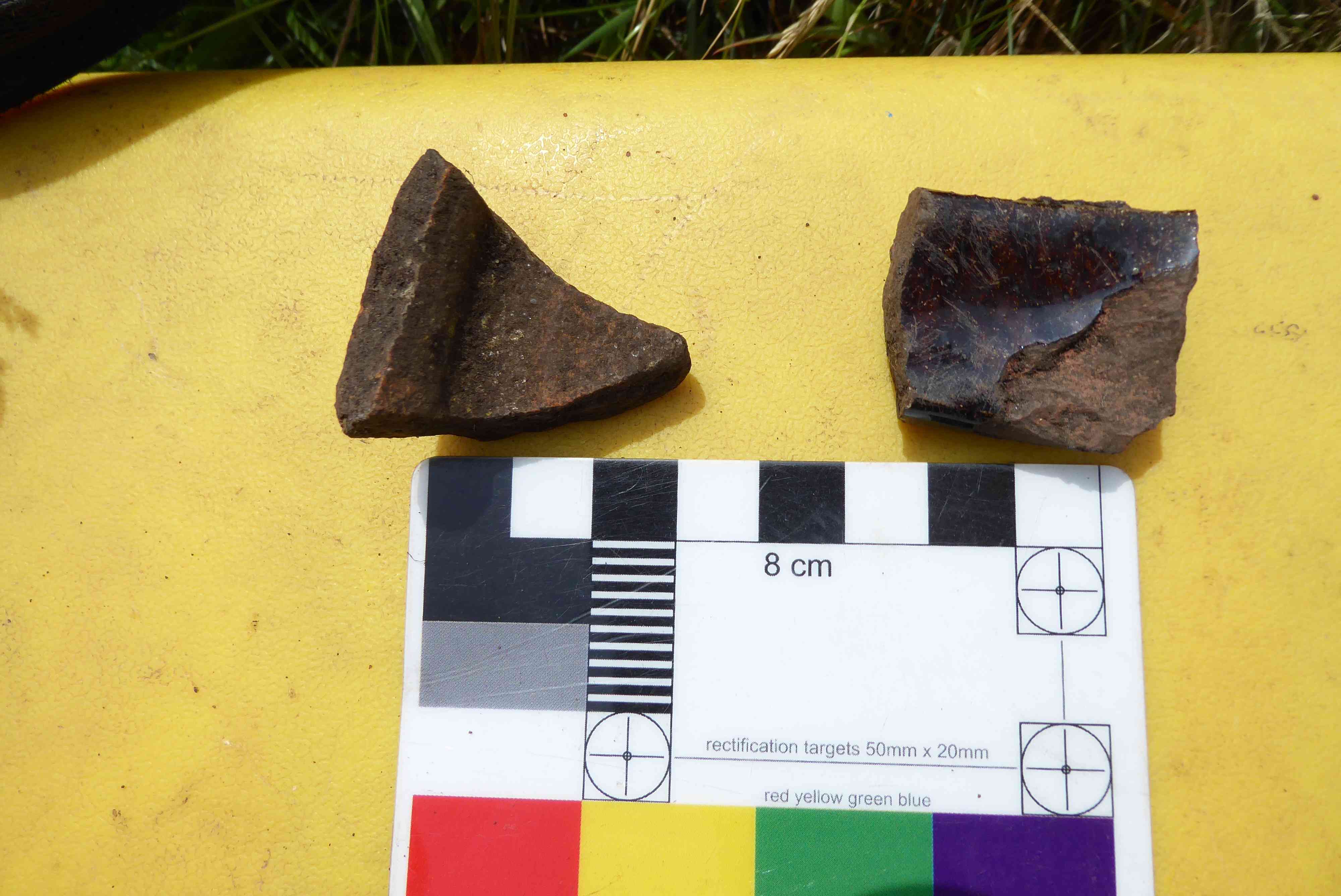
Photo 6
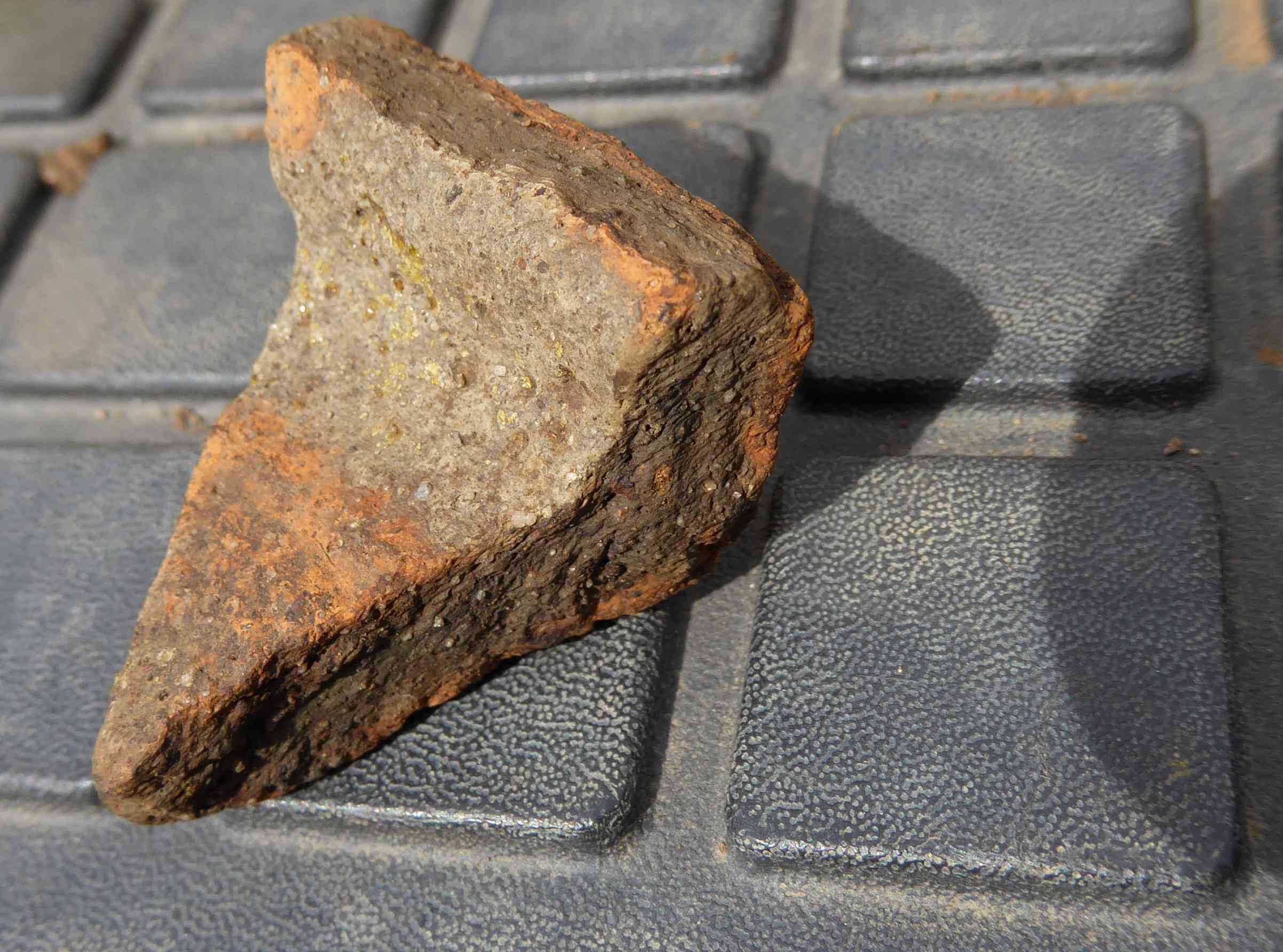
Photo 7

Photo 8
Trench 2
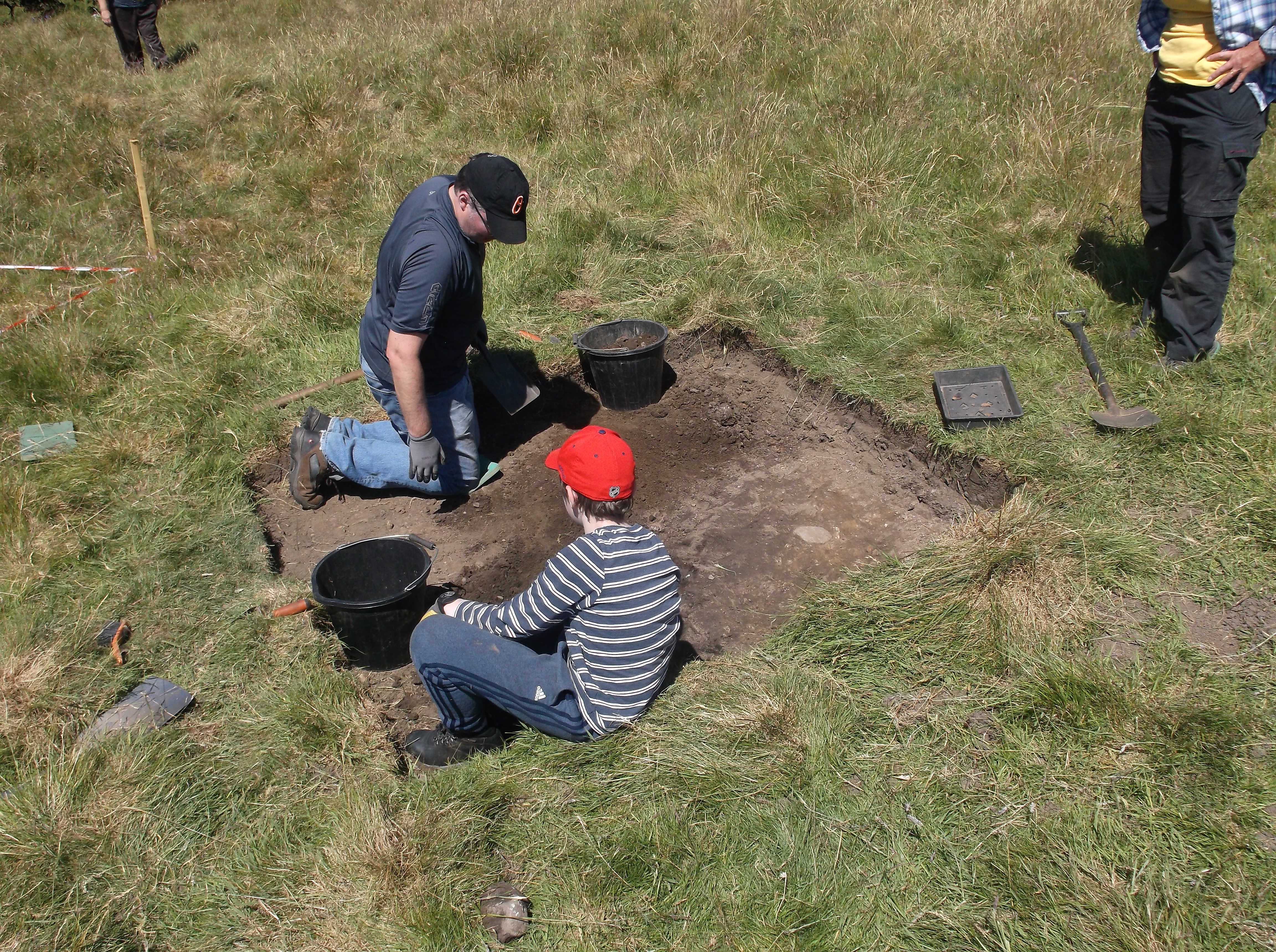
A very warm day today, made excavating very difficult and hard work so an earlier finish. But we did get a lot of work done nevertheless. A new trench, Trench 4, was positioned in the centre of the main oval feature shown on the LIDAR.
A bit more recording was completed first thing over a few of the later features found in the trench. The 'tuyere' opening was cleaned up and the area around was searched for evidence of the bellows that would have blown air into the furnace. Nothing was found however. The tap hole was opened up for the first time in probably 800 or so years and the slag fragments from the last smelt were visible running from the inside of the furnace out into the tapping channel. The trench was then cleaned up for a 'photo shoot'!
More work was carried out cleaning the layers down to the charcoal and roasted iron ore layer. Several small sherds of medieval pottery were recovered but nothing like the large sherds from the other week. A couple of the sherds were showing very small portions of a green glaze, which we hadn't seen on any of the other sherds from the site.
Still work continues cleaning the loamy slag layers away from the bottom of the trench. Once this work is complete we will be able to draw the trench sections which will hopefully show how the sequence of layers have been laid down and hopefully give us some clues as to what the oval feature is on the LIDAR.
A new trench was opened and work started on the removal of the topsoil layers. We have just started to reveal a grey clay layer with a linear feature cutting through it from one side of the trench to the other. This will take a few more days before we can hopefully find out what the feature is.
So there you go, a hard day in the warm weather. But very rewarding.
Trench 1 in all its glory
The tap hole showing in-situ slag
The tuyere hole for air
Trench 2 continues
Removing topsoil in Trench 4
Cleaning down in Trench 3
HMHG Dig Report Saturday 21st July 2018
Weather: overcast and cool, no precipitation
We had a very good turnout today with a total of 14 people on site.
The first job was to mark out two new trenches, trench 5, a 2 x 2 metre trench just to the north west of trench 1. (Photo 1) This trench is over a small circular item of interest observed on the Lidar picture, and trench 6 (photo 2), again a 2 x 2 metre trench situated to the north east of the plateau. This trench was started to investigate a feature on the Lidar which is extending up to the plateau towards trench 4. After the new trenches were plotted and de turfed the remaining top soil was removed. A few sherds of late pottery were recovered from trench 6 but nothing, as yet, from trench 5.
Trench 1
A 2 x 2.5metre extension trench (Photo 3) had to be made to the trench in a westerly direction to investigate the bloomery tapping pit and the narrow-cobbled surface. Unfortunately, this was directly through a spoil tip which had to be moved before the extension could be plotted. There appear to be a couple of unwritten rules in archaeology, one being if you have to extend a trench it will be through a spoil tip and the other, if the lead archaeologist says the initial trench will not be extended, you can be sure it will be.
After moving the spoil, the extension was plotted and most of the top soil removed in preparation for meaningful excavation on Sunday.
Trench 2
Work continued cleaning the soil off the slag deposit. A couple of small sherds of mediæval pottery were recovered close to where the large pieces of pot were discovered a few digs back. It is more than likely the sherds recovered today are associated with the larger sherds.
A length of burnt wood was also uncovered (photo 4), there is speculation as to whether this could be part of the charcoal fuel for the bloomery or could in fact be part of a structure in which the charcoal was stored to keep it dry. If the structure theory is pursued, it will be necessary to extend the trench in an easterly direction - through the spoil heap!
Trench 3
Work continued to clear the grey clay surface on the west side of the slag strip. (Photo 5). Once the trench has been recorded excavation will continue in a selected area to determine whether the grey surface is the natural ground surface or whether it has been deliberately laid.
Trench 4
This trench was initially opened to see whether the grey surface in trench 3 continued eastwards through the bloomery site, (photo 6). Investigations are ongoing.
Visit by Dr. Gerry McDonnell
Dr Gerry McDonnell, one of the countries leading experts on archaeometallurgy, who has taken part in a number of the television Time Team programmes, visited the site today.
Archaeometallurgy is the study of the history and prehistoric use and production of metals by humans. It is a sub-discipline of archaeology and archaeological science. (Wikipedia)
Gerry spent some considerable time viewing the bloomery and the other excavations, and explained in depth the processes of charcoal production, iron ore preparation for smelting and the actual method of construction of bloomeries. He also described how the bloomery worked in the production of iron. Gerry’s knowledge gained from working on many sites throughout the UK and from experimental work on bloomeries meant he could recommend where the group could carry out further investigations to try and locate other bloomeries on the site, in addition to likely processing and storage areas.
From the construction of the bloomery and the type of slag found on site, Gerry is fairly confident that the bellows were hand operated as opposed to water operated. He was unable to put a possible date to the site, so further investigations and expert examinations of charcoal and slag will be necessary before any possible dating can be determined. He did recommend, however, that we extend the area of trench one to try and locate evidence of post holes of the shelter which would have been around the bloomery to protect it from the elements. He also advised a cover would be necessary to enable the operators to determine the state of the smelt by the colours of the flames coming from the top of the bloomery and through the bellows hole, and this could only be accurately determined in subdued lighting.
Gerry was reasonably certain that the area in trench 2 was used for storage of charcoal and iron ore, as these commodities needed to be kept dry and, due to the nature of the smelting, large quantities of charcoal would be necessary for each burn. He did recommend, time permitting, that the trench be extended to look for tell-tail signs of a structure having been built around the immediate area.
While examining trench 3 Gerry remarked that he is aware of only one other site in the UK where a similar slag strip was present. He advised he would delve into his records to see if he could provide us with further details.
The visit by Gerry proved to be extremely valuable to the group, enabling us to gain a better understanding of the site and the processes which were used in the production of iron. The committee are very grateful to Gerry for going out of his way to visit the site and for imparting such valuable information. The visit was very much appreciated.
Photos 7,8,9 & 10
Members on group photo, photo 10
L to R - Robin, Gerry, Jeanette, Abi, Alice, Sue, Barry, Neil, Louise, Margaret, John.
HMHG Dig Report Sunday 22nd July 2018
Weather, very similar to Saturday’s - overcast and cool with no precipitation.
Trench 1.
Work continued on the extension which was added yesterday, cleaning the surface so it could be recorded, (Photo 11). Neil is of the opinion this could be a later trackway as what appears to be two very faint worn tracks can be observed running west to east on the compacted surface. Another faint feature, on the north east edge of the extension, looks to be an extension of the compacted surface which ran on the immediate south side of the bloomery face. It is interesting to note that the feature on the extension ends on a rounded edge, as if a round post was initially in this position. Normally the end of a feature like a compacted surface is just squared off. Could this be part of the structure which protected the bloomery?
Trench 2
The piece of burnt wood, partially uncovered yesterday, was cleared and lifted in pieces and placed on kitchen foil to protect the wood from contamination when samples can be sent away for carbon dating and species identification. (Photo 12)
The slag and natural surface continue to be cleaned. Due to the rough nature of the slag it is difficult to clean, so progress is relatively slow. (Photo 13)
Trench 3
Cleaning right at the western end of the trench revealed a number of flat stones and a void under a couple of them. To resolve this feature, it was necessary to extend the trench. At the end of the day the feature turned out to be a field drain. (Photo 14)
Trench 4
After the trench was cleaned and recorded, work started on investigating the feature which runs through the trench and roughly follows the contours of the side of the escarpment. This feature turned out to be another field drain. Interestingly the drains in trenches 3 & 4 appear to run parallel to each other around the side of the hill and not immediately downhill. This appears to be the same arrangement for the tap channel in trench 1. Hopefully, during the investigation of the site, this preference may be explained. (Photo 15)
Trench 5
Excavations continued on the eastern half of the trench. In the south east corner, we might, with the emphasis being on the word might, have located another bloomery. There is what appears to be the start of a bloomery wall and a small void. (Photo 16) Time will tell. A small sherd of mediæval pottery was found in the trench.
Trench 6
Work continues clearing the trench to try and ascertain the feature observed in the Lidar picture. As well as a number of sherds of pottery a broken piece of flat corroded metal was recovered (Photo 17). Could this be part of a plough blade which broke off against some slag? The Lidar picture of the site shows that no ploughing took place over the escarpment; it went around it and trench 6 is very close to the demarcation band. Any one ploughing Cinder Hill Field would have been very aware of the slag and kept well clear. The fact the ploughing kept away from the escarpment explains why the bloomery and the other features are in such good condition. Could the feature seen on the Lidar extending towards trench 4, ref Saturday’s report, be an extension of the drain found in trench 4?
Next dig Dates: August 11th and 12th
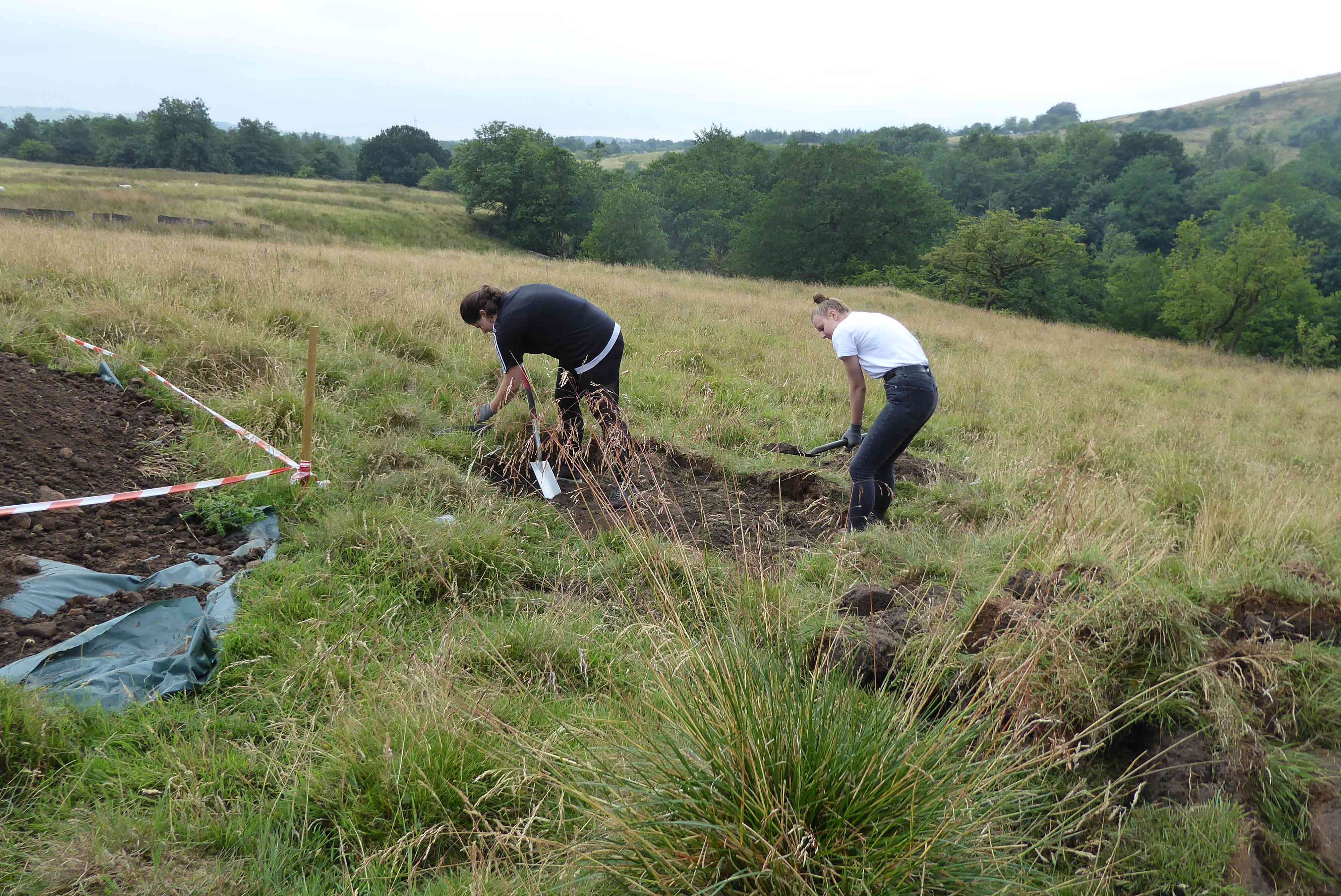
Photo 1
Photo 2
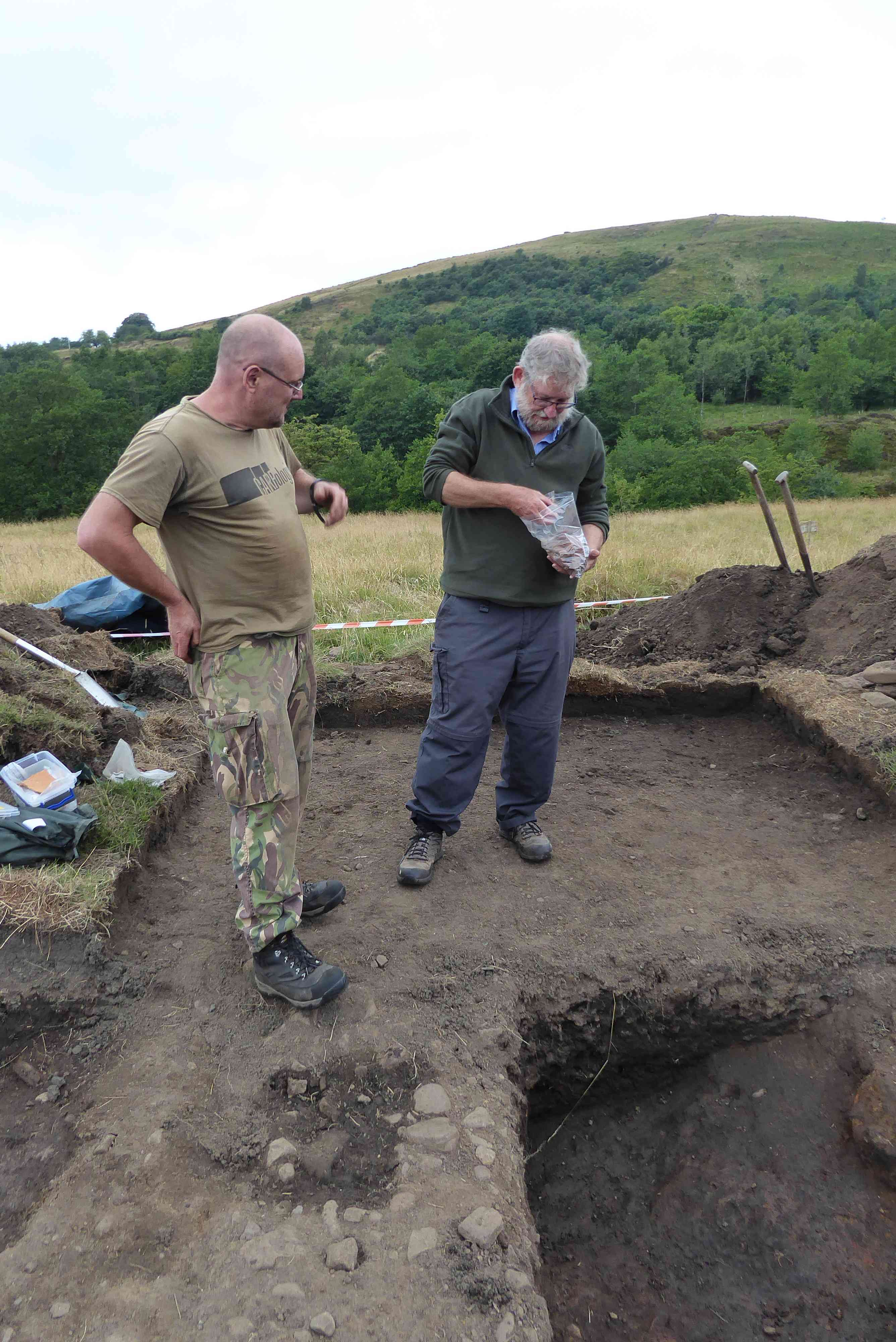
Photo 3
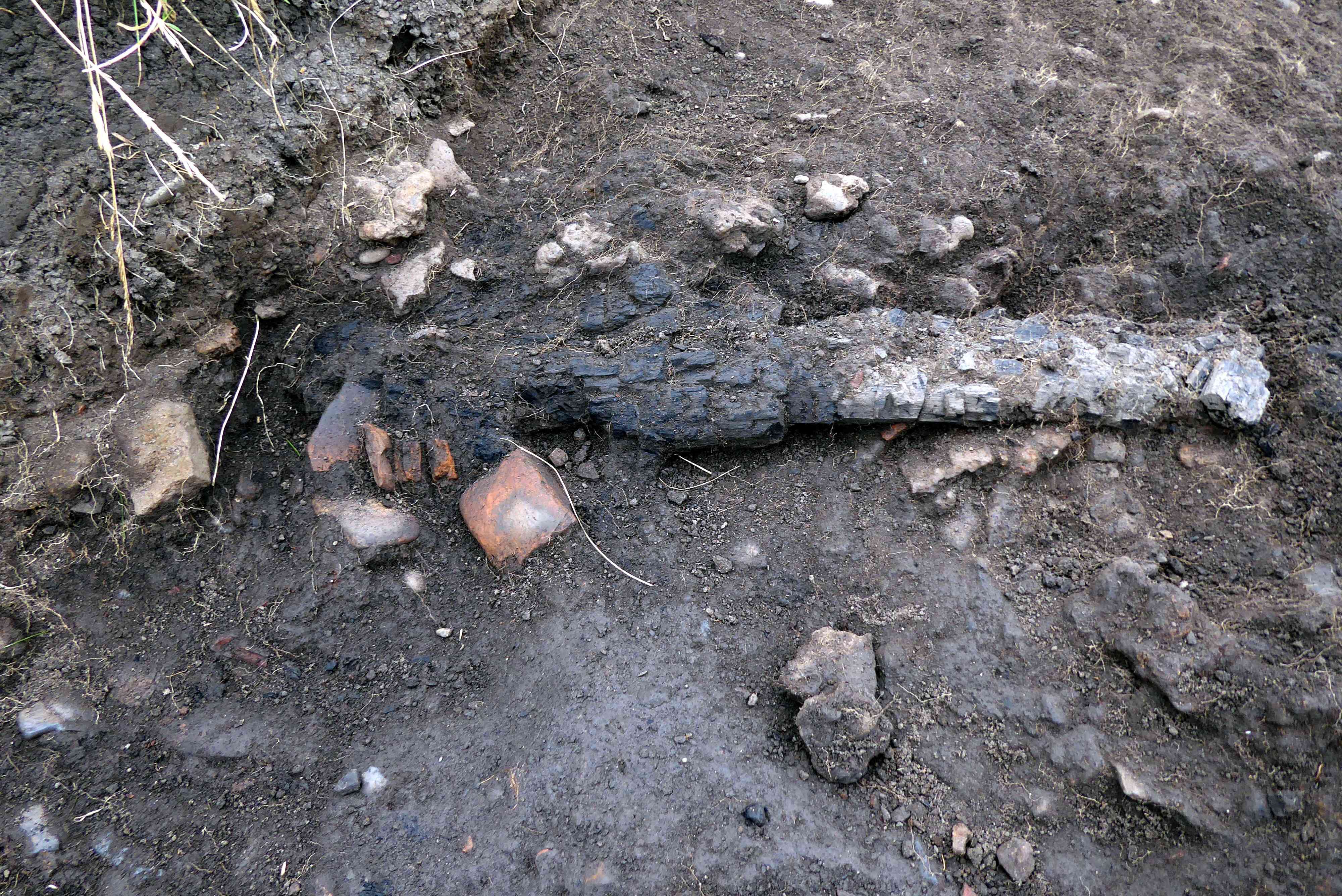
Photo 4
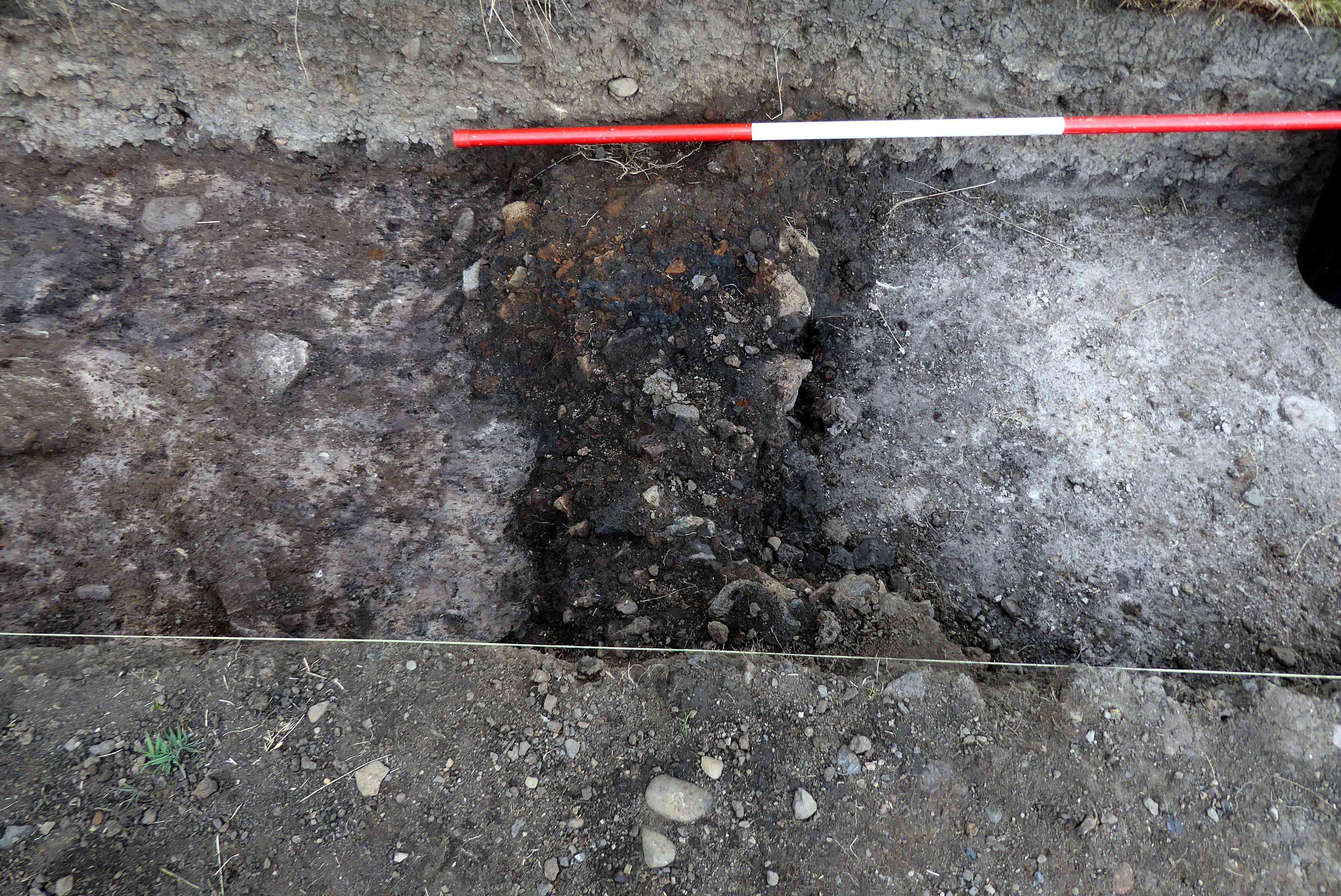
Photo 5
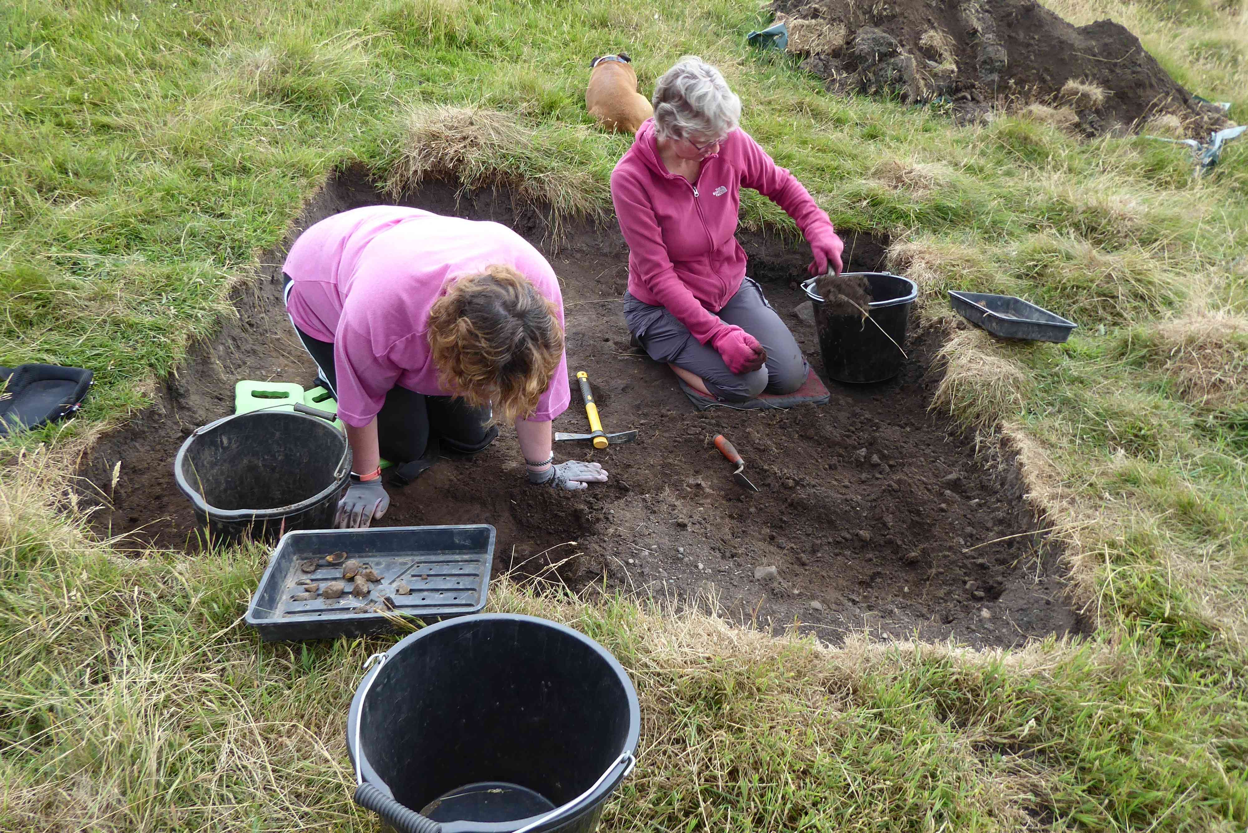
Photo 6
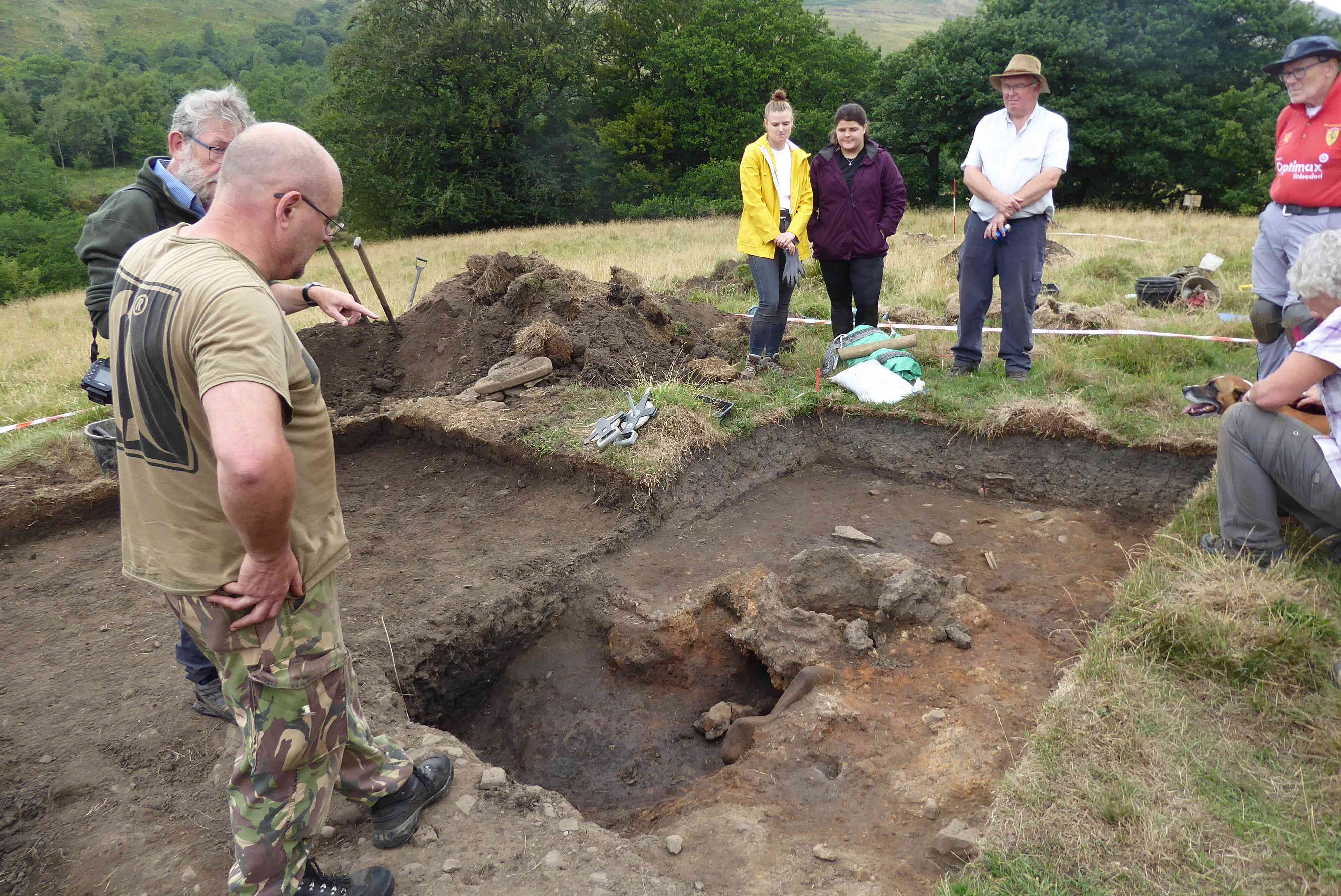
Photo 7
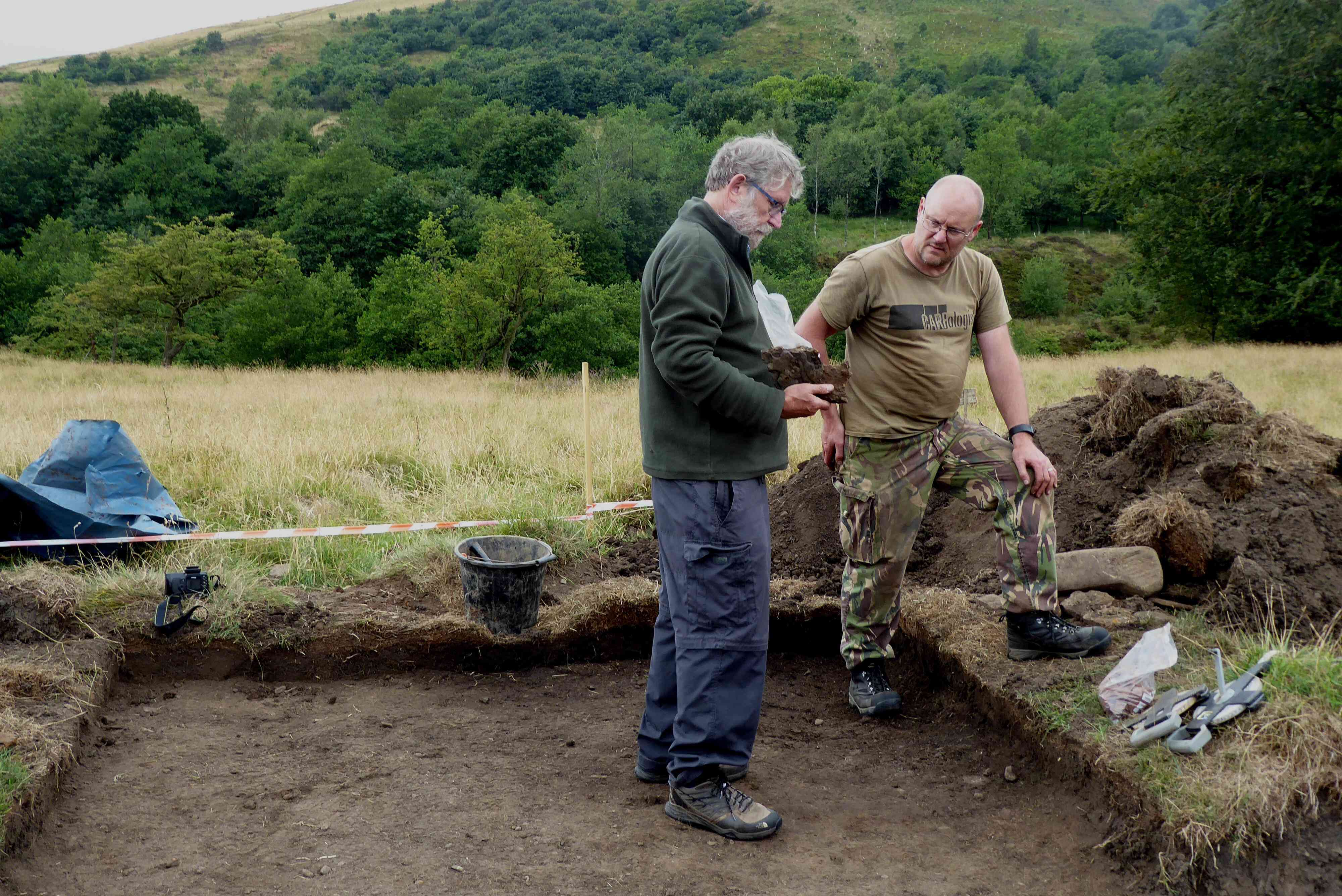
Photo 8
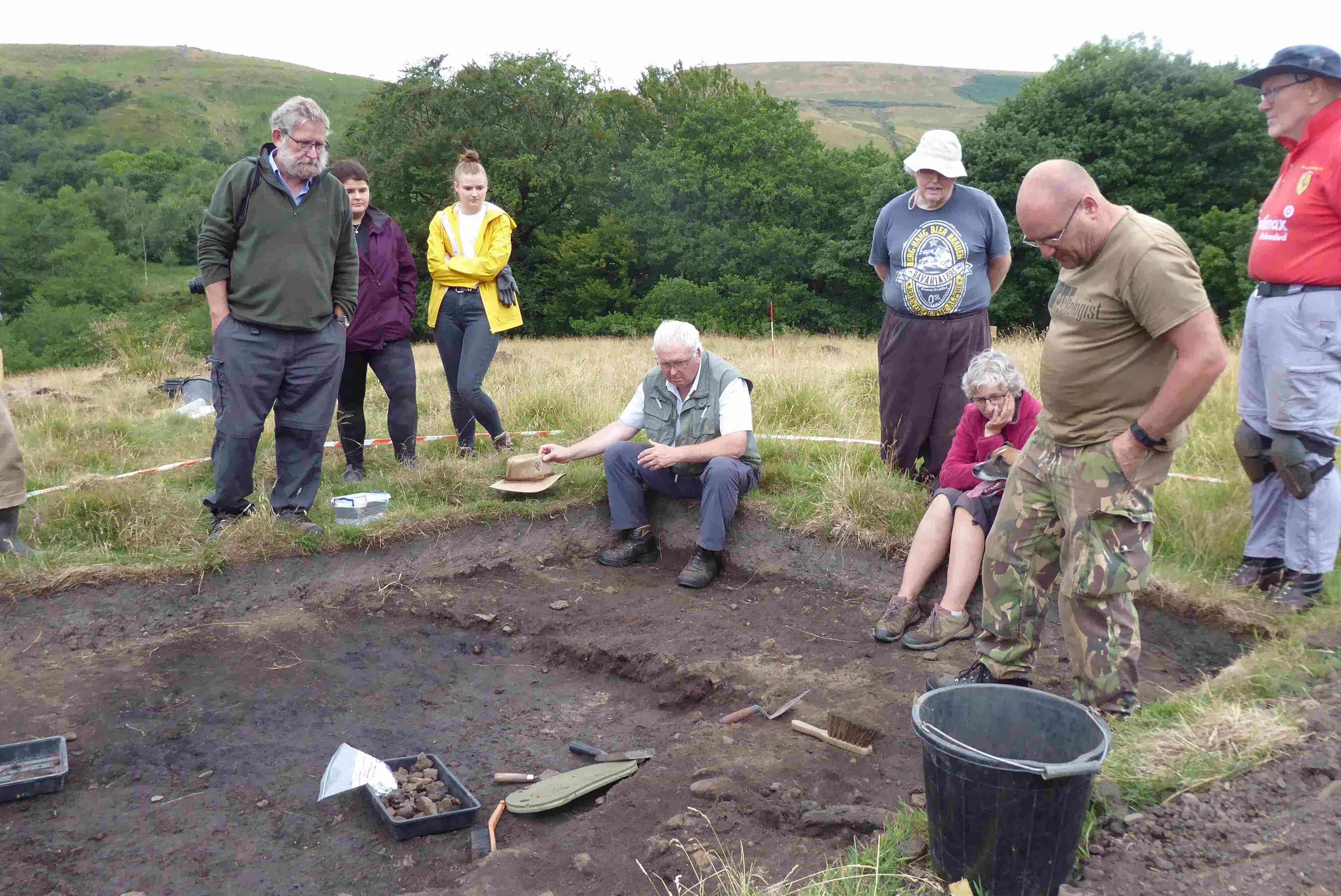
Photo 9
Photo 10 L-R Robin, Gerry, Jeanette, Abi, Alice, Sue, Barry, Neil, Louise, Margaret, John.
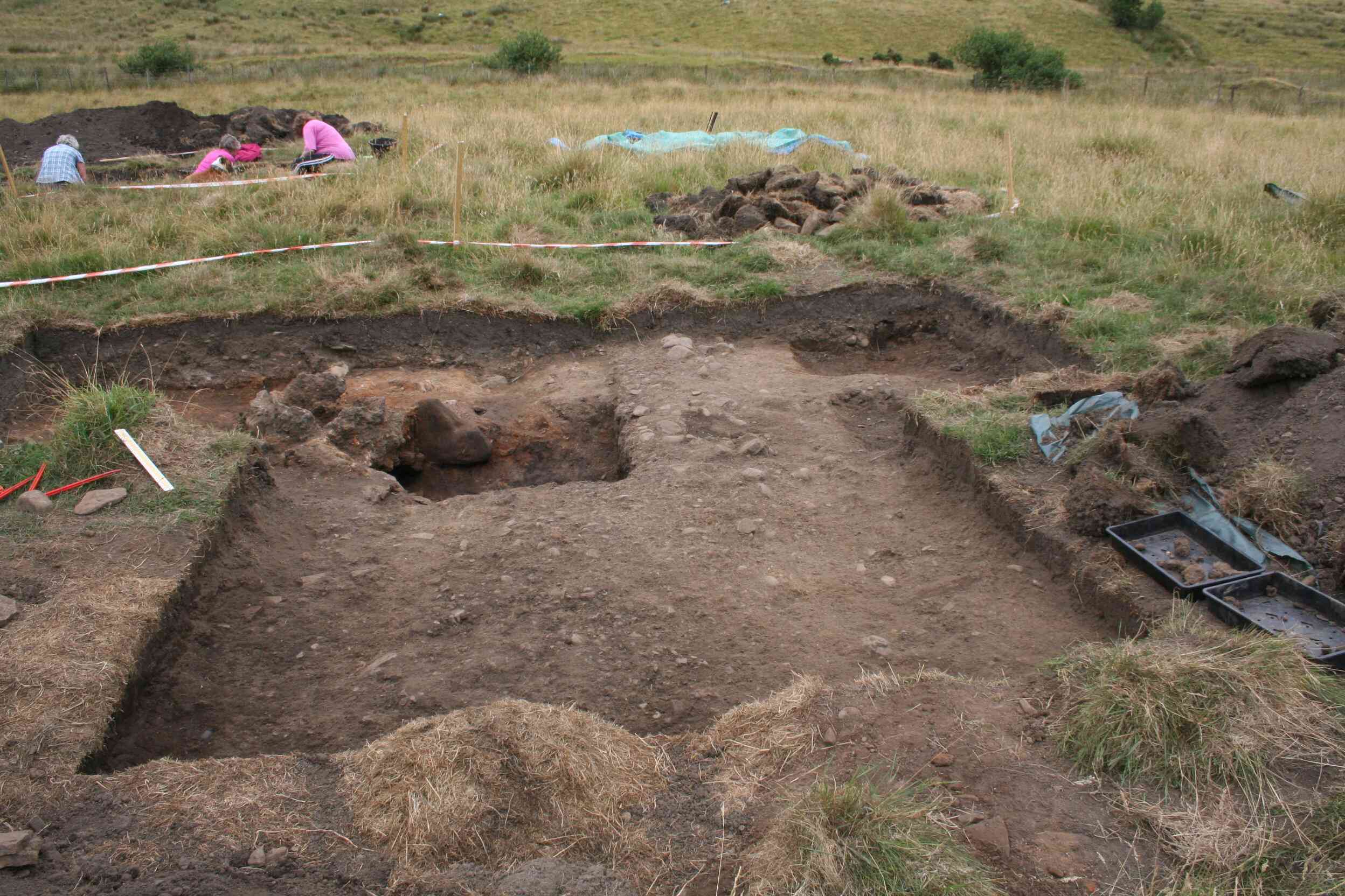
Photo 11
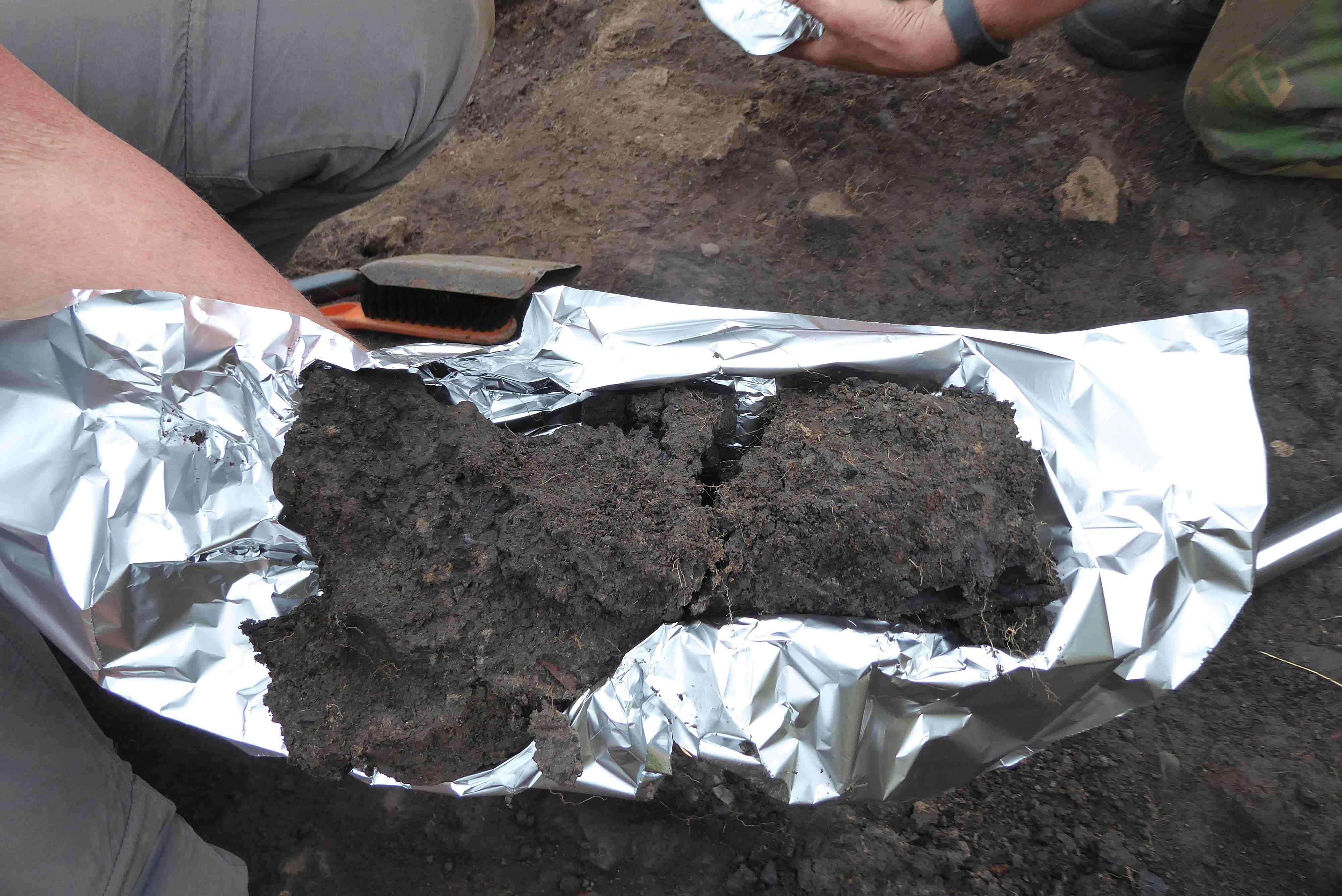
Photo 12
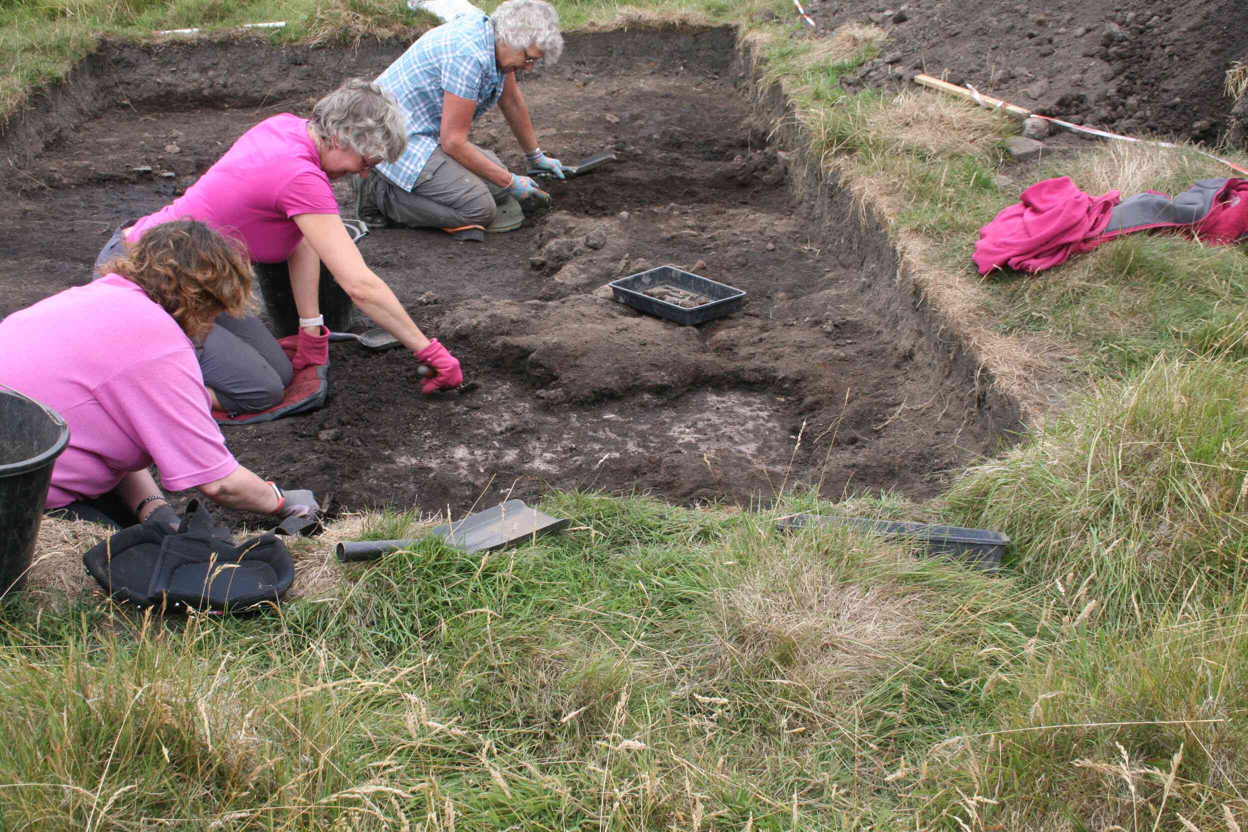
Photo 13
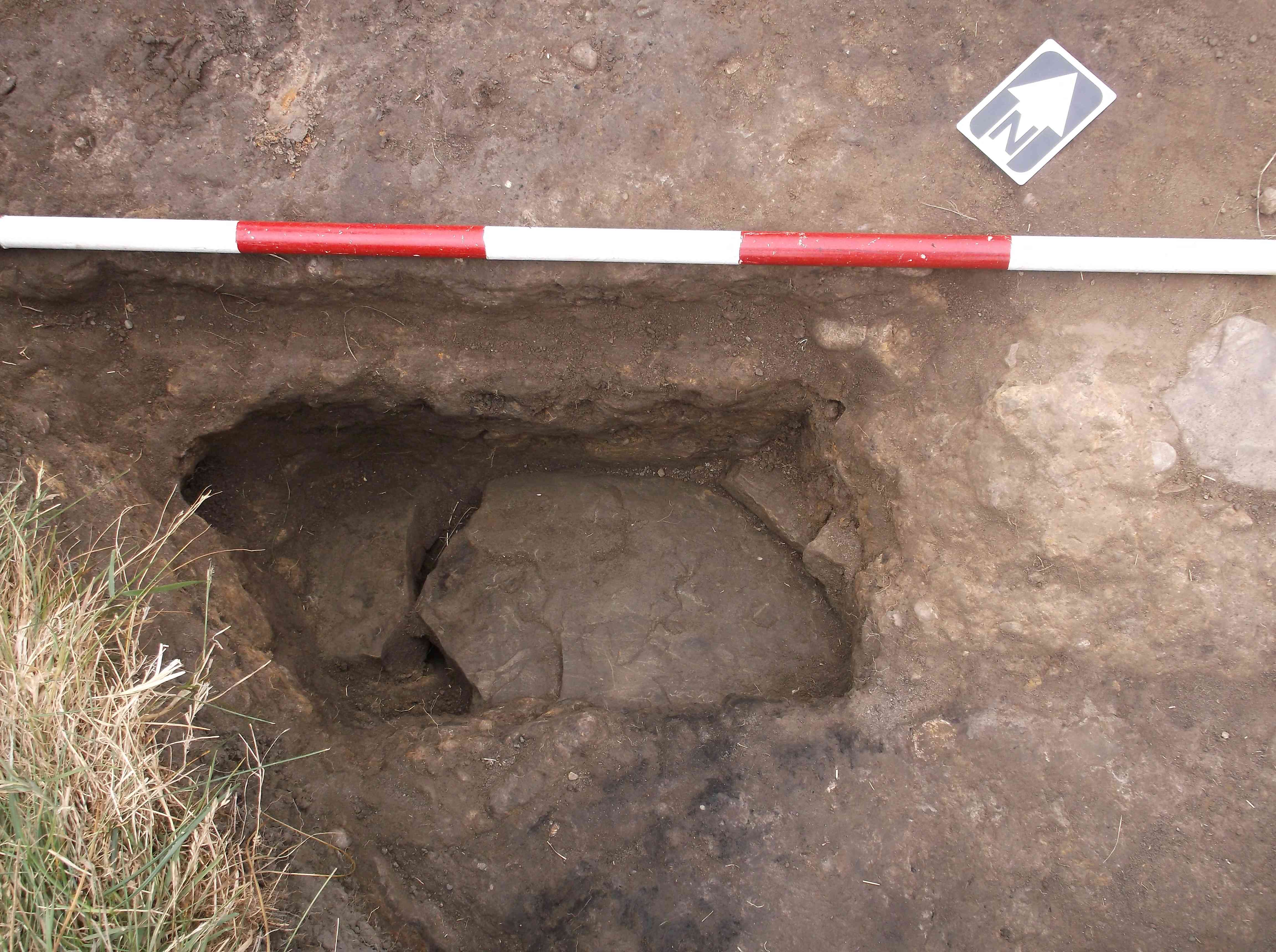
Photo 14
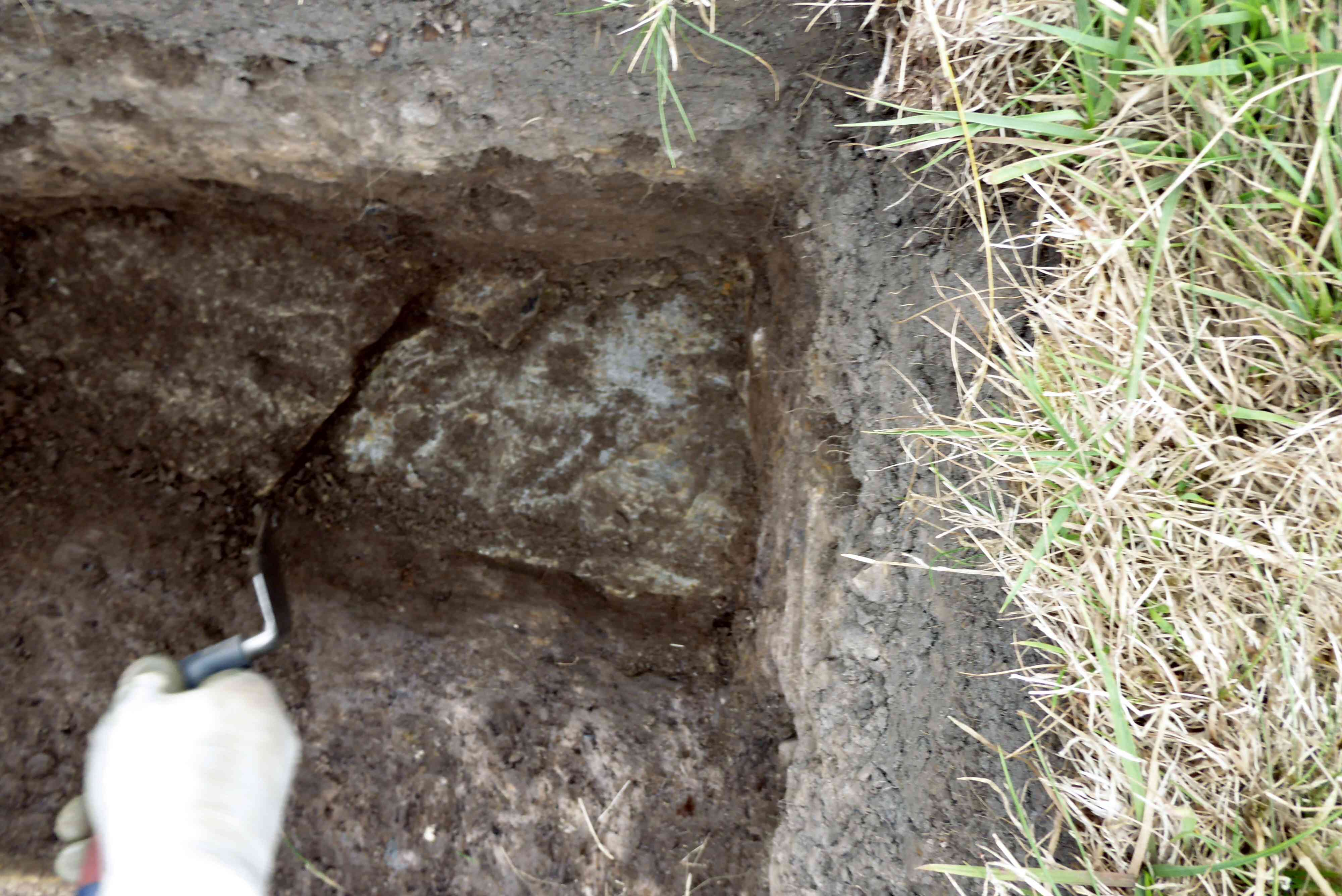
Photo 15
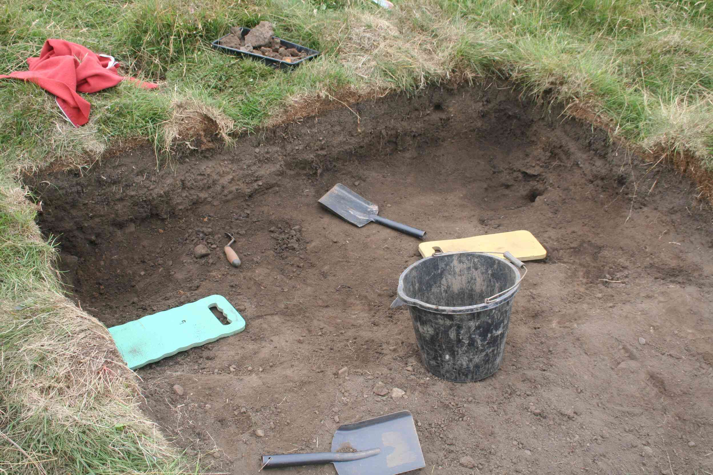
Photo 16
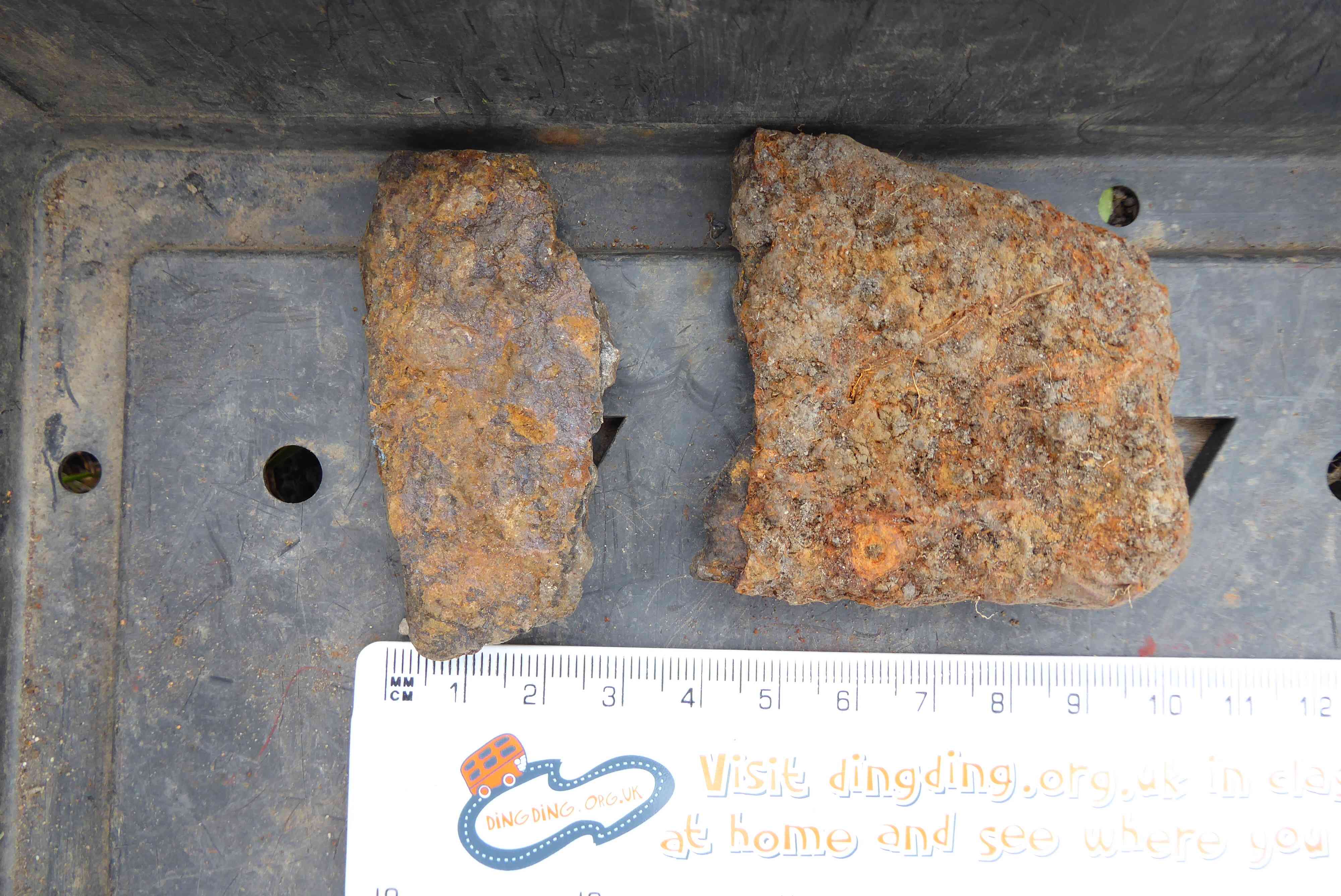
Photo 17
Weather was ideal for the dig, cool and sunny. The trenches had some water in them from the previous days rain which was quickly bailed out. The tarpaulin covers certainly helped.
It was unfortunate to find most of the wooden poles around the various trenches which held warning barrier tape had been pulled down. Difficult to determine whether damage was caused by two or four-legged sheep. Photo 1. Fortunately, no damage appears to have been done to the trenches.
Trench 1
Excavation of the western extension to the trench continued. The purpose being to try and find a possible tap drain pit associated with the bloomery which might exist at the end of the tap drain channel. It might hold slag or charcoal which could be used to date the last firing. Work was somewhat restricted as the narrow compacted cobbled path adjacent to the excavations had to be retained. At the end of the day the shape of the excavated area appears to indicate that it may be the combination of two bloomery tapping channels. Another bloomery might exist to the south of the existing one, under the compacted cobbled path. Photo 2
Trench 2
Work continued carefully cleaning the areas which are clear of slag, As well as numerous pieces of charcoal and slag fragments, six sherds of mediæval pottery were recovered. One piece, part of the base of a vessel, has a green glaze on it, very similar to the other two pieces recovered last month. As the glaze is on the inside, the sherd probably comes from a pitcher.
A section of the slag on the eastern side of the trench was removed to ascertain what the slag was sitting on. The slag was on a thin layer of dark material, possibly a combination of charcoal and soil, which in turn was sitting on the greyish/white coloured clay surface which is present in the rest of the trench. The jury is still out as to whether this greyish/white clay is natural or has been laid down for some reason, as it is present in some, but not all the trenches. Photos 3 and 4
Trench 3
Work continued on the apparent drain uncovered during the July dig. By the end of the morning a nice stretch of capping stones was revealed, Photo 5. After these were recorded and photographed, they were lifted. The capping stones were sitting on side stones with a relatively narrow gap between the opposite faces. The space between the side stone being filled with a dark soil, Photo 6. It is hoped that some pottery sherds may be recovered from the fill to help date the ditch. A section of the of the fill was removed and it was discovered that the drain is very shallow, Photo 7, this does not bode well for finding any pottery sherds.
Trench 4
Work continued removing the clay infill to the narrow trench which last month’s dig revealed to be a drain with the capping stones collapsed into the trench, or so it appeared. The infill started off as hard clay, then a section in the middle became a mixture of predominantly dark soil with small pebbles and slag pieces. This darker soil was only some 2 to 3cm thick and was sandwiched between two layers of the same type of clay. The significance of this was not apparent. After removing all the clay, the stones were all found to be running at an angle of approx. 45 degrees and neatly butted together, Photo 8. As it is very unlikely that all the collapsed capping stones would be arranges so neatly, Neil is of the opinion they were deliberately laid in this manner. Once the arrangement has been recorded and the ‘capping stones’ removed, the reason for this particular method of construction may become apparent. After recording, the trench will be closed down and back filled.
Trench 5
At the end of last month’s dig indications were that there was a possibility this trench held another bloomery. Unfortunately, this has proved not to be the case, Photo 9. Further work today failed to find any archaeology of any description, and the sherd of mediæval pottery found in the trench last month is the only item of any significance recovered. As a consequence, this trench will also be closed down and backfilled.
Weather. Overcast and warm with no precipitation. There was quite a lot of water in trenches 1 and 2 which had to be bailed out thanks to the overnight rain.
Trench 1
The task for the day was to remove all the compacted cobbled surface above what was hoped would be a second bloomery, going by what was found during yesterday’s dig. Getting through the cobbled surface took quite lot of effort, although once through, the excavation became a bit easier. One of the contexts was a layer of the greyish/white clay on top of lower layers which proves this particular type of clay, found over much of the site, was laid down and is not a natural deposit, Photo 10. Eventually, after all the various infill layers had been removed, it was apparent that the excavated pit, which would have held the molten slag at the base of the tapping channel, was associated with the one bloomery and not two as was previously hoped. Photo 11.
Trench 2
There were some interesting developments in the trench today. A small sondage (fancy French word for a deeper investigation of a small part of a larger trench) was dug in the northeast corner of the trench to investigate the surface under the slag layer. This revealed an extremely uneven surface of the greyish/white clay. Speculation is that the slag may have been deposited on top of the clay to even the surface out. Photo 12.
A second small sondage was dug in the northwest corner of the trench just outside the slag layer. The very uneven layer of clay was not repeated in this section.
A long piece of charcoal, probably part of a branch, was unearthed towards the end of the day in the southeast section of the trench. This was carefully encased in kitchen foil to prevent contamination should it be decided to send a section away for dating/species identification. Unfortunately, there were no further mediæval pottery finds.
Trench 3
The very thin sludge deposit at the bottom of the drain was cleaned out, The base of the drain was not stone lined and the builders relied on the natural clay base to retain the water. Unfortunately there were no pottery sherds found to assist in the ageing of the drain, Photo 13. A number of levels, height measurements, were taken at various locations in the trench. The next stage of investigation will be carried out in the eastern half of the trench above the thin band of slag.
Trench 4
After being recorded, photographed and levels taken the sloping ‘capping stones’ were removed. The sloping stones were found to be resting on vertical wall stones providing a drain base width of some 110mm. As in the case of the drain in trench 4 there were no base stones in the bottom of this trench. There was a black sludge layer on the base of the trench which was only approx. 1 cm thick which would tend to indicate that either the water flow rate was high, keeping the drain clear, or else there was very little water in the drain. The reason for this type of construction is unknown, Photo 14. If the drain in trench 4 and this drain were built at the same time, why were they constructed differently? Unfortunately, as in trench 4, no finds were recovered from the drain. There are indications at the north end of the drain which suggest the drain may have been opened at an earlier date; this anomaly will be investigated in due course.
Trench 5
After taking a number of levels the trench was backfilled, turfed and closed down.
Photo 1
Photo 2
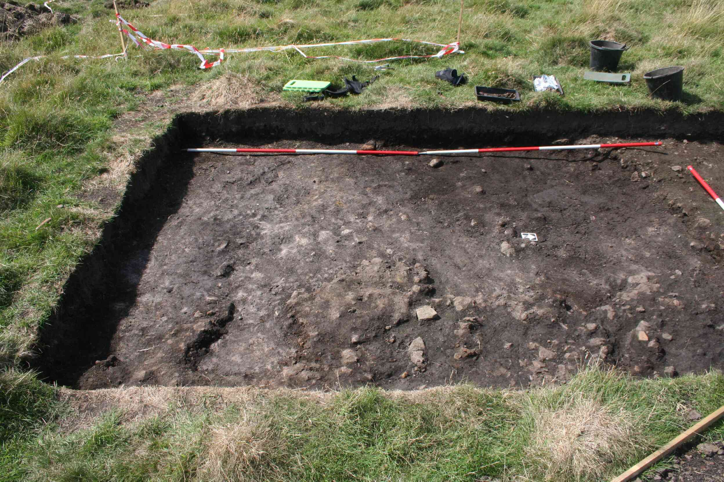
Photo 3
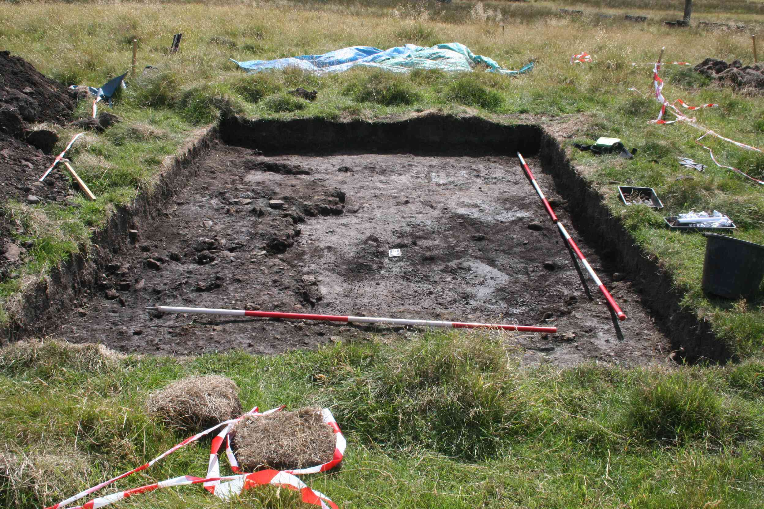
Photo 4
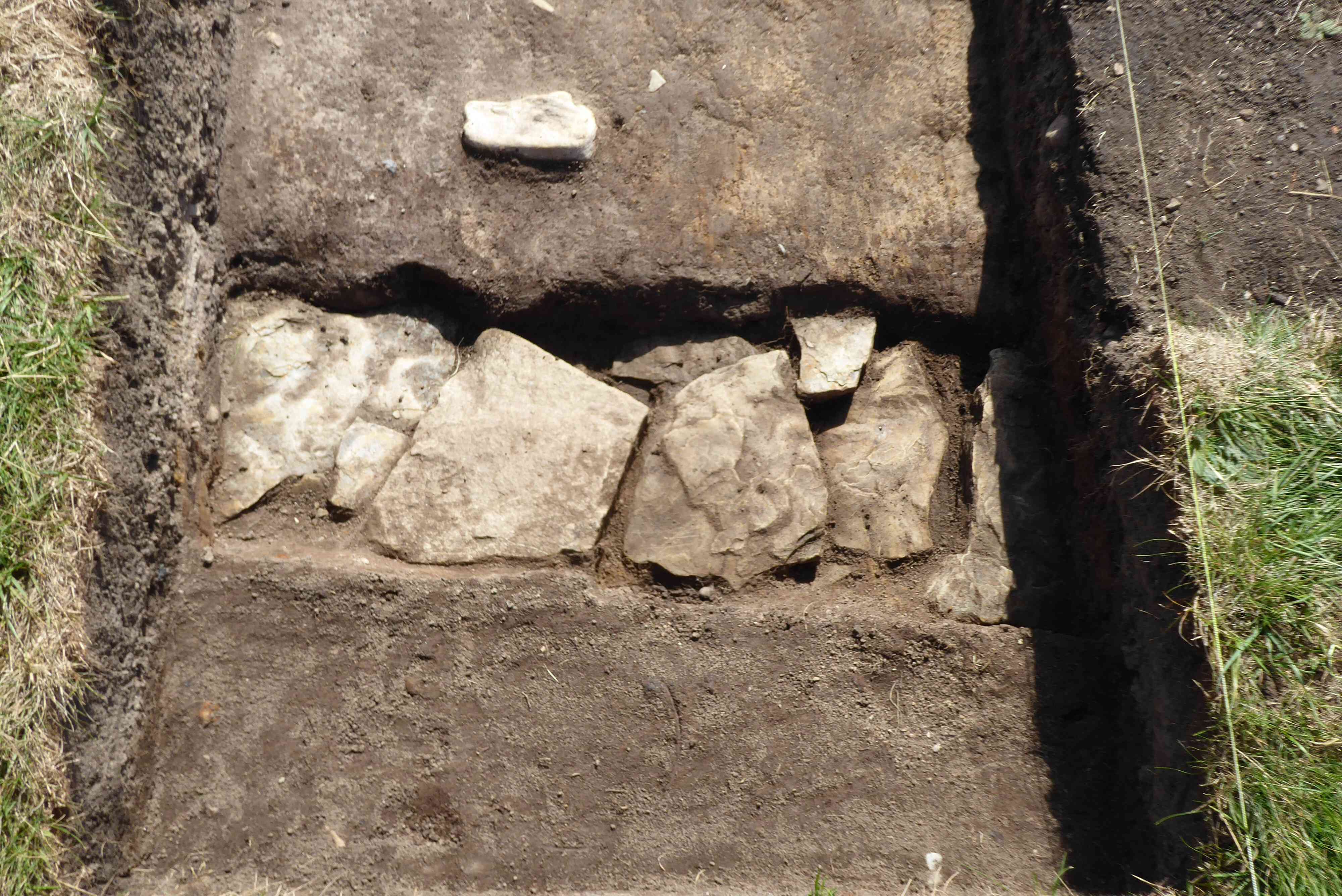
Photo 5
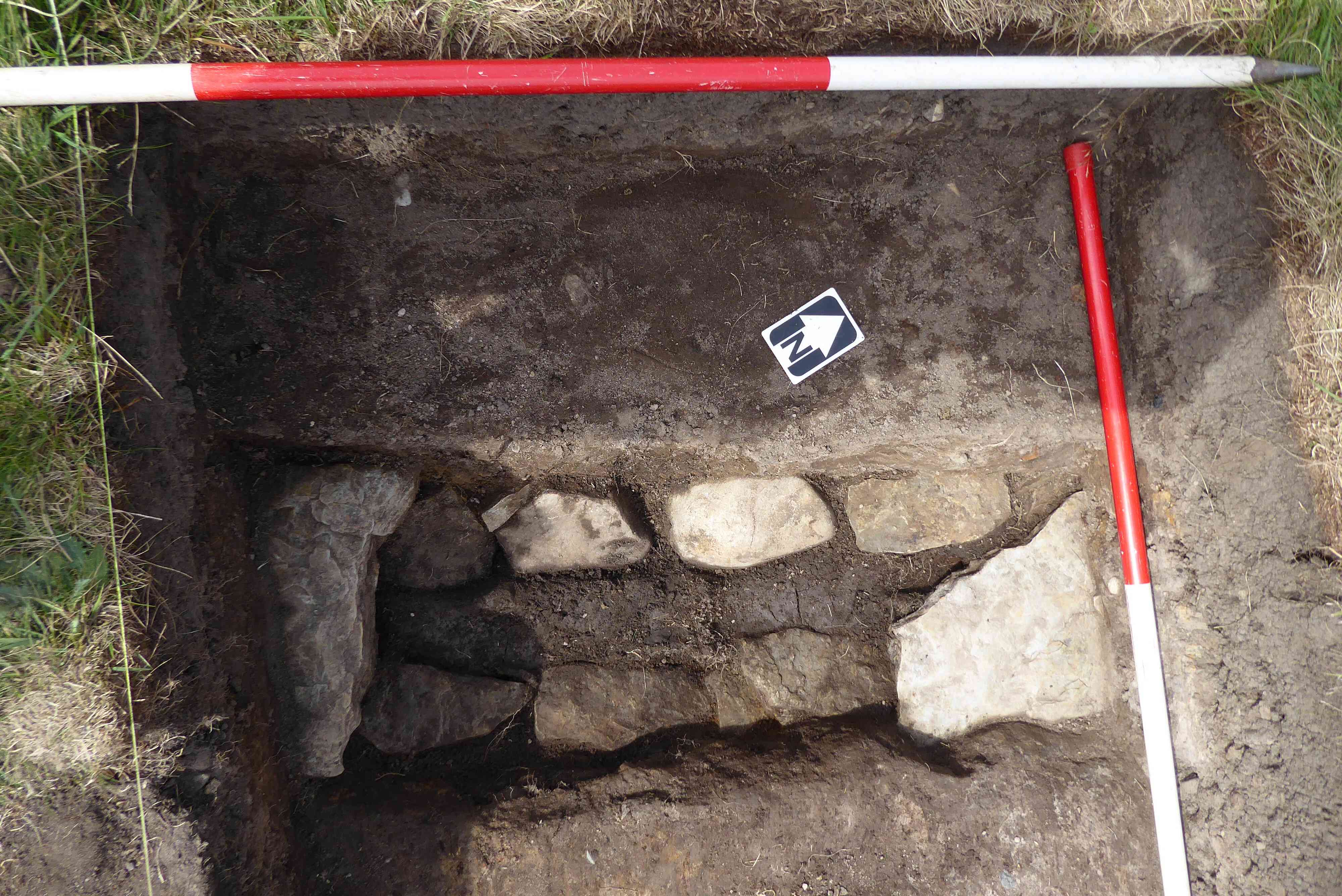
Photo 6
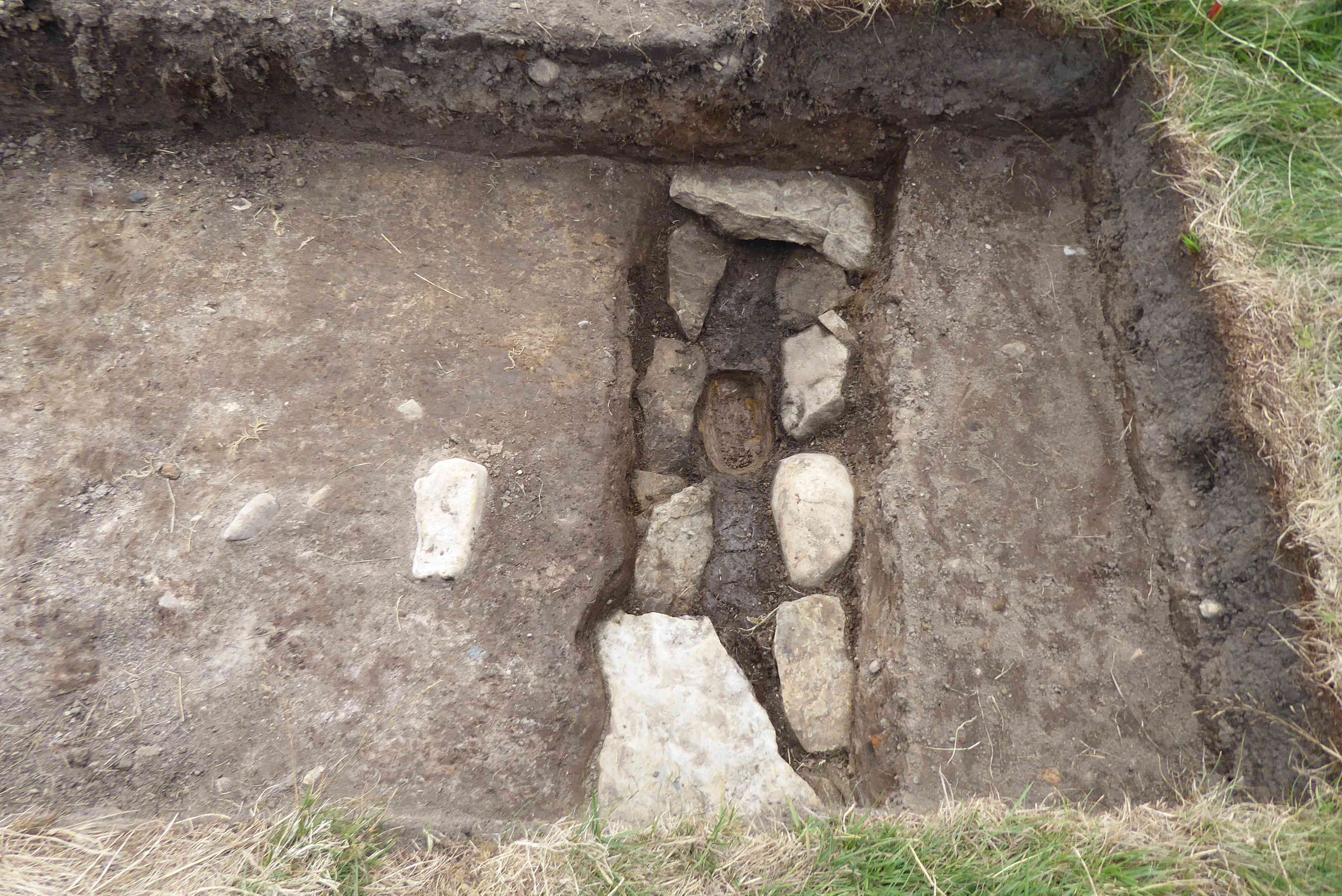
Photo 7
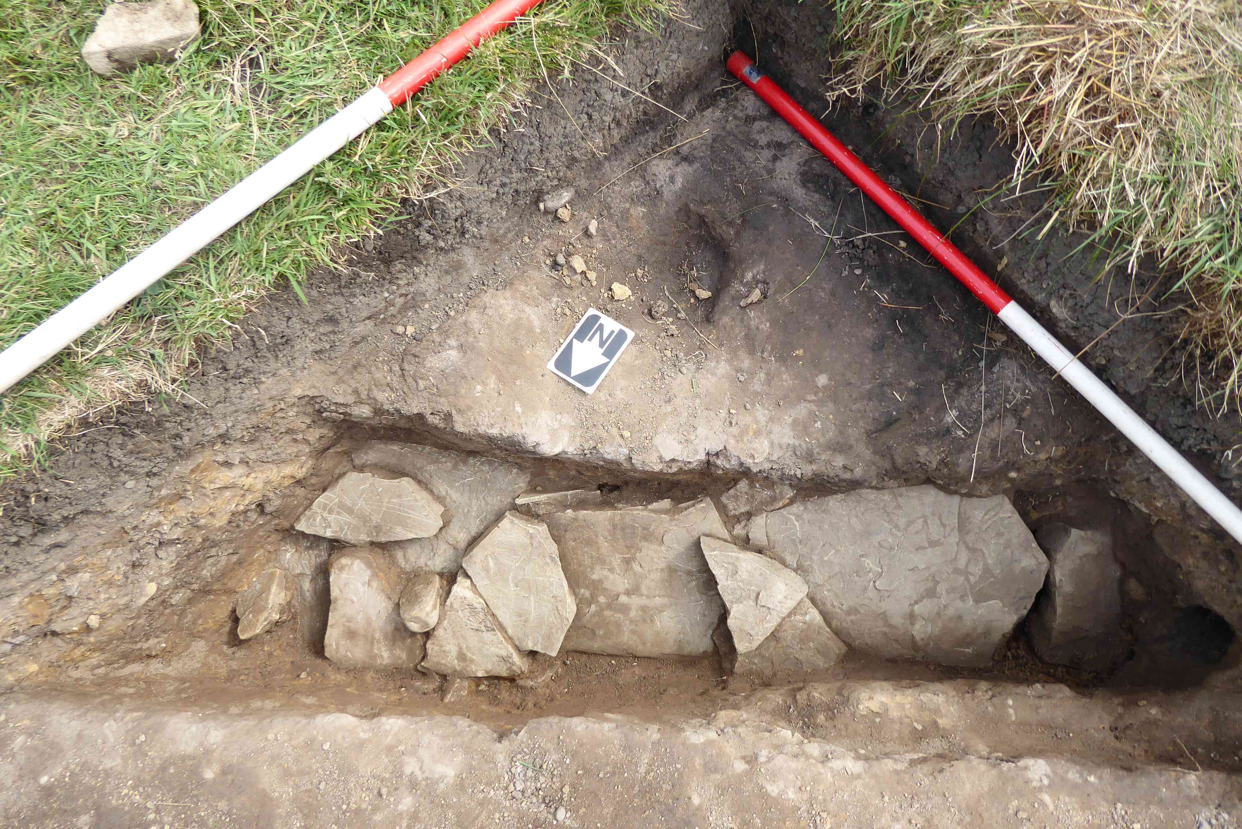
Photo 8
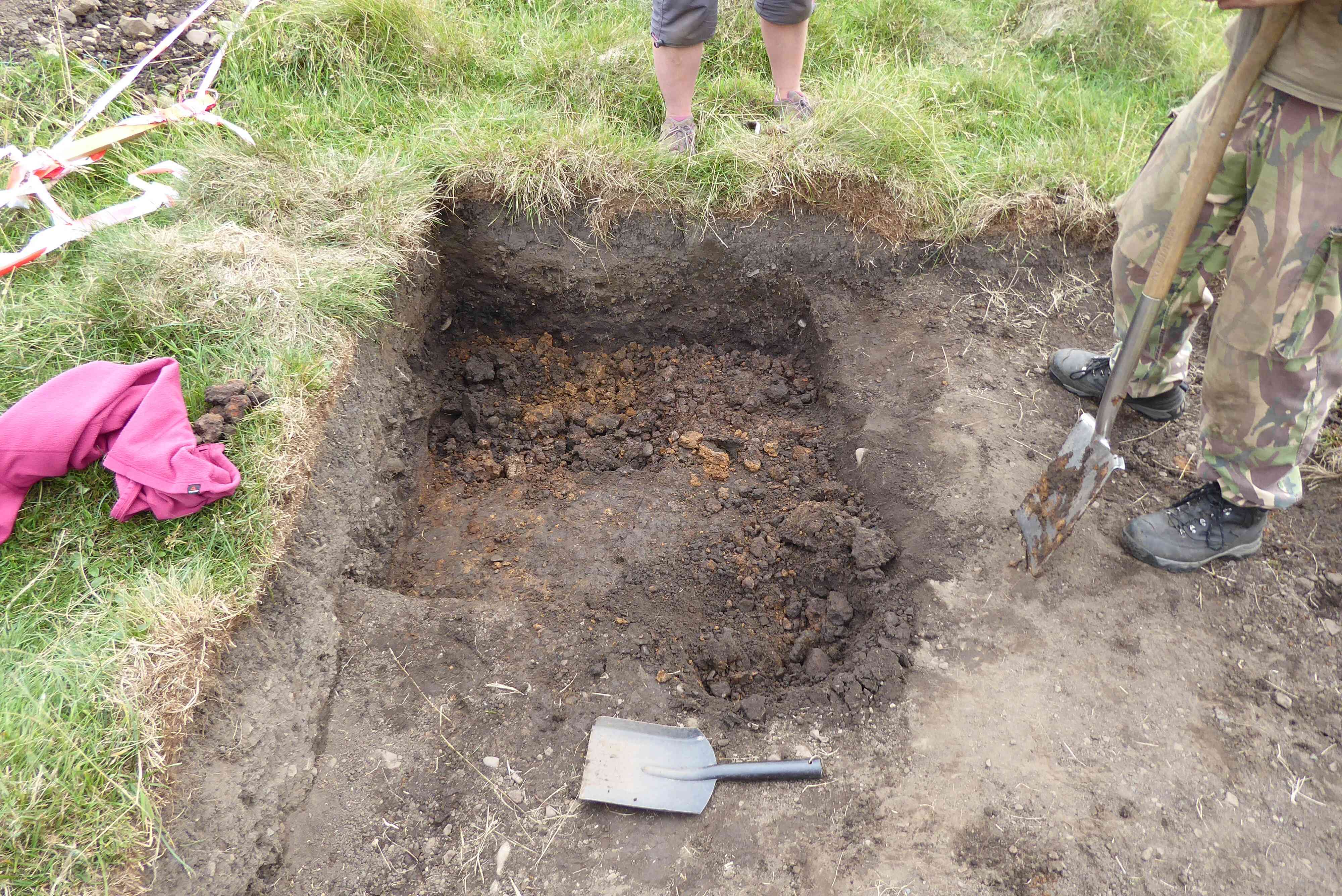
Photo 9
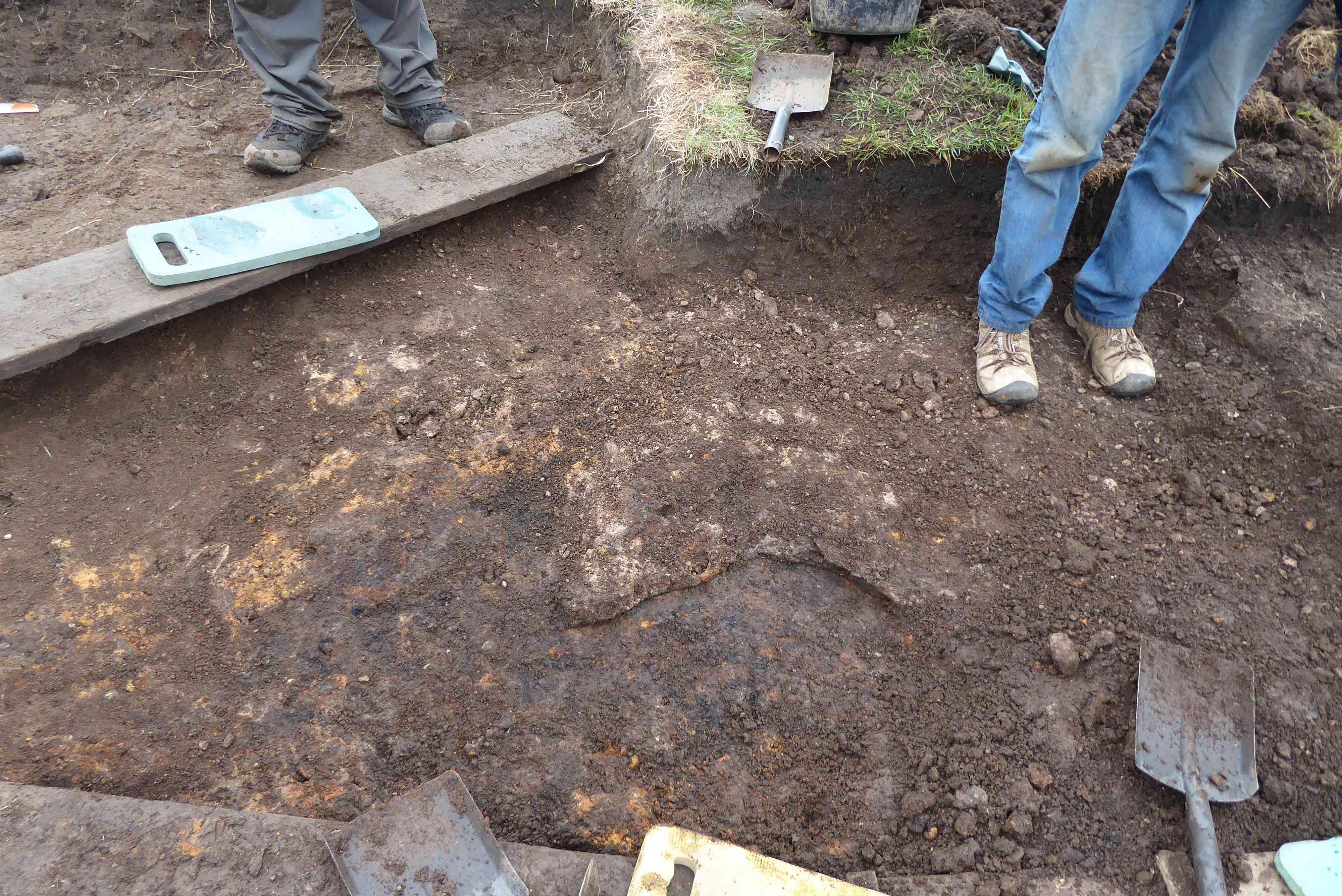
Photo 10
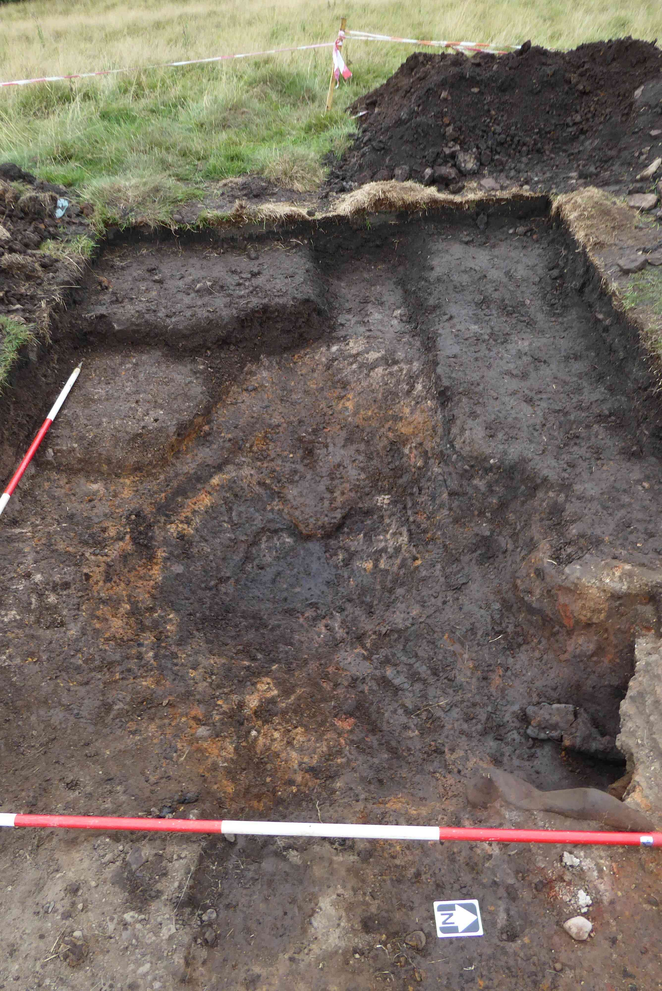
Photo 11
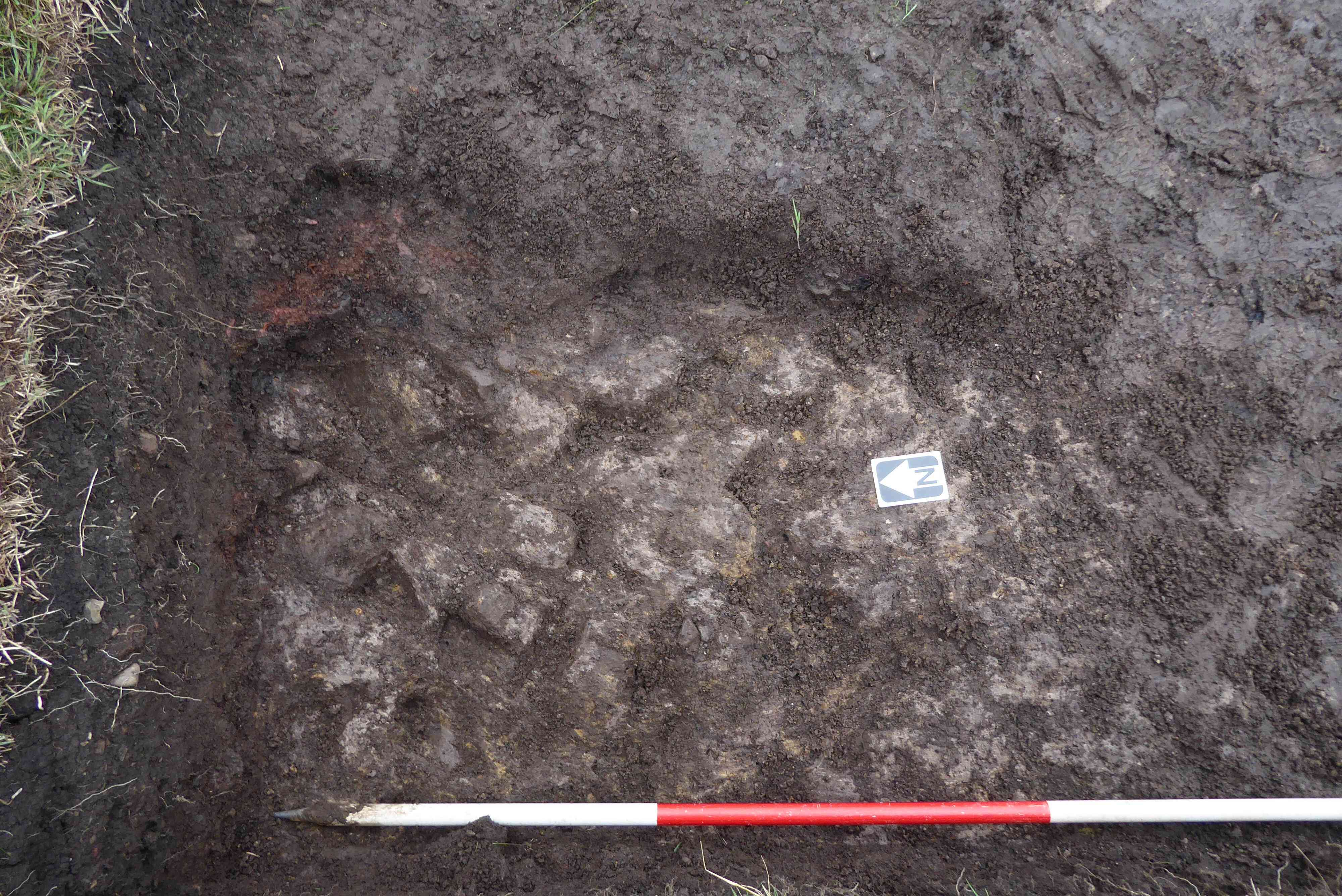
Photo 12
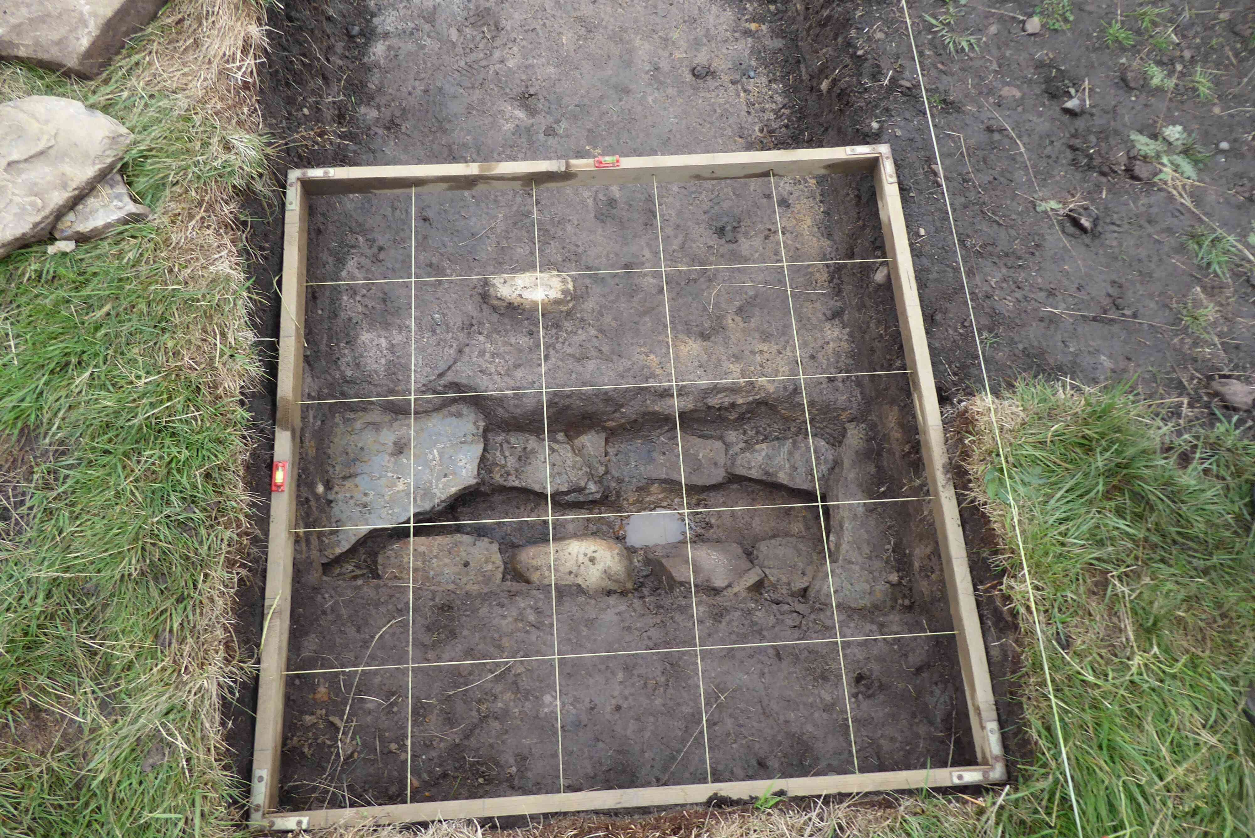
Photo 13
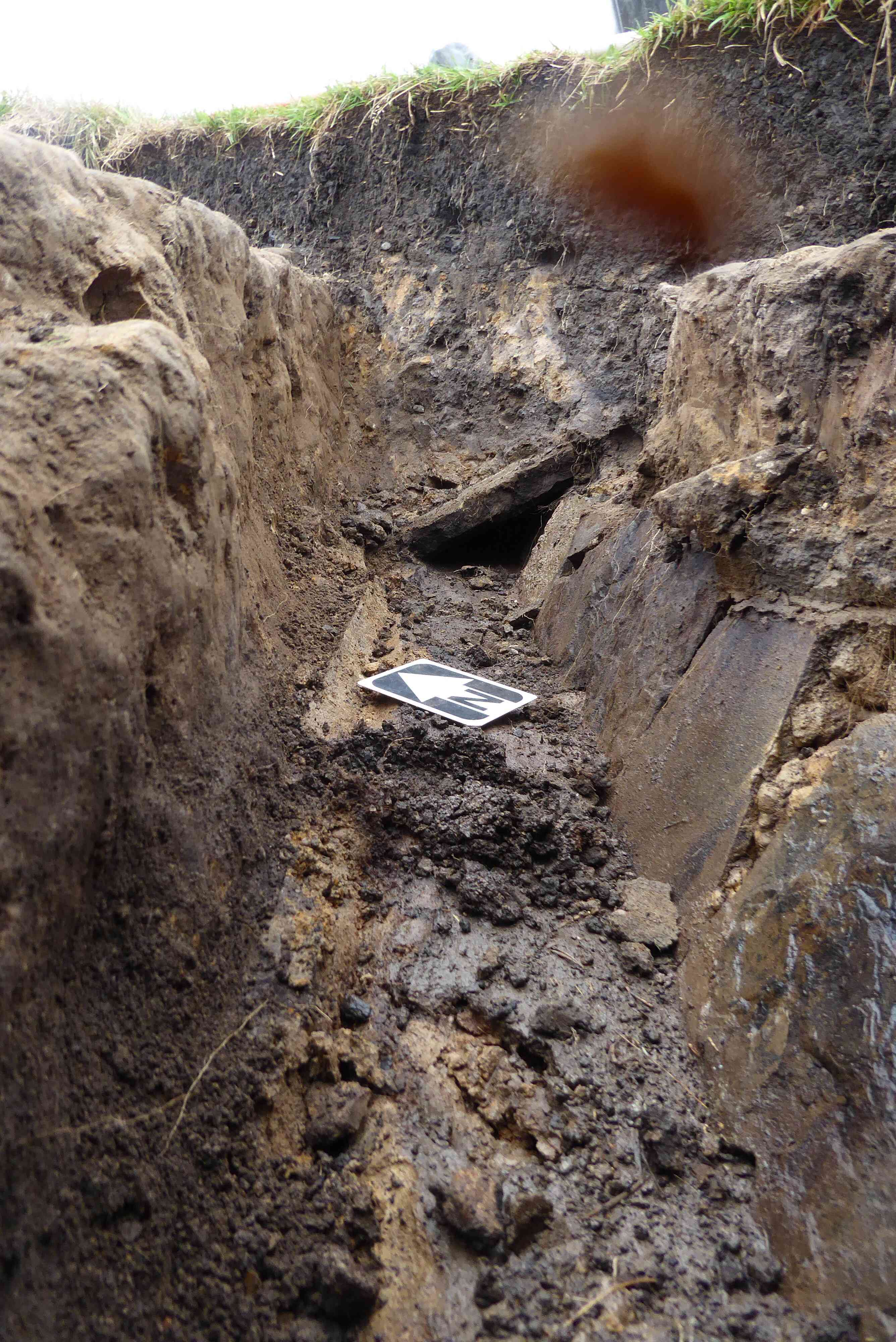
Photo 14
Weather overcast and cool for most of the time.
Some bailing of the trenches, however, was necessary. As there were 14 members on site, this did not take long.
Neil spent what free time he had making a start on recording the trench details, Photo 1. As it is a very complicated trench it is going to take some considerable time to complete the exercise. A small test pit was sunk in the North West corner of the trench in an area where little, if any, activity associated with the bloomery appears to have taken place. It was not long before a relatively loose, gravelly, clay soil was reached, which appeared to be the natural earth surface, Photo 2. As there was little to be gained by deepening the test pit, the exercise was abandoned.
Work continued removing the darker surface soil from the greyish/white clay surface, working from the southern area of the trench to the northern area. Photo 3. This is unfortunately a slow task without any new finds popping up to make the task more interesting. One more dig should complete this trench when recording can be carried out and the trench closed down.
Work continues on the west end of the trench just beyond the drain complex. The surface was taken down to the grey/white clay layer to match the level on the east side of the drain, Photo 4.
Work was then started on the east end of the trench taking the level below the greyish/white clay level to determine where the natural earth surface begins, Photo 5.
Work concentrated on the southeast corner of the trench between the trench walls and the drain cut. The surface was initially taken down to the hard packed orangy clay layer under the lighter clay layer, Photo 6. Once the exposed layer was photographed the orangy clay layer was taken down to the level of the top of the vertical drain side stones.
Work continued taking the trench down to greyish/white clay layer. Photo 7.
The decision was taken to try and determine the extent of the drain located in trench 4 by digging two test pits along the drain line. The supposed drain line was marked out with ranging rods, Photo 8, and two locations selected for two 1 metre square test pits 9 and 10.
The extension to the drain in trench 4 was located in the pit running from the north east corner to the south west corner. In photo 9 the cut marks can be clearly seen running diagonally through the photo from top right to bottom left.
Unfortunately, the continuation of the drain failed to appear in this test pit, Photo 10, so another 1 metre square test pit was excavated immediately off the south east corner of test pit 10, should the drain curve away off the straight and narrow. This new test pit also drew a blank, Photo 11. The only consolation was the finding of some 4 sherds of mediæval pottery, two being joining rim sherds, in TP 10. Test pit 10, together with its extension, were backfilled, re-turfed and closed down.
This elusive drain either terminates between TPs 9 and 10 or else it curves away sharply between the two. This is where a drain camera would come into its own. A decision will have to be taken whether it will be worth while trying to track the drain; the question being would the time taken tracking the drain add to the understanding of the site?
Sunday 19th August
Sunday’s weather forecast was very poor with a 90% chance of rain forecast between 09:00 and 13:00 hrs. As a result, it was decided to cancel the Sunday dig.
Next dig dates: 22nd & 23rd September and 29th & 30th September
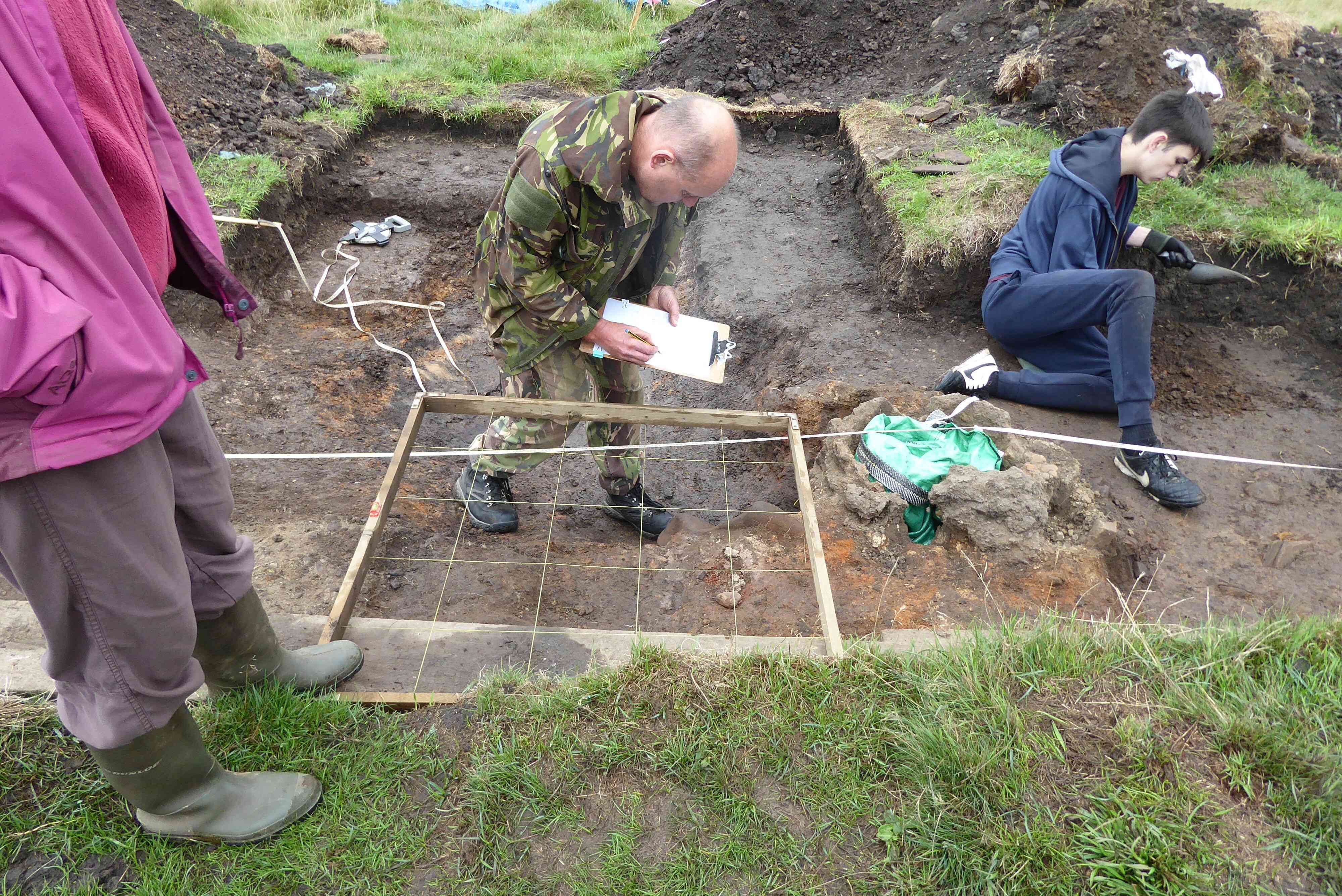
Photo 1
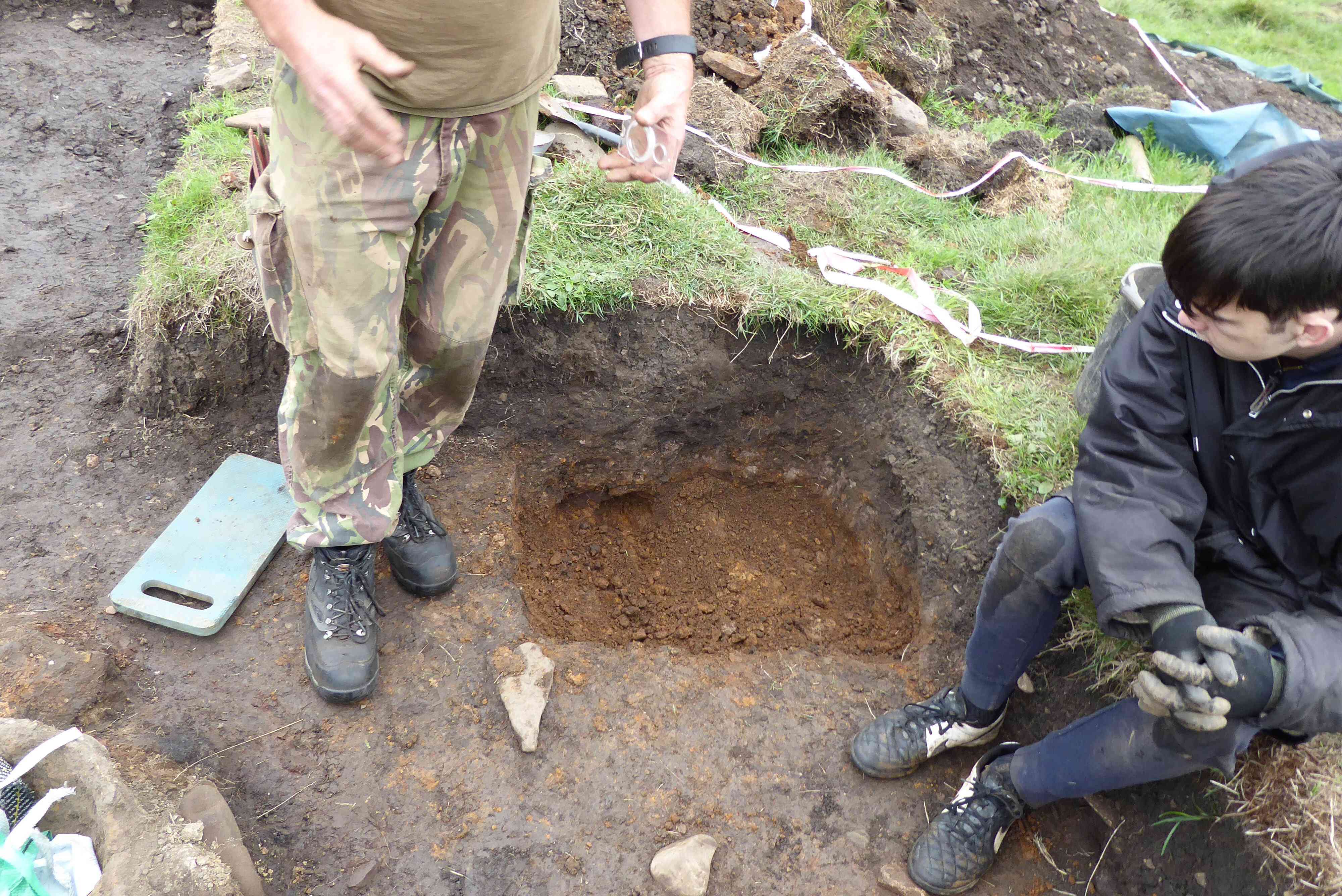
Photo 2
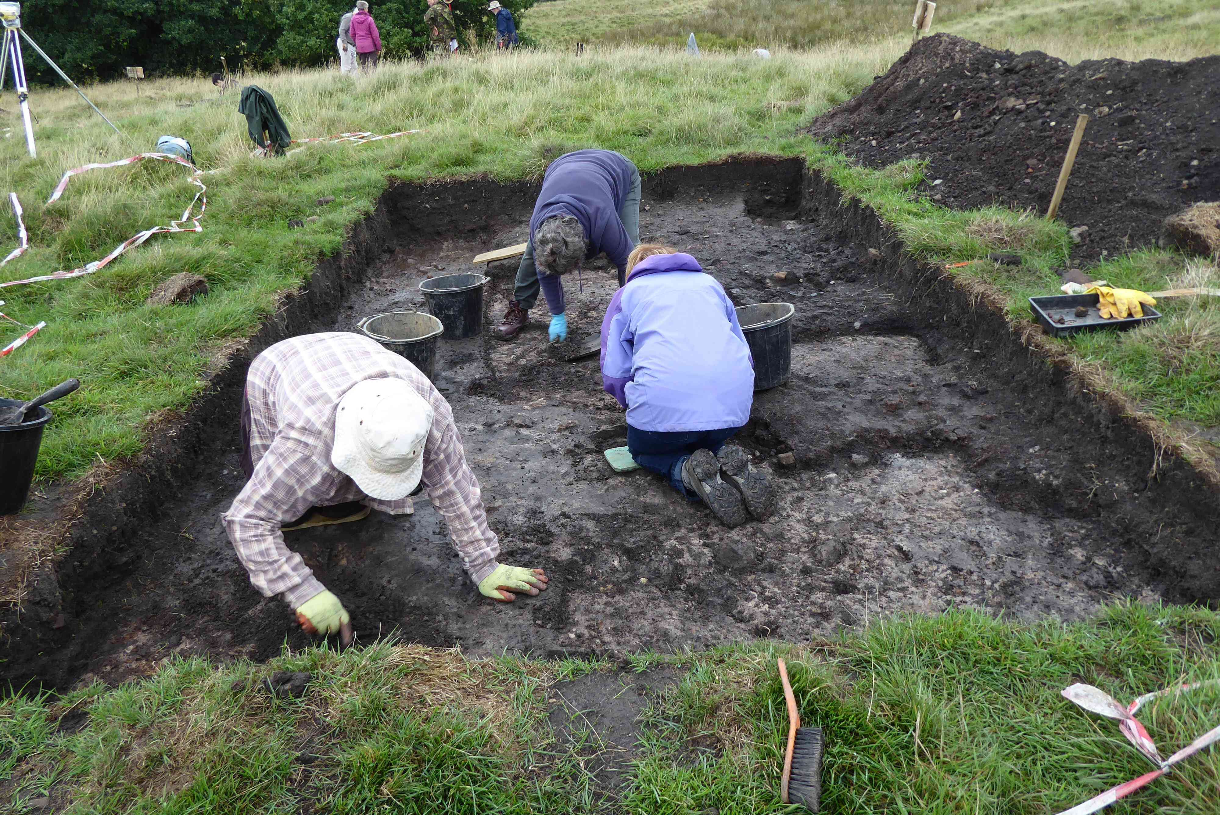
Photo 3
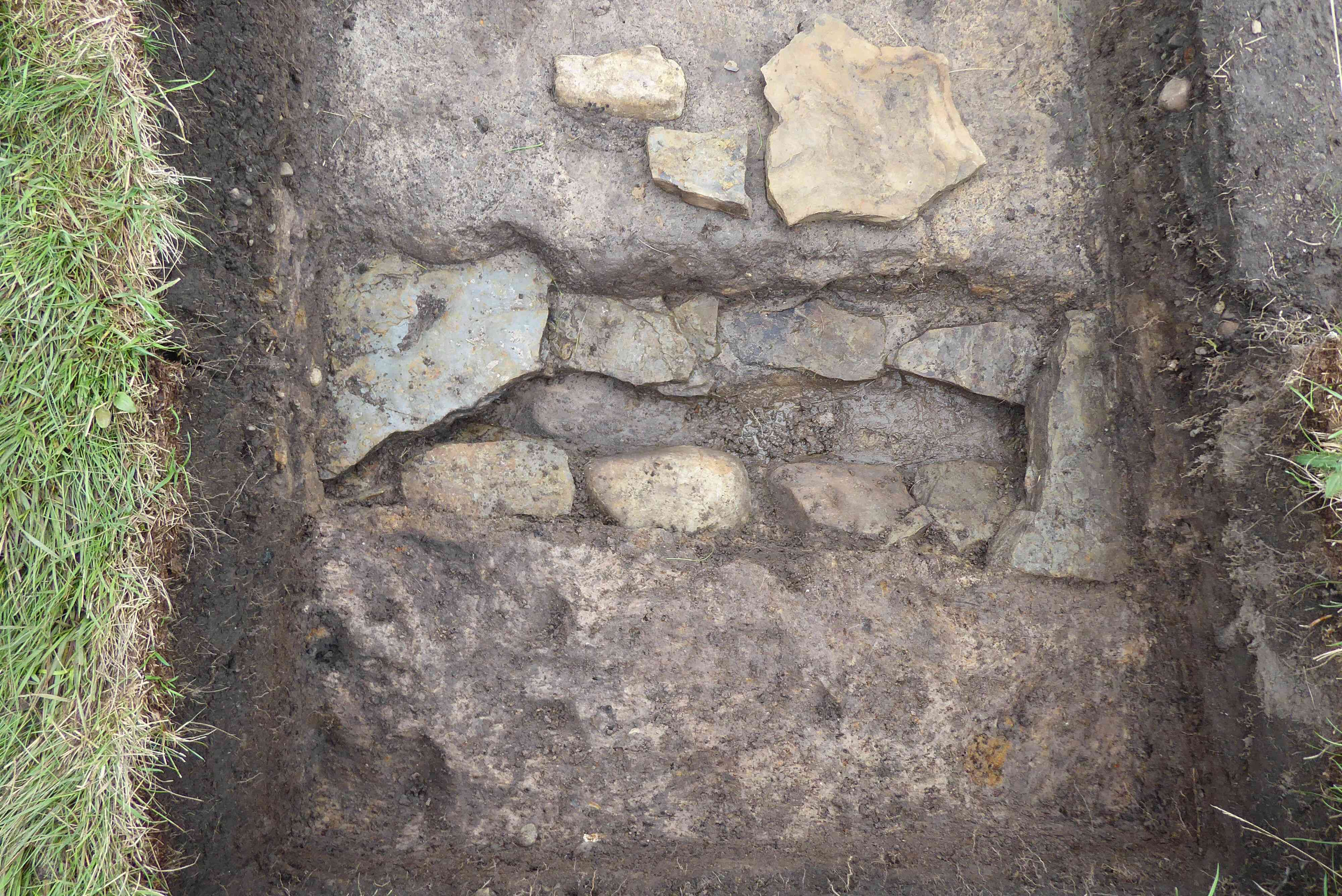
Photo 4
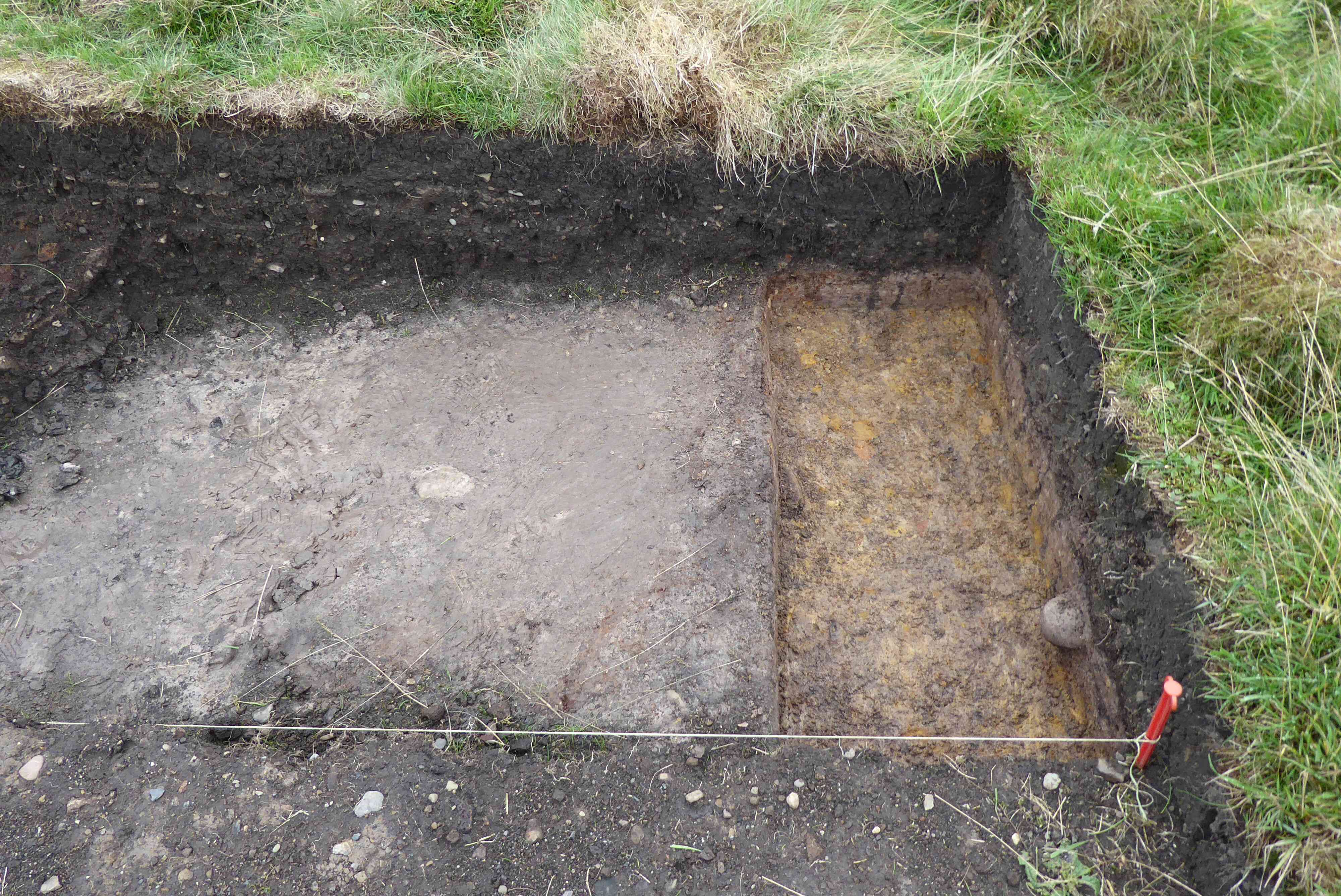
Photo 5
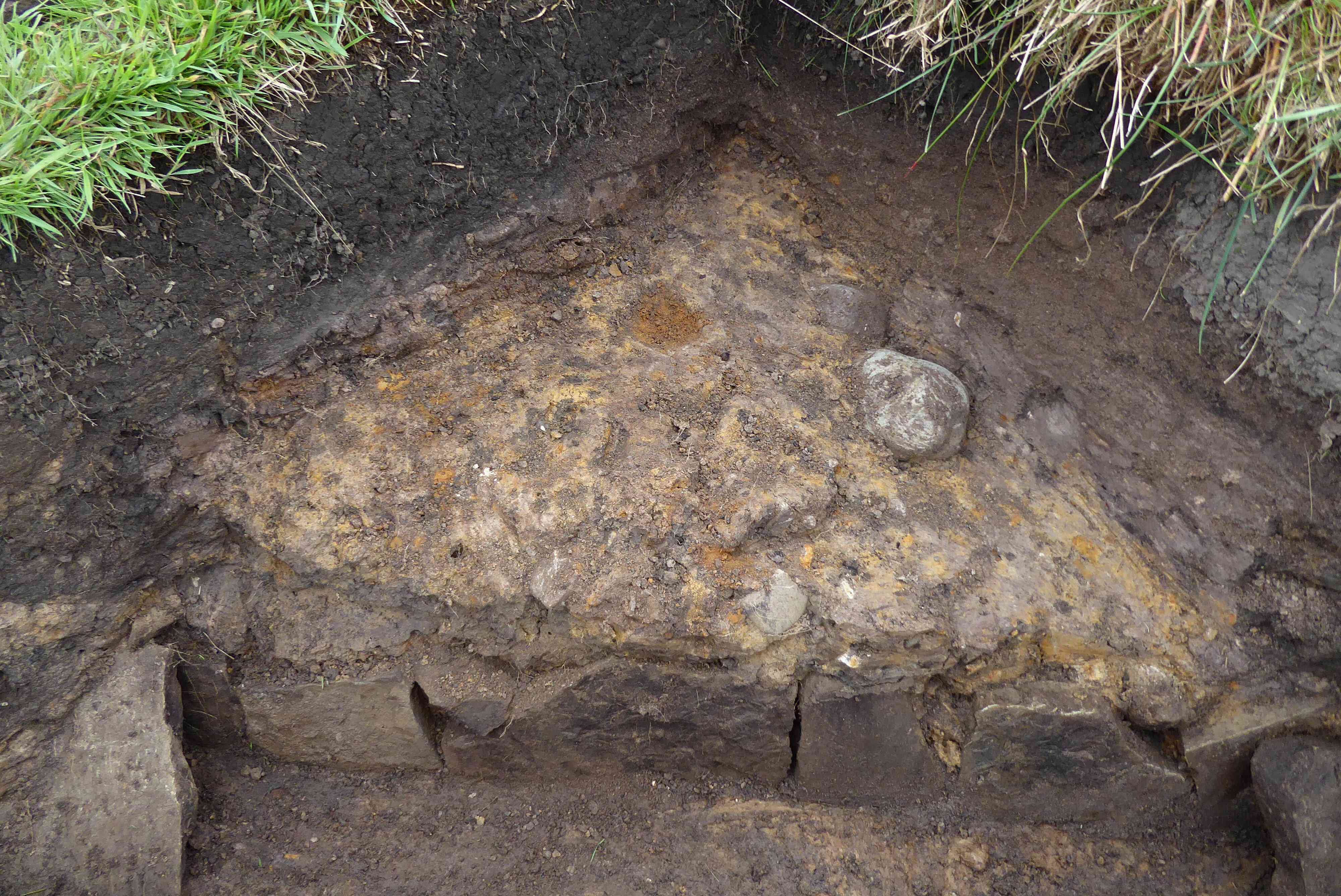
Photo 6
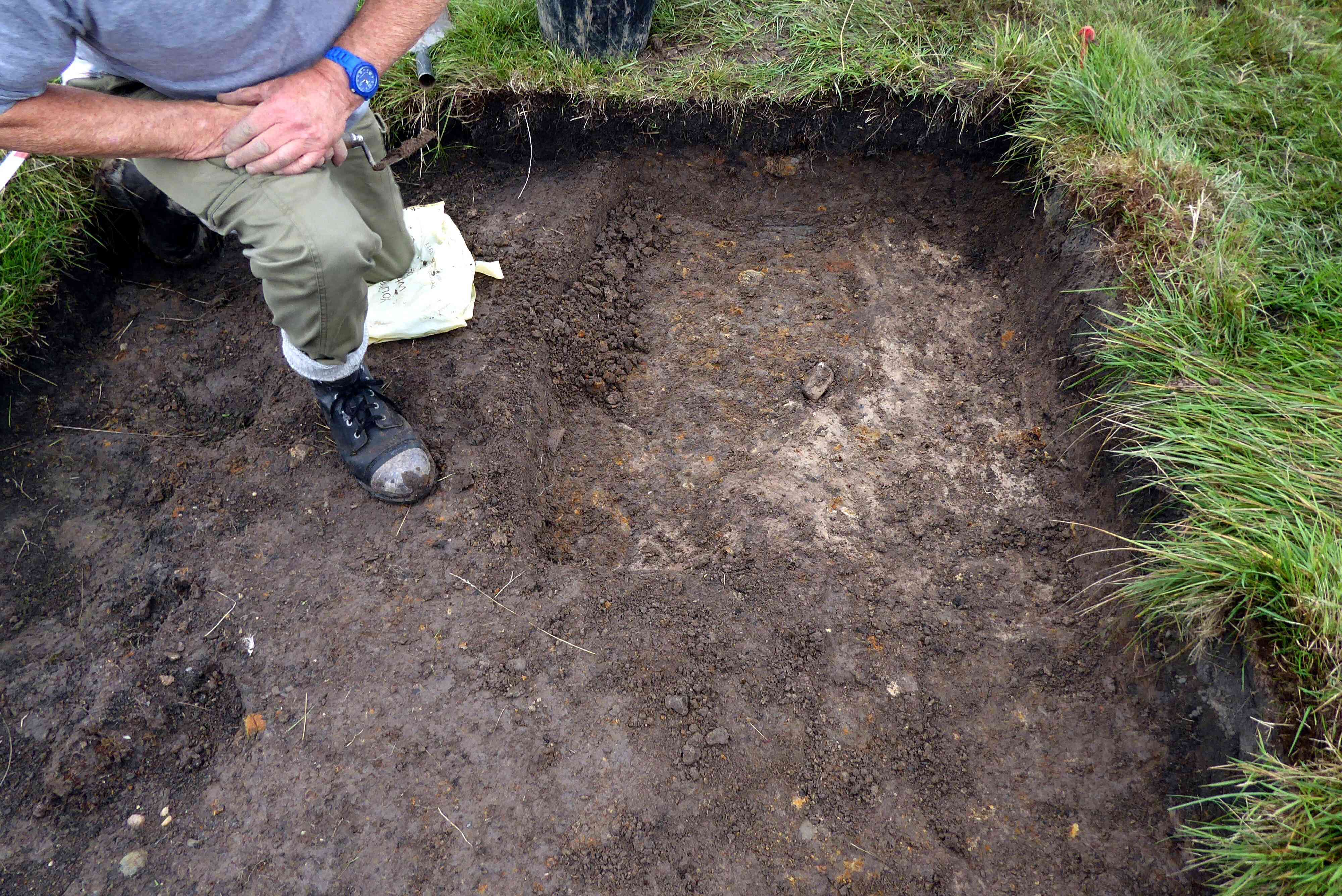
Photo 7
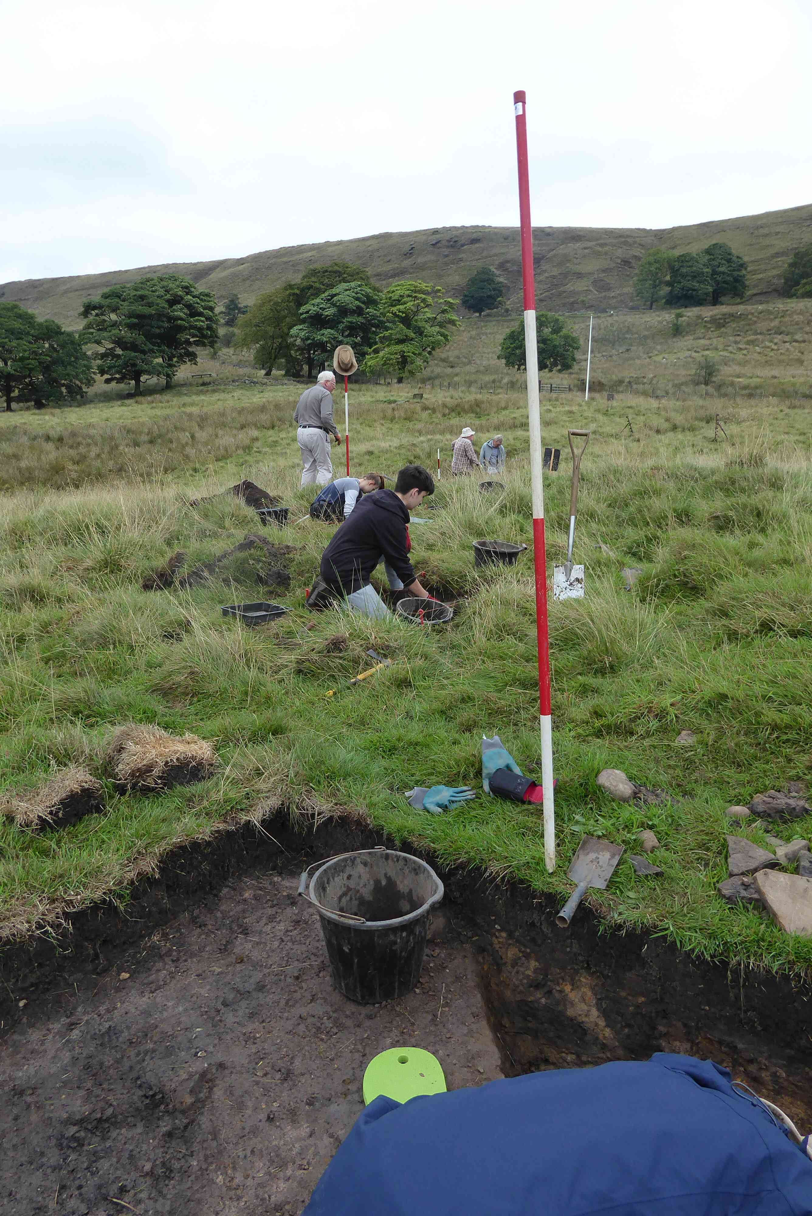
Photo 8
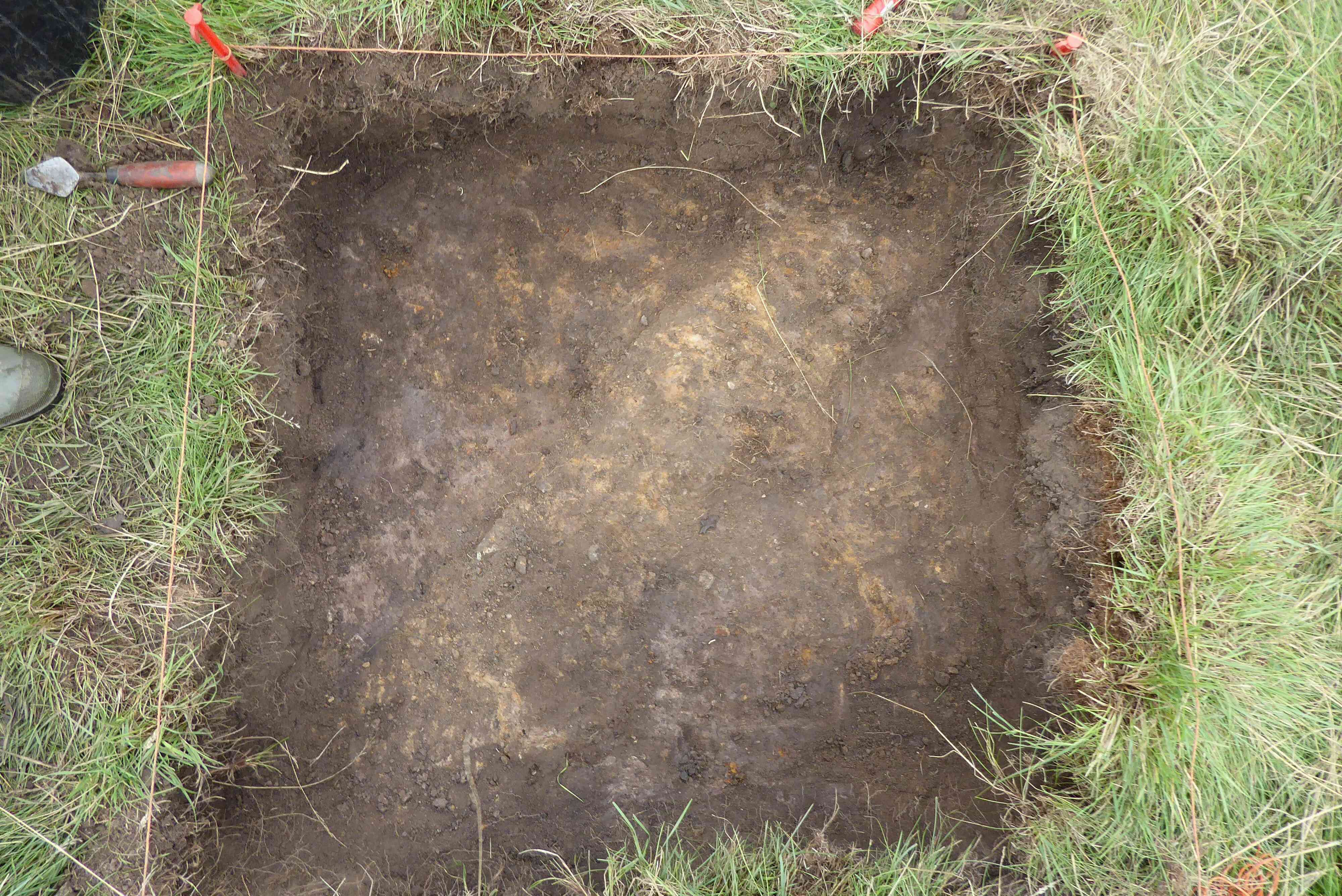
Photo 9
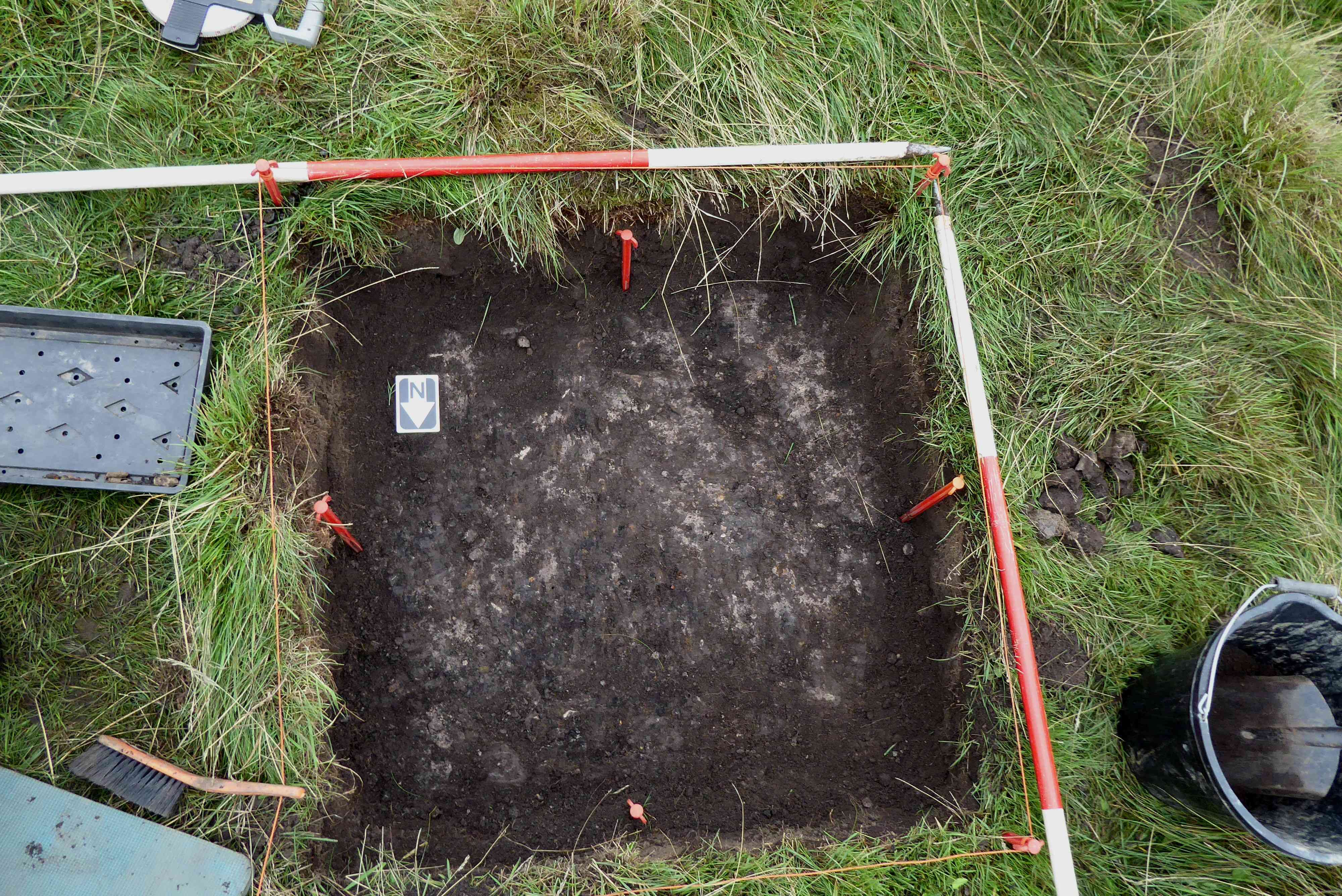
Photo 10
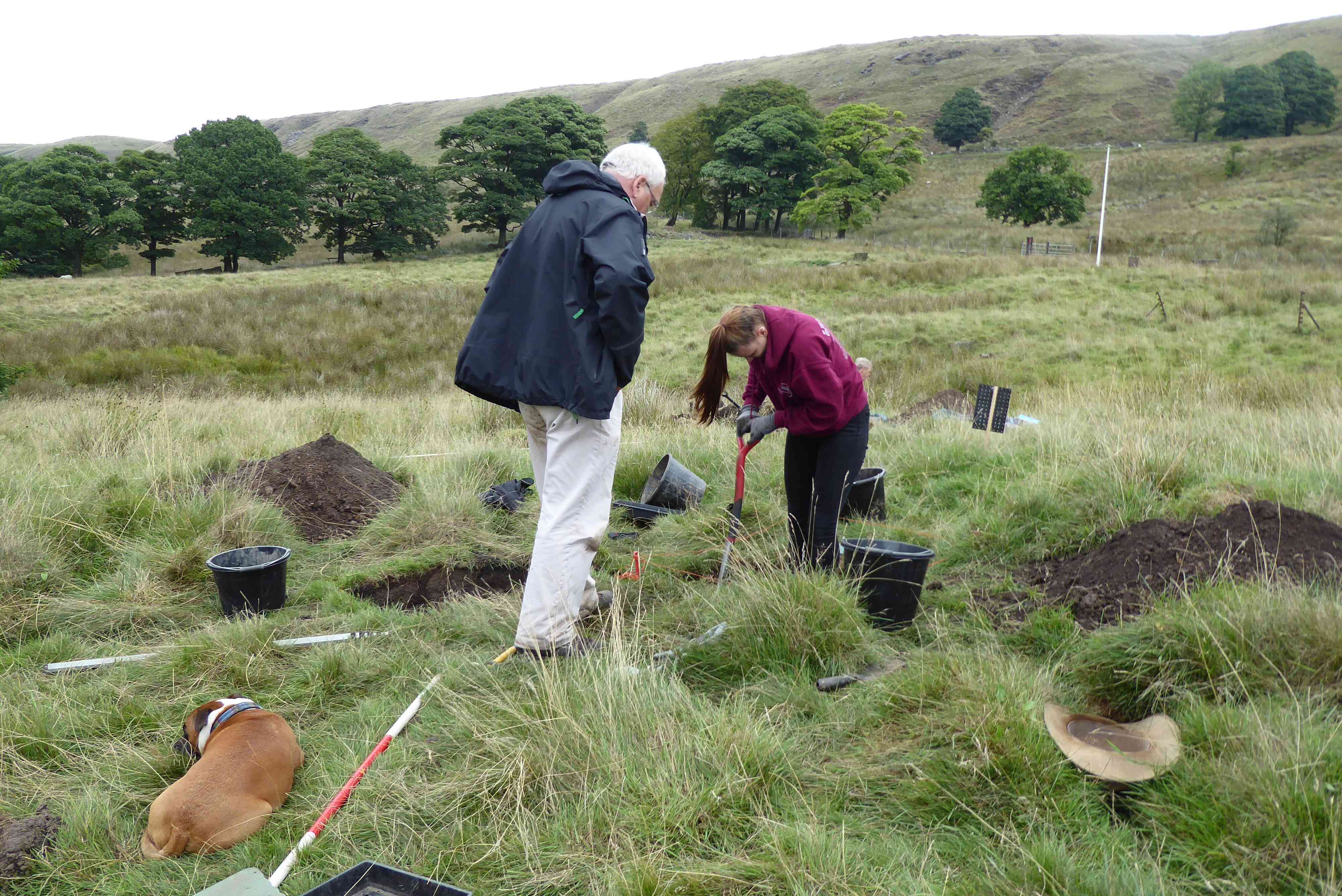
Photo 11
After all the rain over the past couple of days we were expecting the trenches to be swimming with water; we were not wrong. Trenches 1 and 2 were very badly flooded, trenches 3, 4 and test pit 9 were relatively dry, thanks to the drains in these excavations.
It was decided to leave this trench until tomorrow, Sunday 23rd September, and concentrate on closing down trench 2
The first task was to drain the trench prior to back filling. Experience has shown that it is better to drain a trench prior to backfilling or else you run the risk of being left with a backfill which is very wet, resulting in a very soft surface which could prove hazardous for anyone stepping on to it, photo 1. The backfilling operation was nearly complete by the end of the day. Sunday should see this operation finished and the trench re turfed. During the backfilling two pieces of mediæval pottery were found. Photo 2 shows the larger piece.
Recording of the areas around the drain and the band of slag was carried out before a number of levels were taken in the trench. As work on this trench is now complete it will be closed down and backfilled in the near future.
Sections of the trench were recorded, then a series of levels taken. This completes the work on this trench, photo 3.
This is the pit which holds the extension of the drain found in trench 4. Although no work was carried out in this pit today, the intention is to extend the pit tomorrow to try and ascertain where the drain terminates or turns. Test Pit 10 had been dug approx. 2 metres to the NNW of TP9 in order to track the drain in trench 4 and TP9. Unfortunately the drain did not appear in TP10, so it must either terminate between TP9 and TP10 or else branch off the straight and narrow after TP9.
Close to the boundary fence of Cinder Hill Field to the east of trench 2 is a raised section of earth. The decision was taken to put a 1 x 3 metre trench through this section of earth, running west to east to try and ascertain its purpose, photo 4.
Unfortunately, nothing was found. The soil consisted of compacted sand down to half a metre and appeared to continue deeper, photo 5. It looks as if this feature could well have been created by clearing sand out of a drain or cut, the remains of which can be discerned between trench 7 and the stone boundary wall.
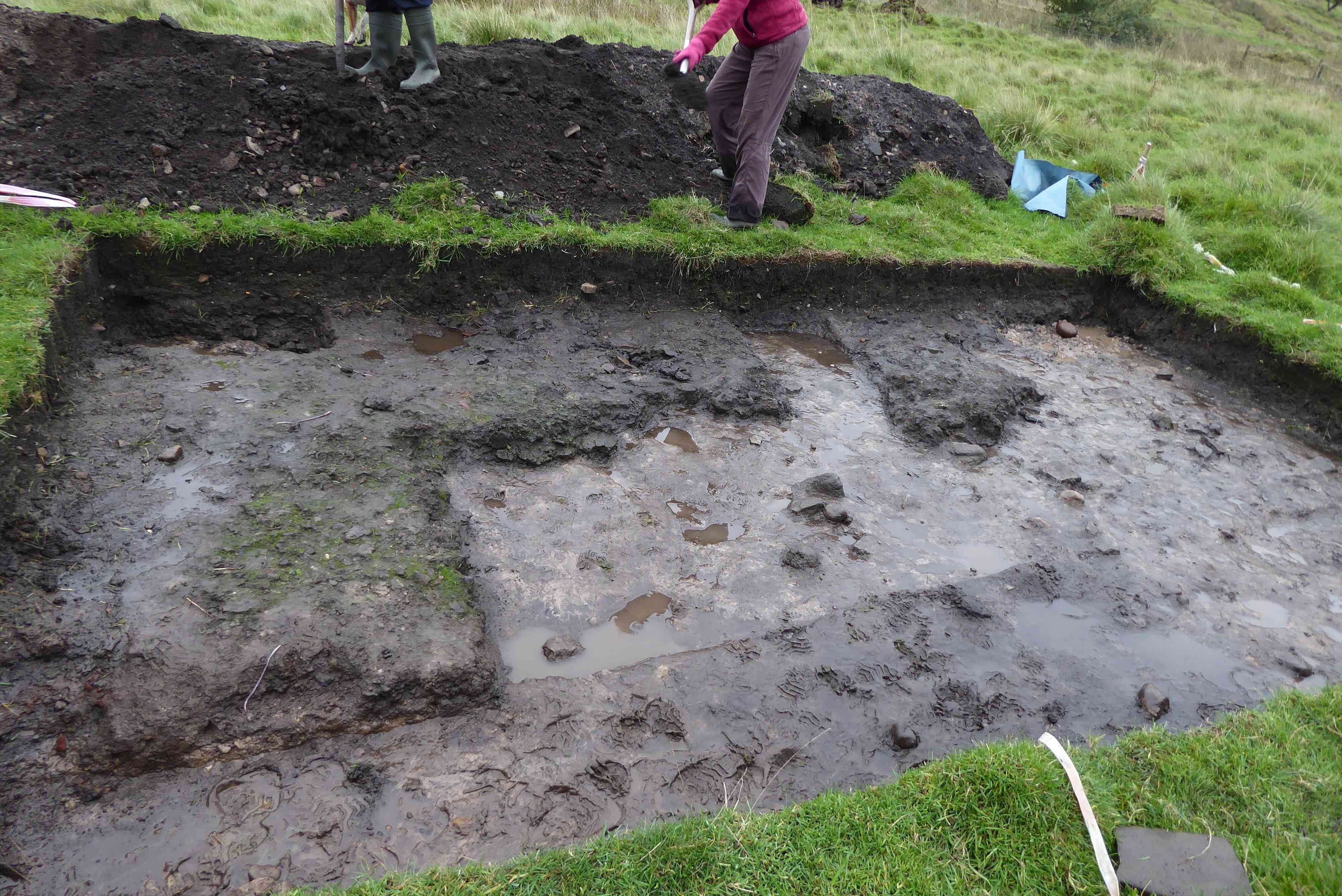
Photo 1
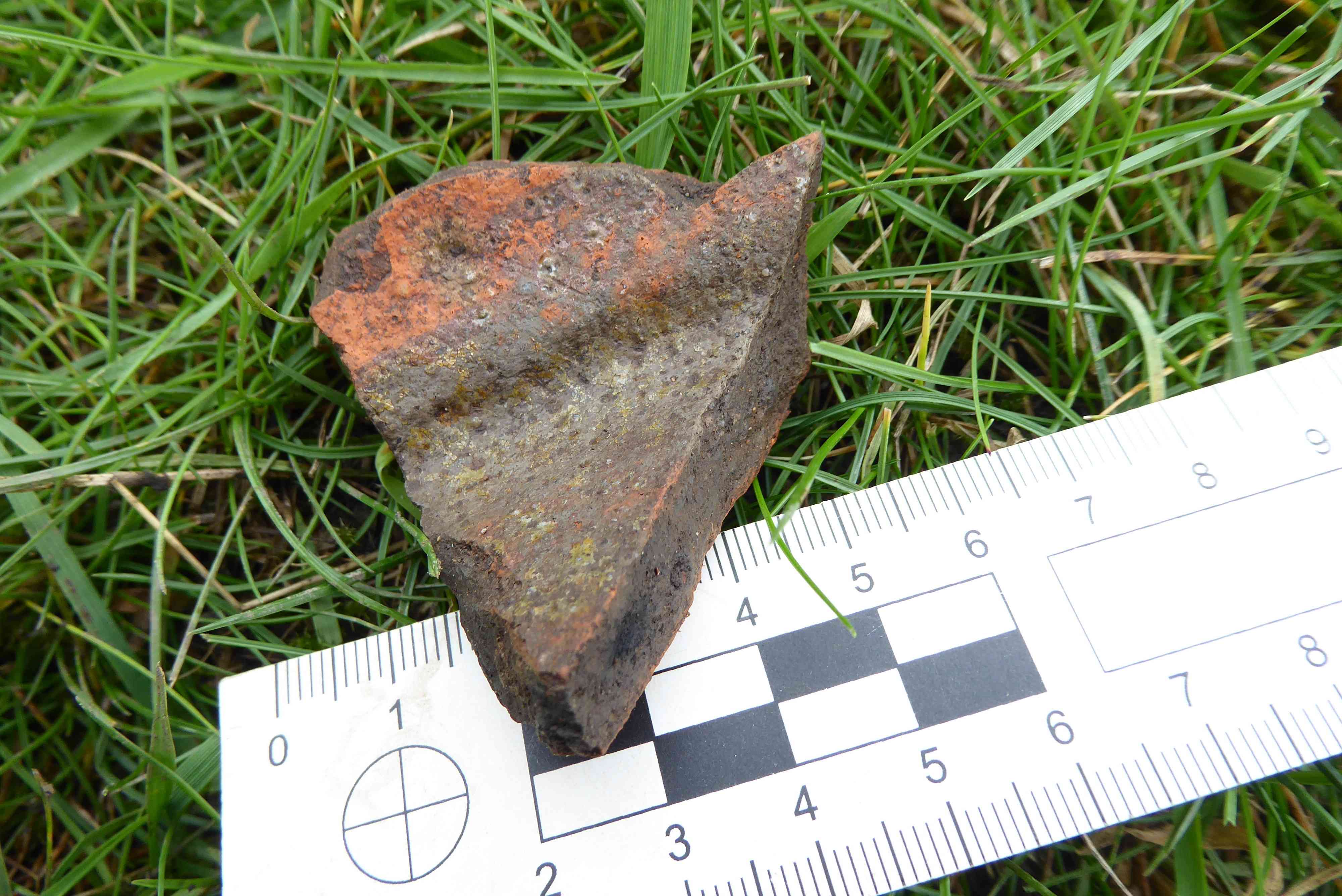
Photo 2
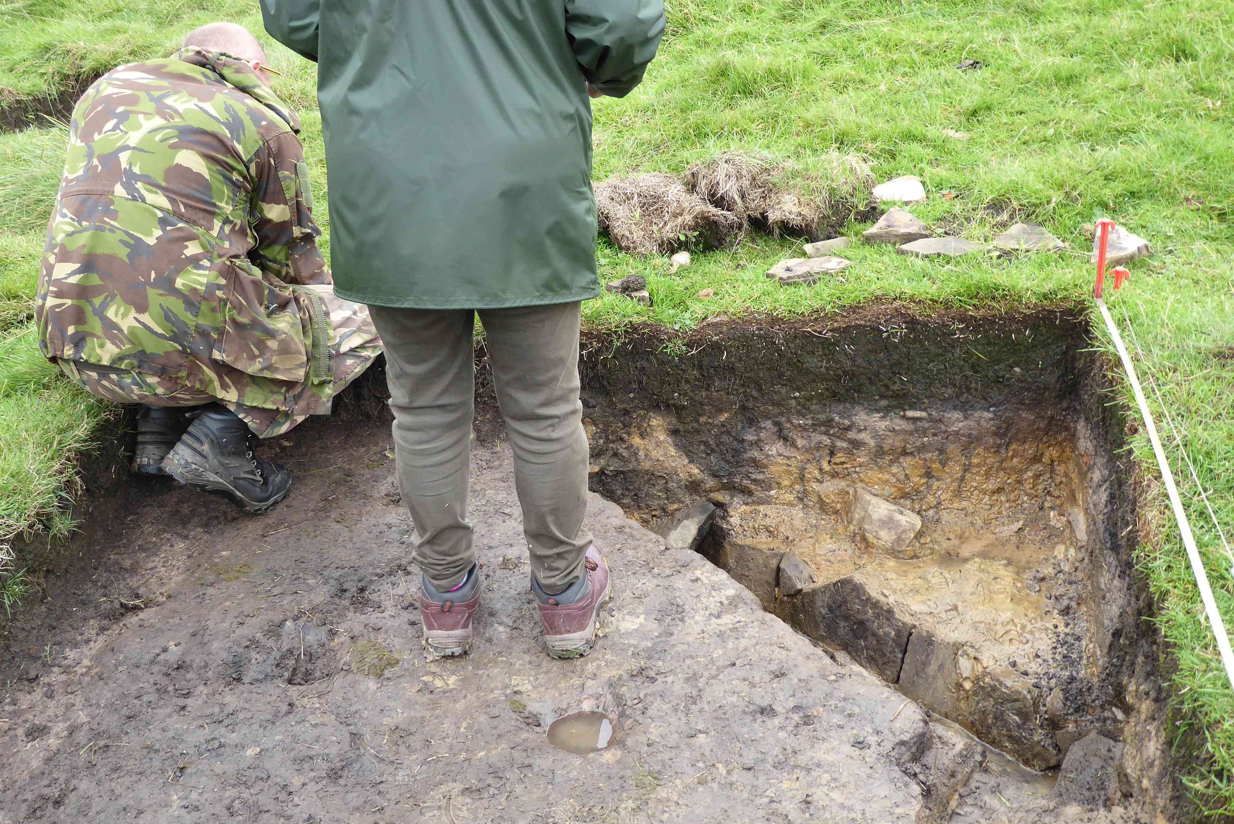
Photo 3
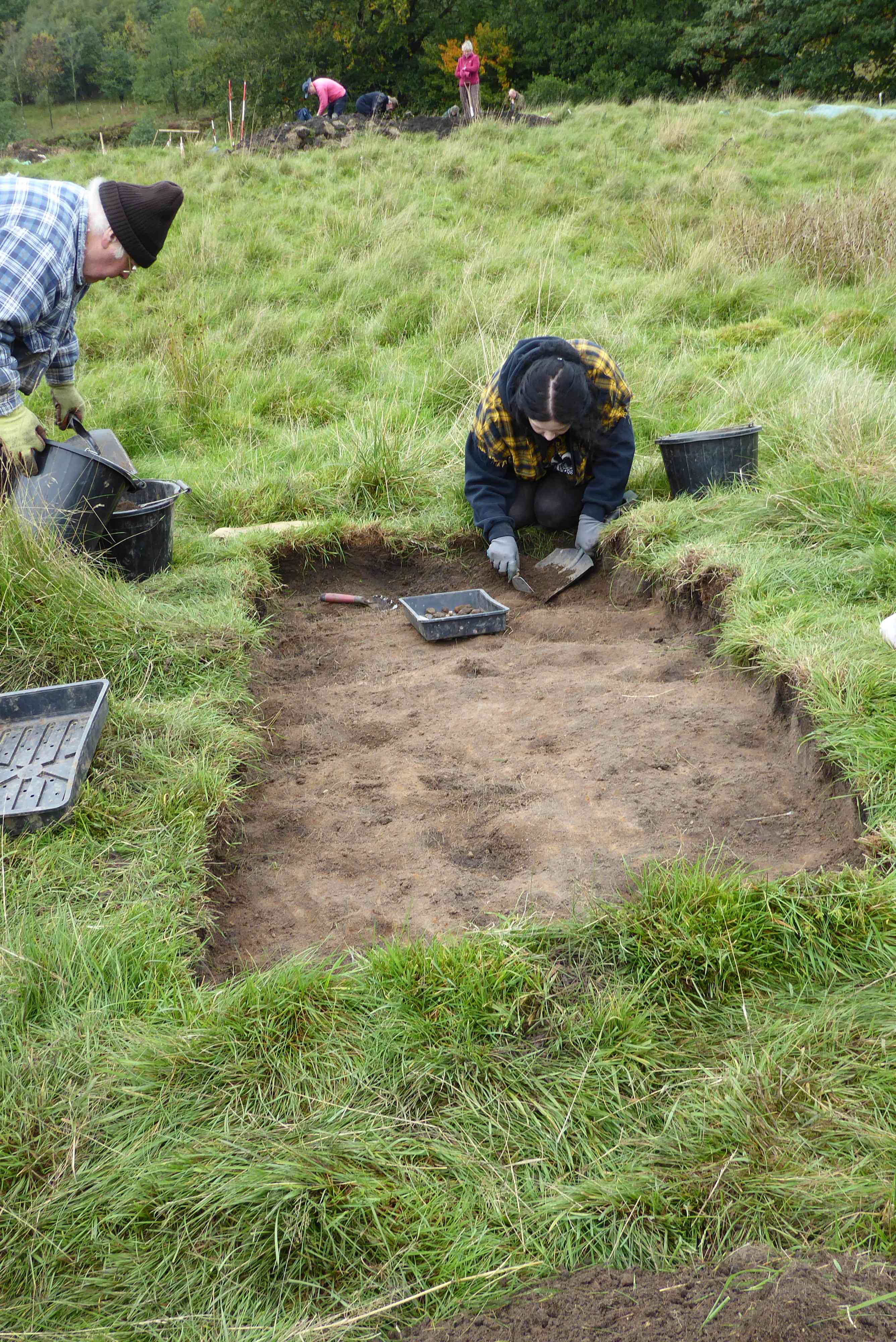
Photo 4
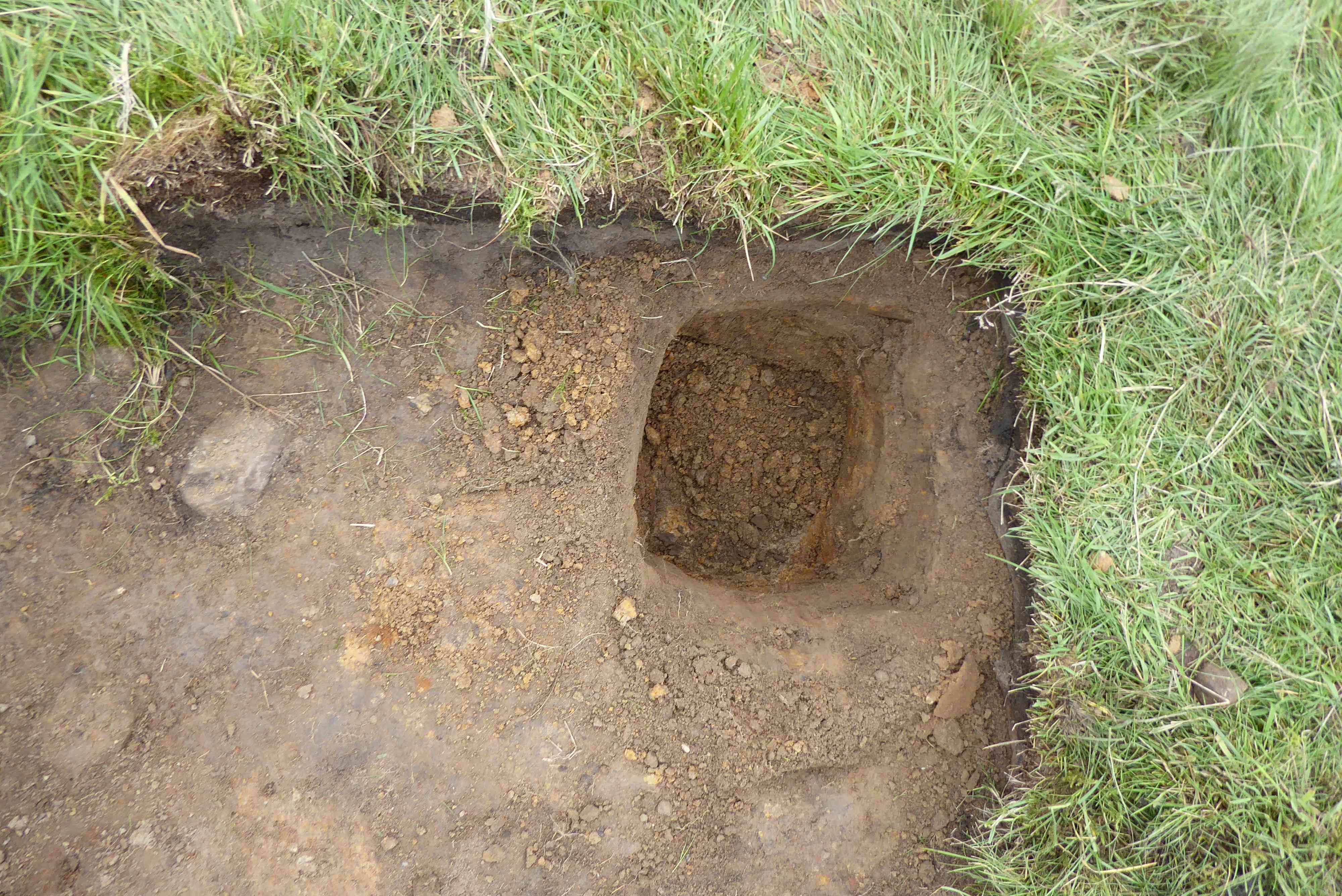
Photo 5
Dig report for Sunday 23rd September 2018
A bright and breezy day with lots of sunshine. There had been no rain overnight, so the flooding of the trenches was no worse.
Trench 1.
The water in trench 1 was bailed out. The bloomery furnace was protected by a membrane and then the backfilling of the trench was begun. This was not completed, but will probably be finished next weekend. (Photos 2 and 3)
Trench 2
Work continued backfilling this trench and replacing the turf, but there is still more work to do to finish this trench.
Trench 3
The recording was completed in this trench and it is now ready for backfilling in the near future.
Trench 4
The soil was replaced in this trench. The turf will be replaced next weekend.
New trench Trench 8
This trench was opened for two reasons. One was to examine if the possible trackway in trench 1 continues further east and the other was to see if features in trench 2 continue further south. The topsoil was removed and archaeology was revealed, but this will need further cleaning next week, in order to define the features. Levels were taken around the trench. (Photos 1, 4 and 5)
Test pit 9
The trench was extended slightly to find out in which direction the drain continues. The drain did continue, then it was decided to close the trench and continue with the excavations in this trench next year.
The next dig dates are Saturday 29th and Sunday 30th September.
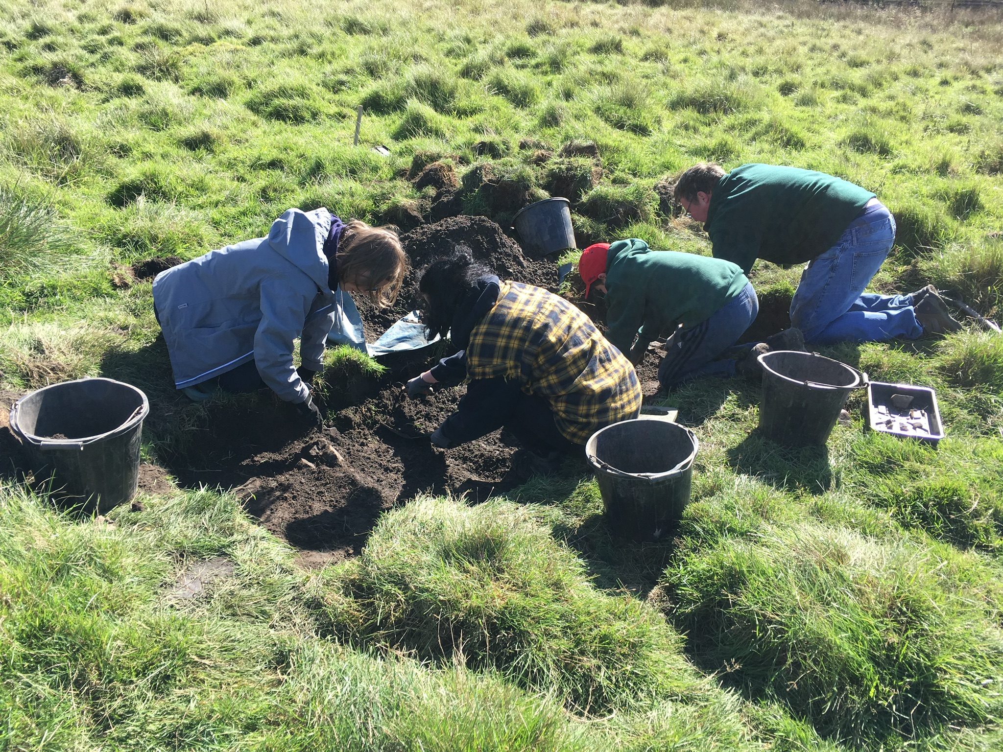
Photo 1
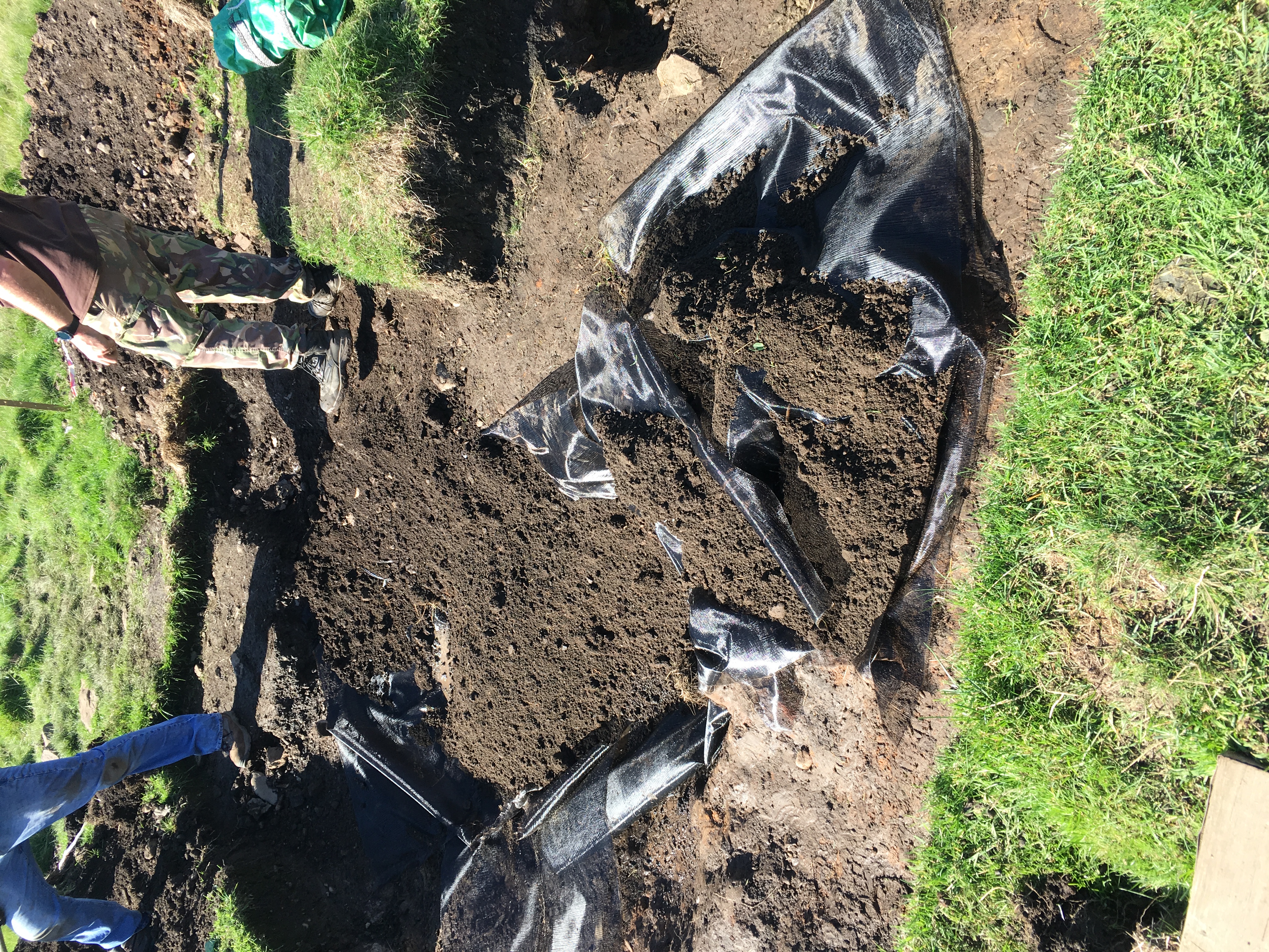
Photo 2
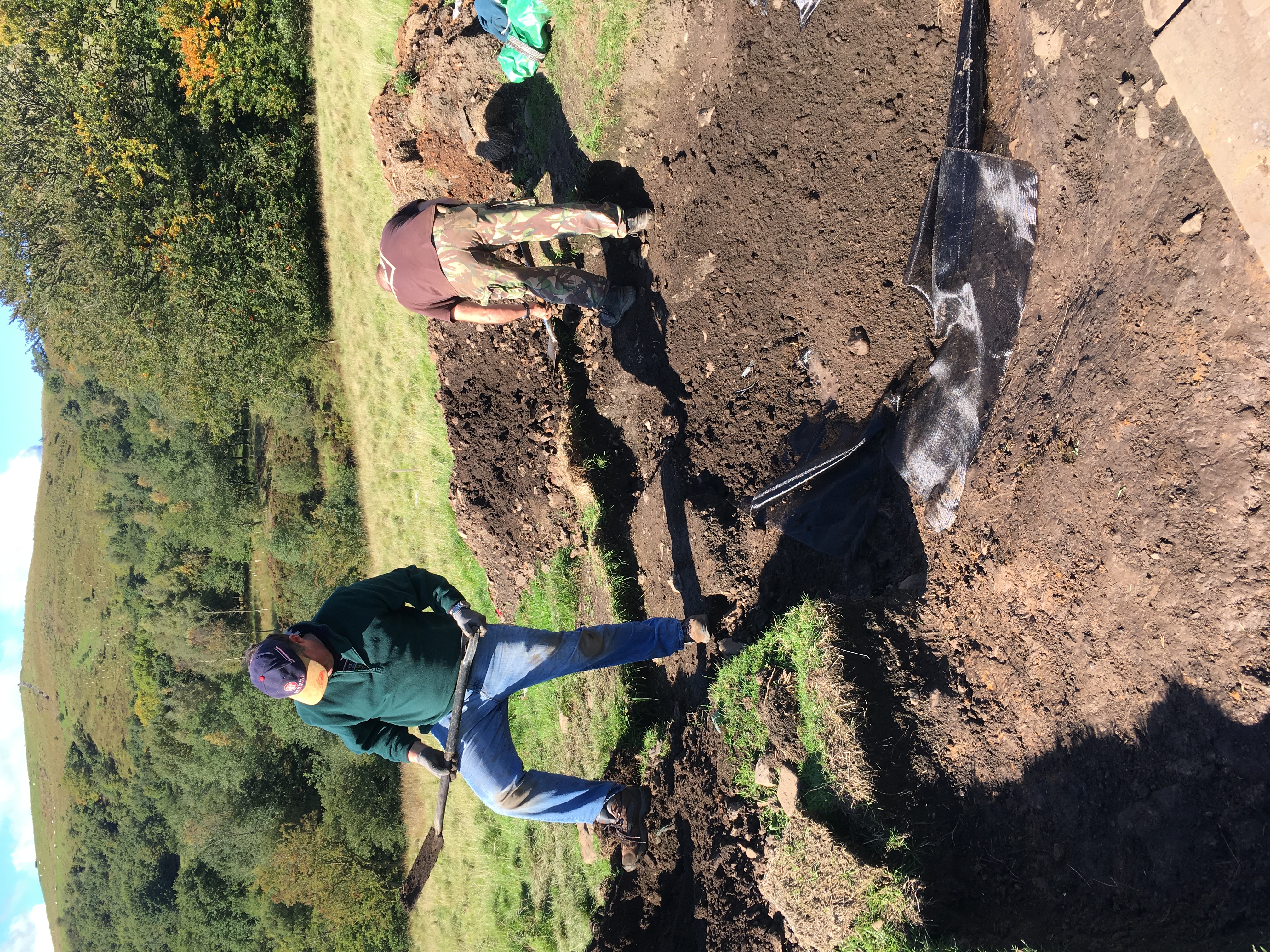
Photo 3
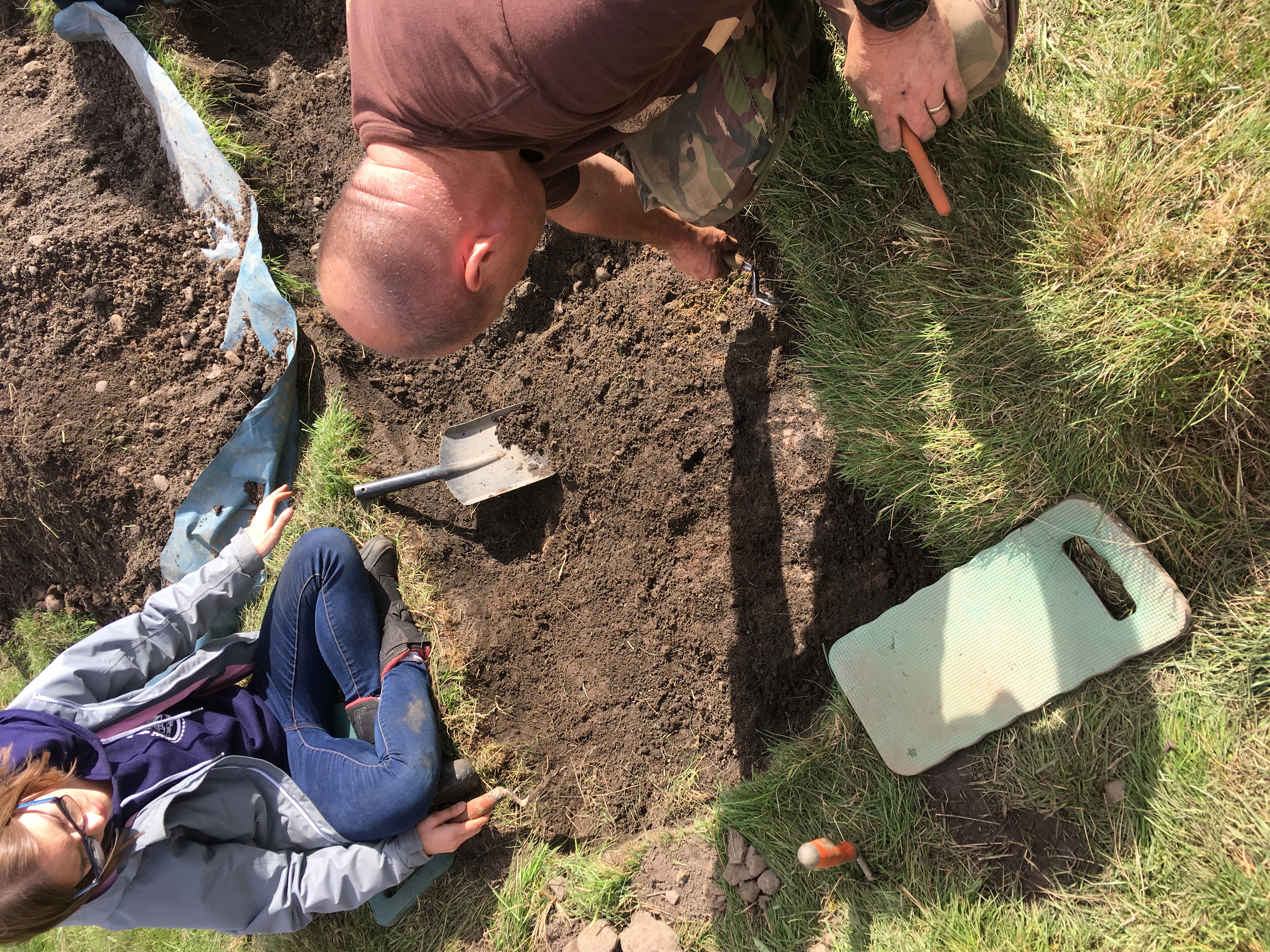
Photo 4
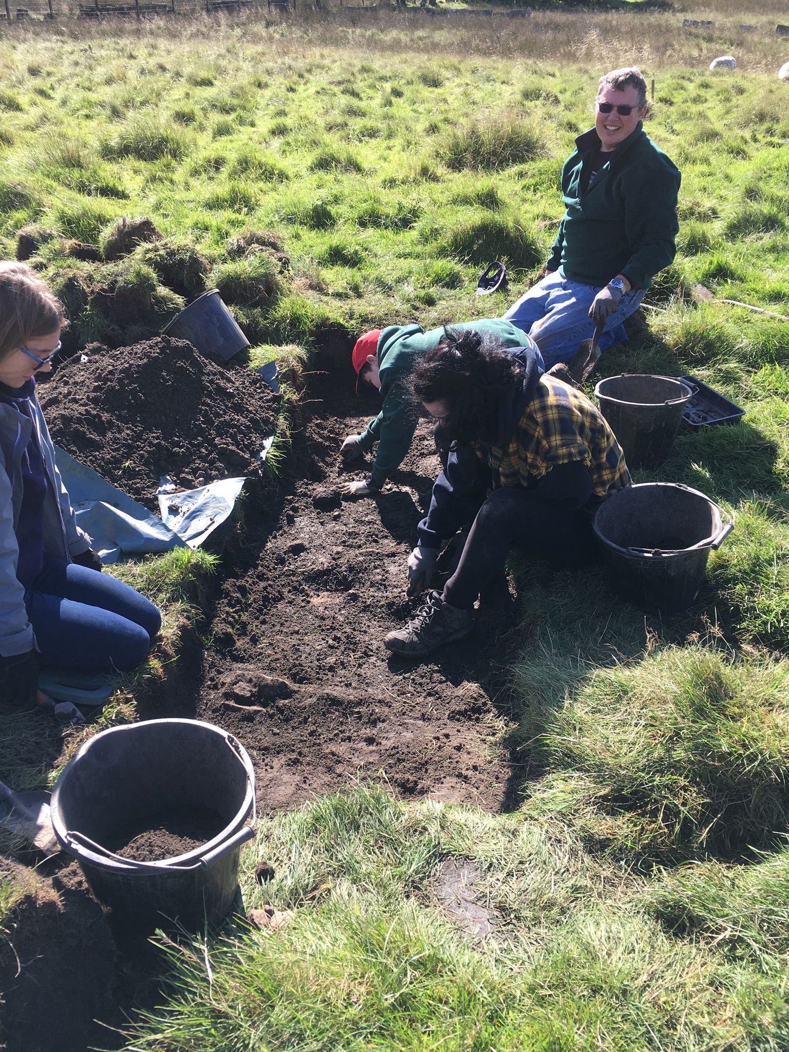
Photo 5
HMHG Dig Report : Saturday 29th September 2018
Weather: sunny with a cool breeze and no rain
This was the trench opened last weekend to determine whether the possible trackway in trench 1 continues further east and to see if features in trench 2 continue further south.
It was confirmed that the feature in the southern section of trench 2 extended into the northern half of trench 8. It was also confirmed that the compacted narrow stone and clay trackway extended from trench 1 through trench 8 and appears to continue in an easterly direction. After taking some levels in the trench it was backfilled and re-turfed. This trench will be re-opened next year, together with other pits as necessary, to determine the extent of the trackway, photo 1
All the other trenches other than trench 3 were backfilled and re turfed. Backfilling of trench 3 was started but not competed. This will be completed tomorrow. The site, with the exception of the perimeter of trench 3, was cleared of stakes, warning signs and barrier tape.
Sunday, 30th September will see the completion of this year’s dig. Dates and details of next year’s Cinder Hill Field dig will be sent to members and Friends of the group in the new year.
In the intervening period the Members and Friends will be kept up to date with news, events and talk details.
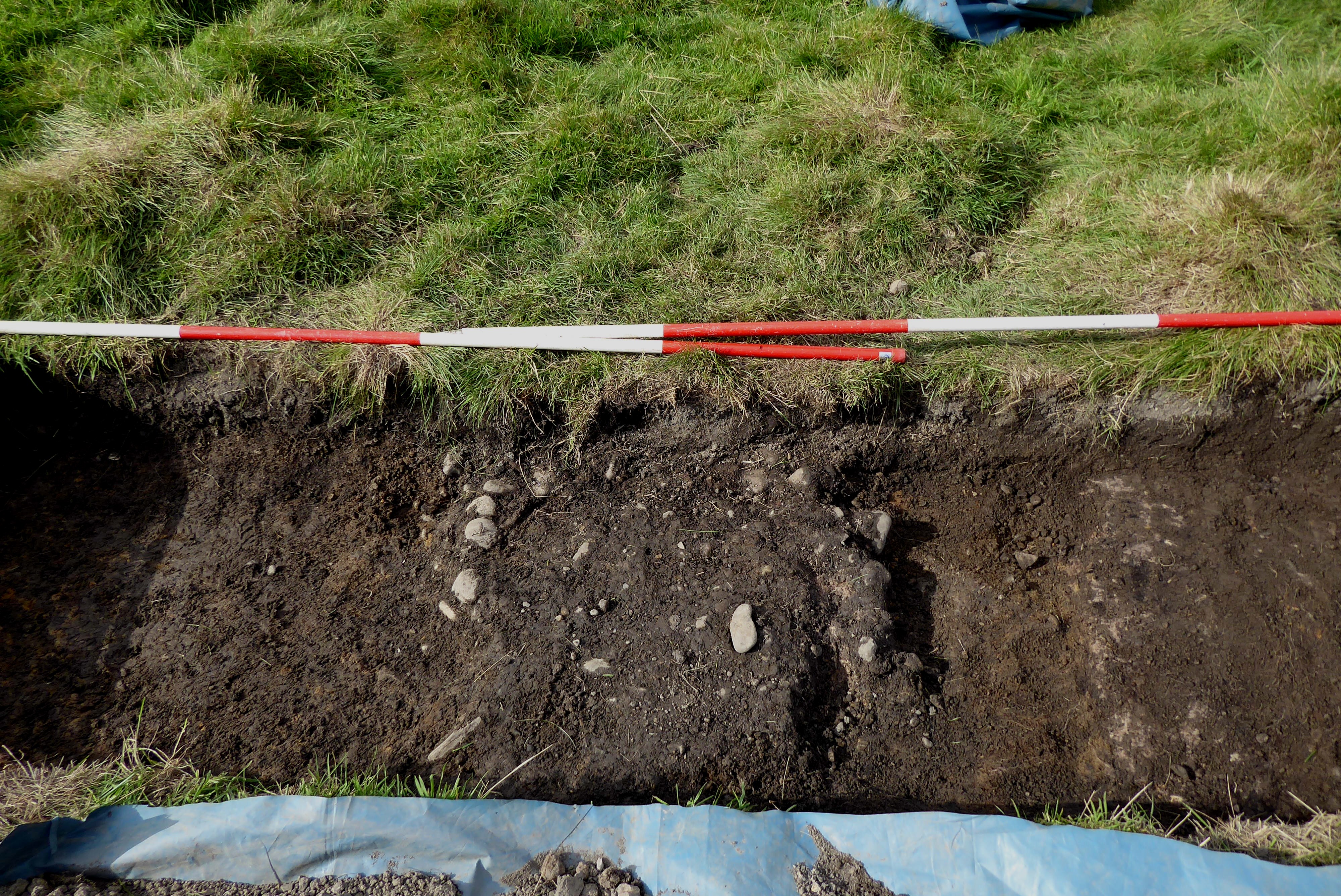
Photo 1