Unfortunately, the digging season has not gotten off to a very good start. The first dig, scheduled to take place over the weekend of the 25/26th March, had to be called off due to road works. A new tarmacadam surface had recently been laid on the road to the dig site and the contractors had advised the army not to use it for at least 5 days, to allow the road to settle. It was very unfortunate the dig was cancelled as the weekend turned out to be dry and sunny on both days.
The next dig, scheduled for Thursday 30th March, turned out to be a cold, wet, miserable day. Although we had four diggers for the morning session we would only have two for most of the afternoon. As the army’s, Health and Safety rules stipulate there must be a minimum of 3 persons on the site at any time the afternoon session was called off.
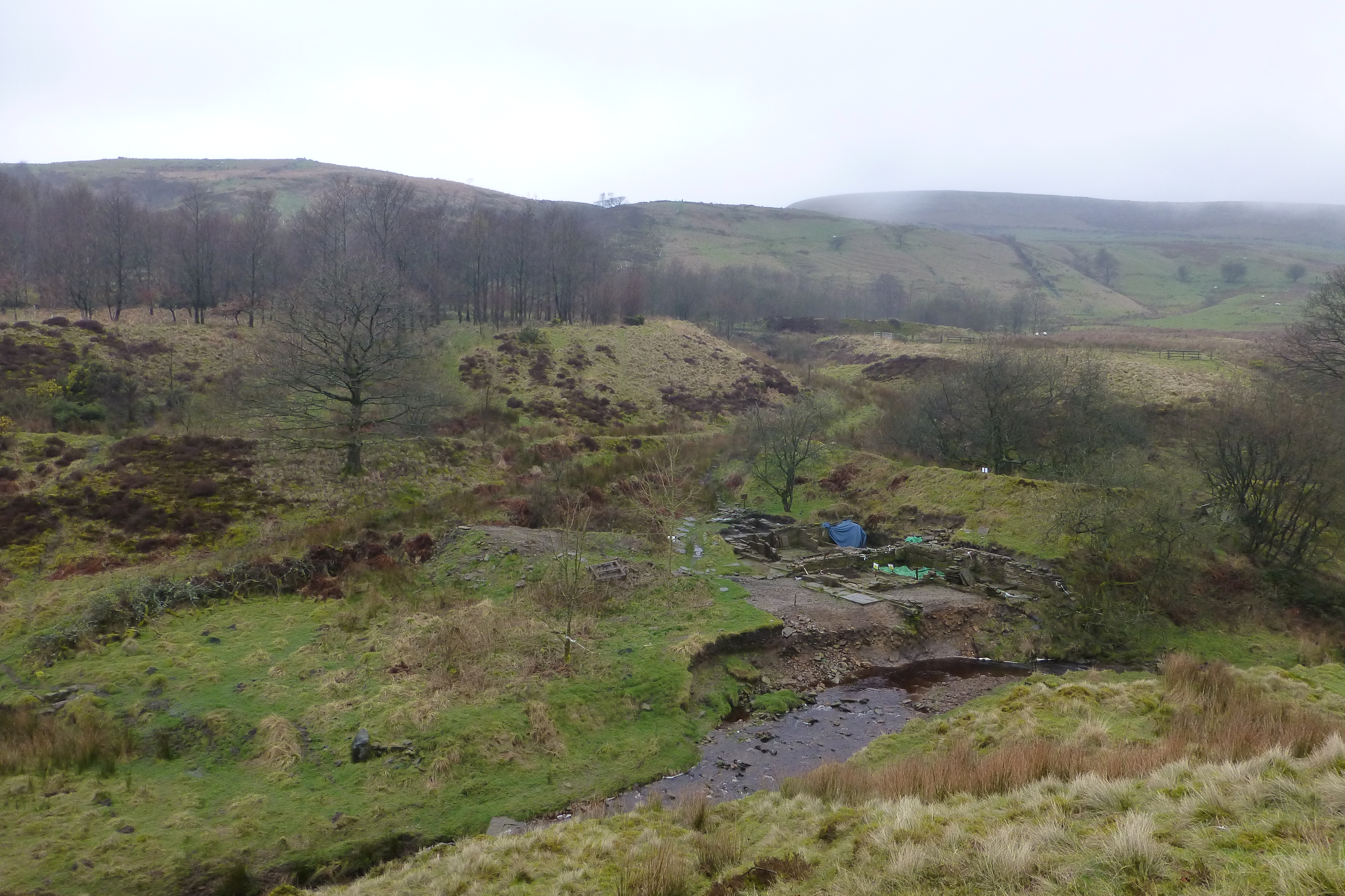
The morning was spent reconnoitring the site and planning the next two scheduled digs. Although the river had removed some soil from the east section of the east bay the amount was not as bad as had been anticipated. Generally, apart from some sections being extremely water logged, the site has fared reasonably well over the winter.
The May dig concentrated on 3 areas: the small annexe walled area and surrounds adjacent to the west wall of the West Bay, the pond bank behind the north walls of the west and centre bays, and the plateau wall to the south of the dig site.
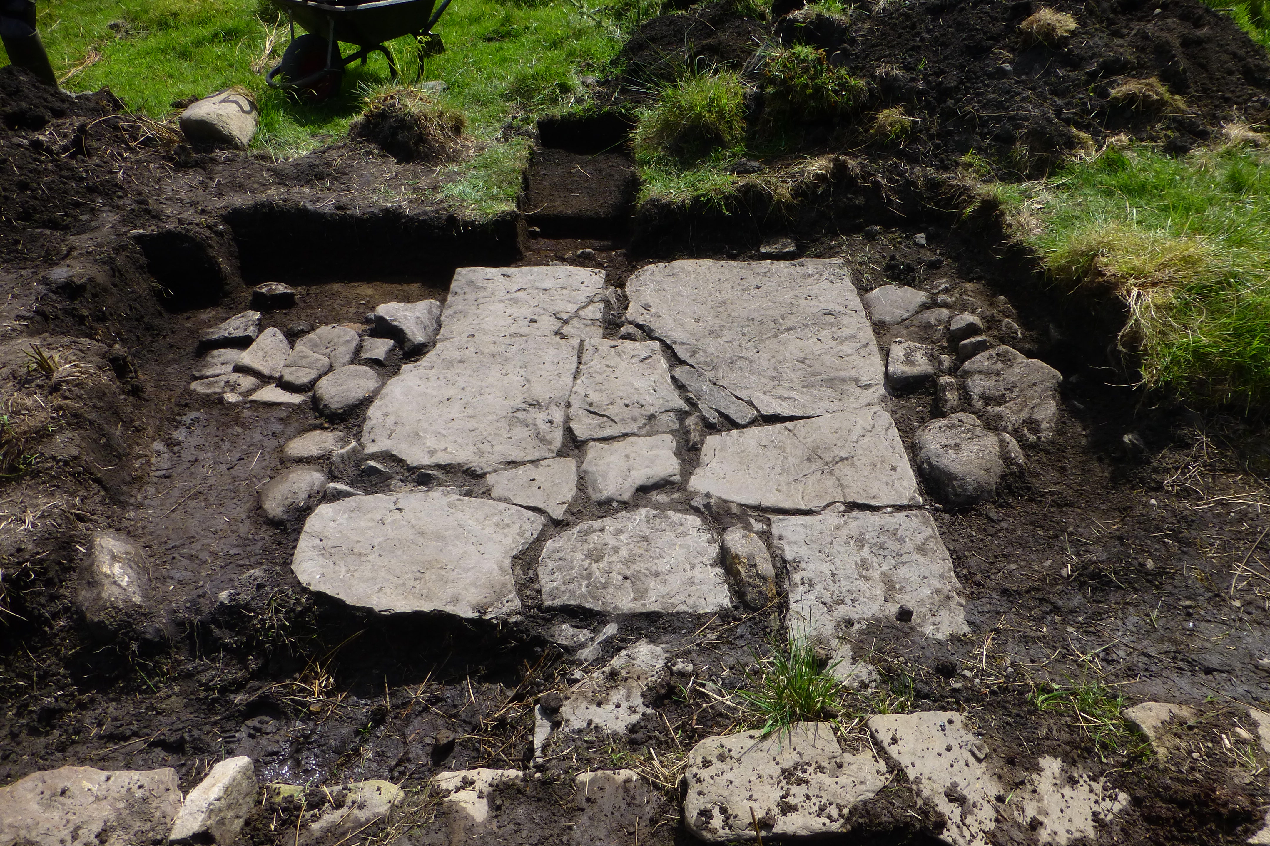
Work continued removing the cinders in the excavated area, and a negative feature was found just to the south of the second vertical stone. This feature would appear to have held a third vertical stone. Further excavation adjacent to the second vertical stone revealed a flagged surface which appears to continue eastwards to the outer face of the west bay west wall, under a later flagged surface (Photo 2). Once the existing excavated area has been recorded, this newly discovered flagged area will be investigated to ascertain if it does in fact extend to the west bay west wall.
As a result of these recent finds the decision has been taken to extend the excavation area around the annexe to the west and south. The turf around the area was removed together with the topsoil until the continuation of the cinder layer, found earlier, was reached. A number of shards of a large pot were unearthed in the northwest corner of the recently exposed area (Photo 4). Work on this area will continue slowly so as not to destroy any context details which may exist. It is hoped further finds will be exposed as excavations into the deep cinder layer continues. (Photo 5)
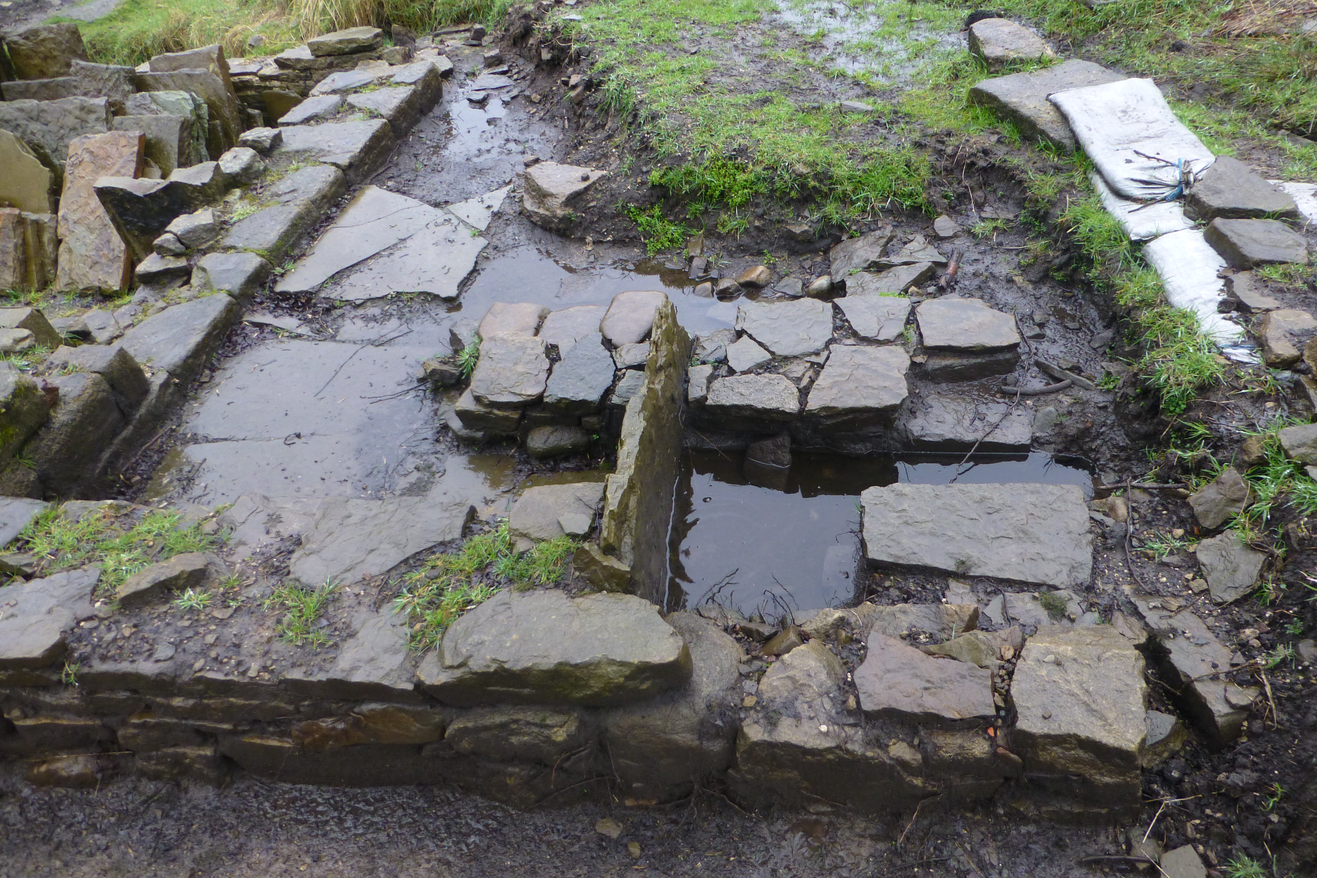
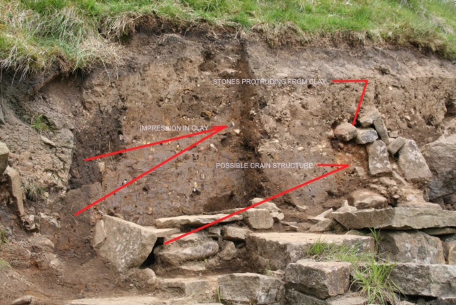
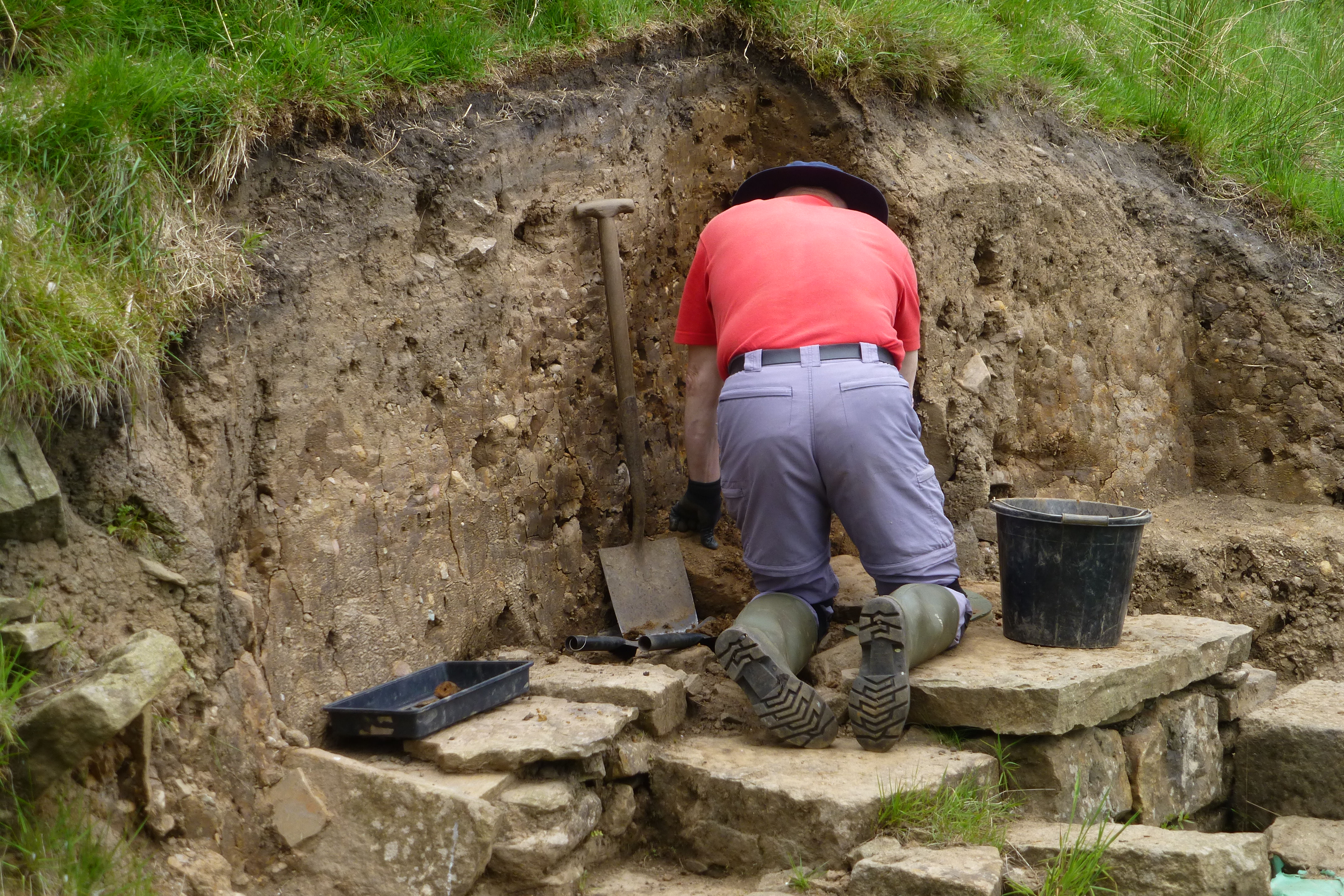
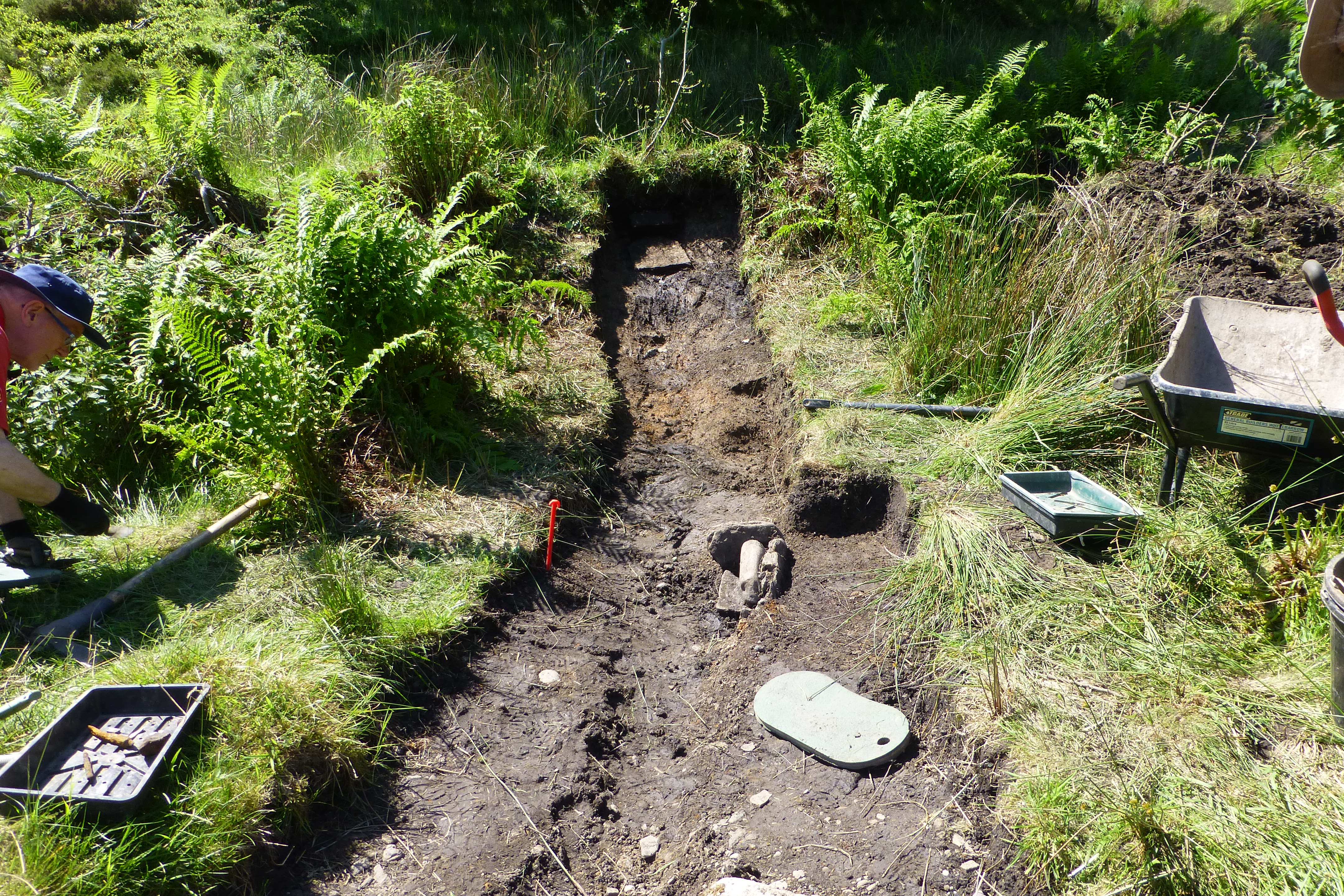
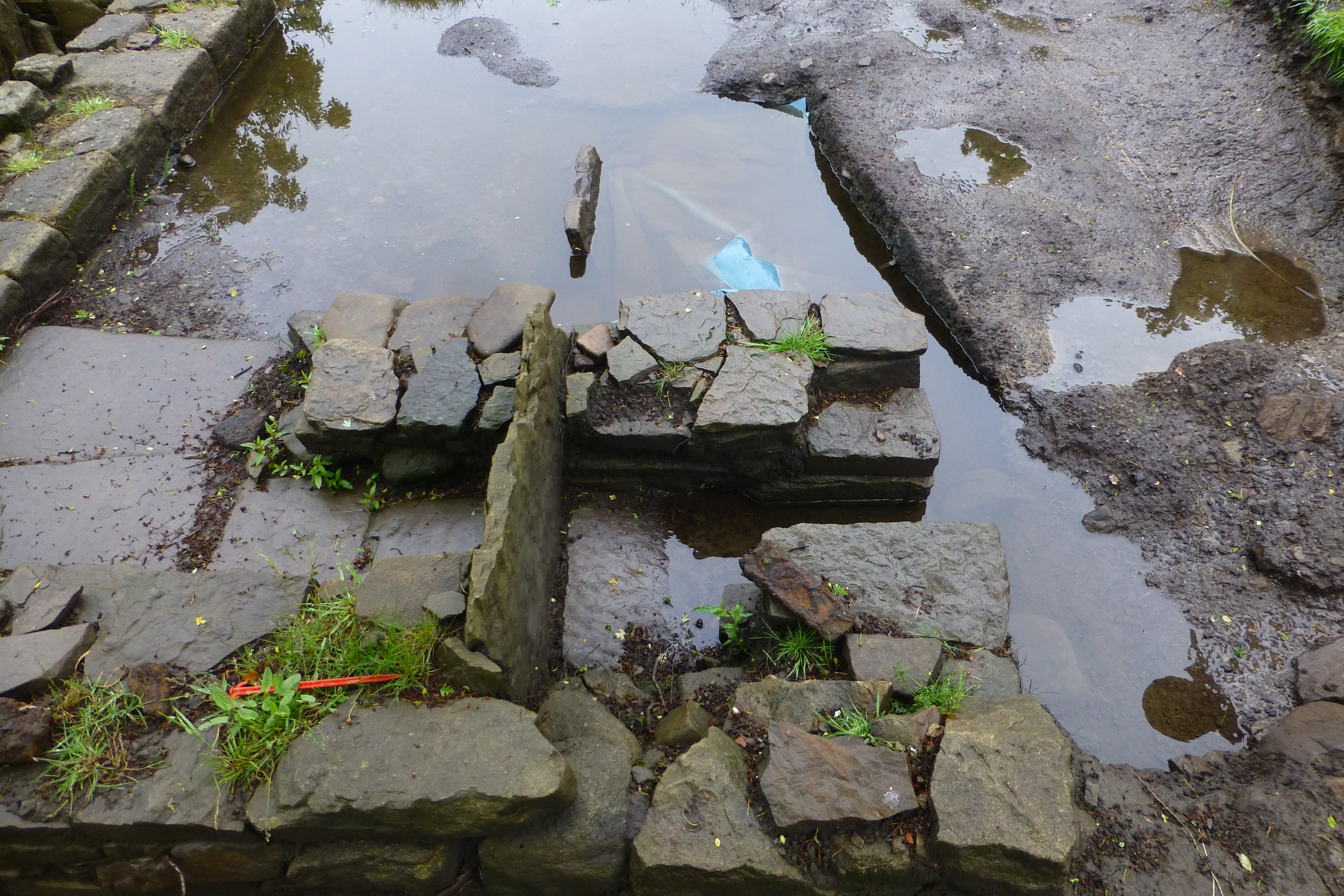
Excavation of the pond bank was started to try and understand how the water was delivered to the water wheel, which could determine whether the wheel was overshot, breast or undershot. A number of large stones protruding from the clay face in one particular area might prove to be a clue or, on the other hand, could just prove to be tumble.
Excavation work was undertaken by removing layers of the clay banking in thin slices, which would help secure any subtle context changes. At one stage an impression in the clay looked as if a long flat surfaced object, such as a plank of wood, had sat vertically in the clay. Although a small number of wood fragments were found, these did not prove conclusively that a wooden object was the cause of the impression.
A small drain type structure with stone walls and caps has been exposed; further investigation into this structure is required before any assessment can be made as to its purpose. (Photo 1)
Work on the bank has not progressed far enough yet to gain any further understanding of the stones protruding from the clay face.
Recording of the west bay walls continued. Once this unpopular, arduous task is completed final backfilling of the west bay area can continue.
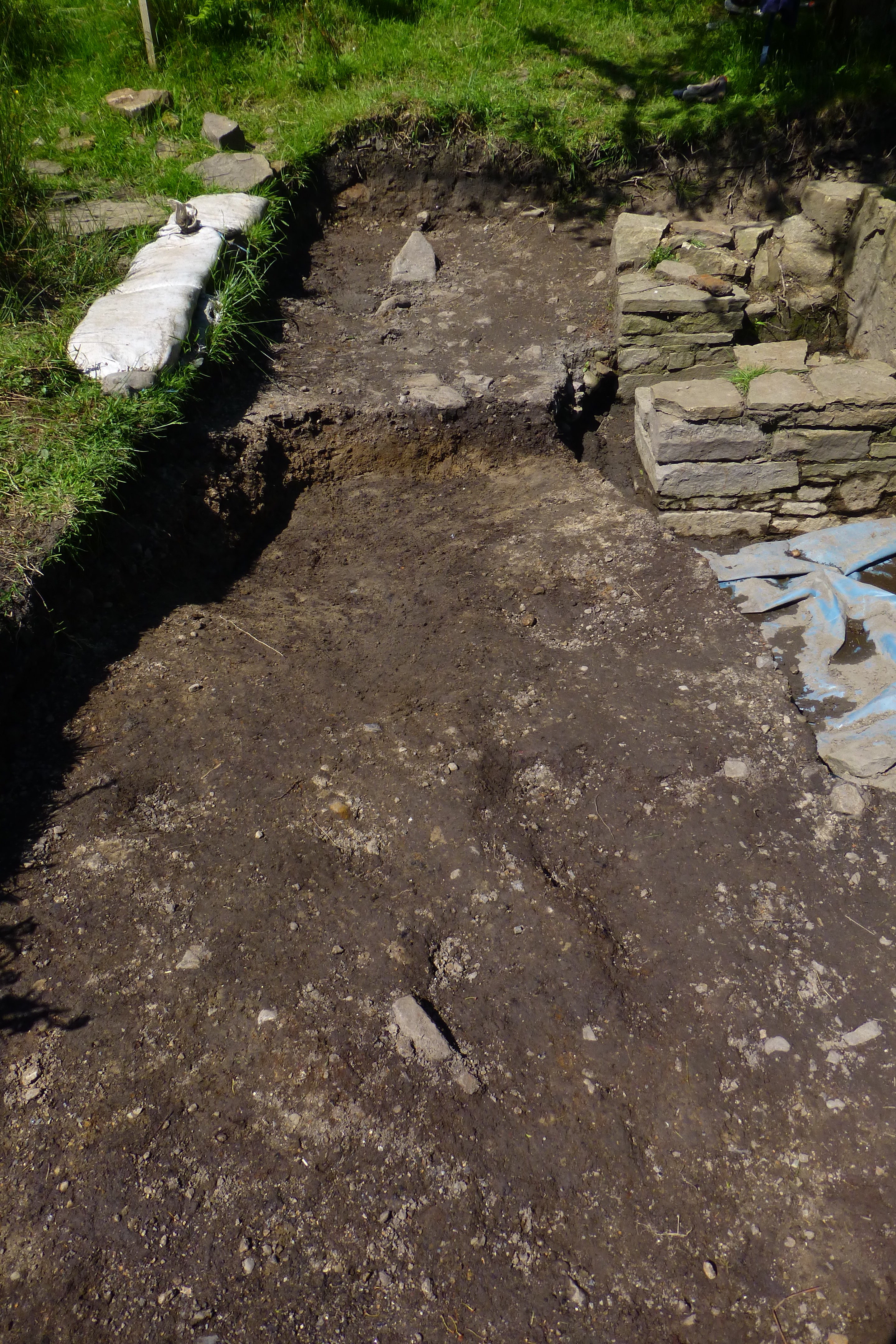
Work continued to expose the remains of the west/east running wall. The western section appears to be well constructed while the remains of the eastern half of the wall appear to have been poorly constructed. It may be that the eastern section could be medieval, although no dating evidence has been obtained to confirm this theory. (Photo 3).
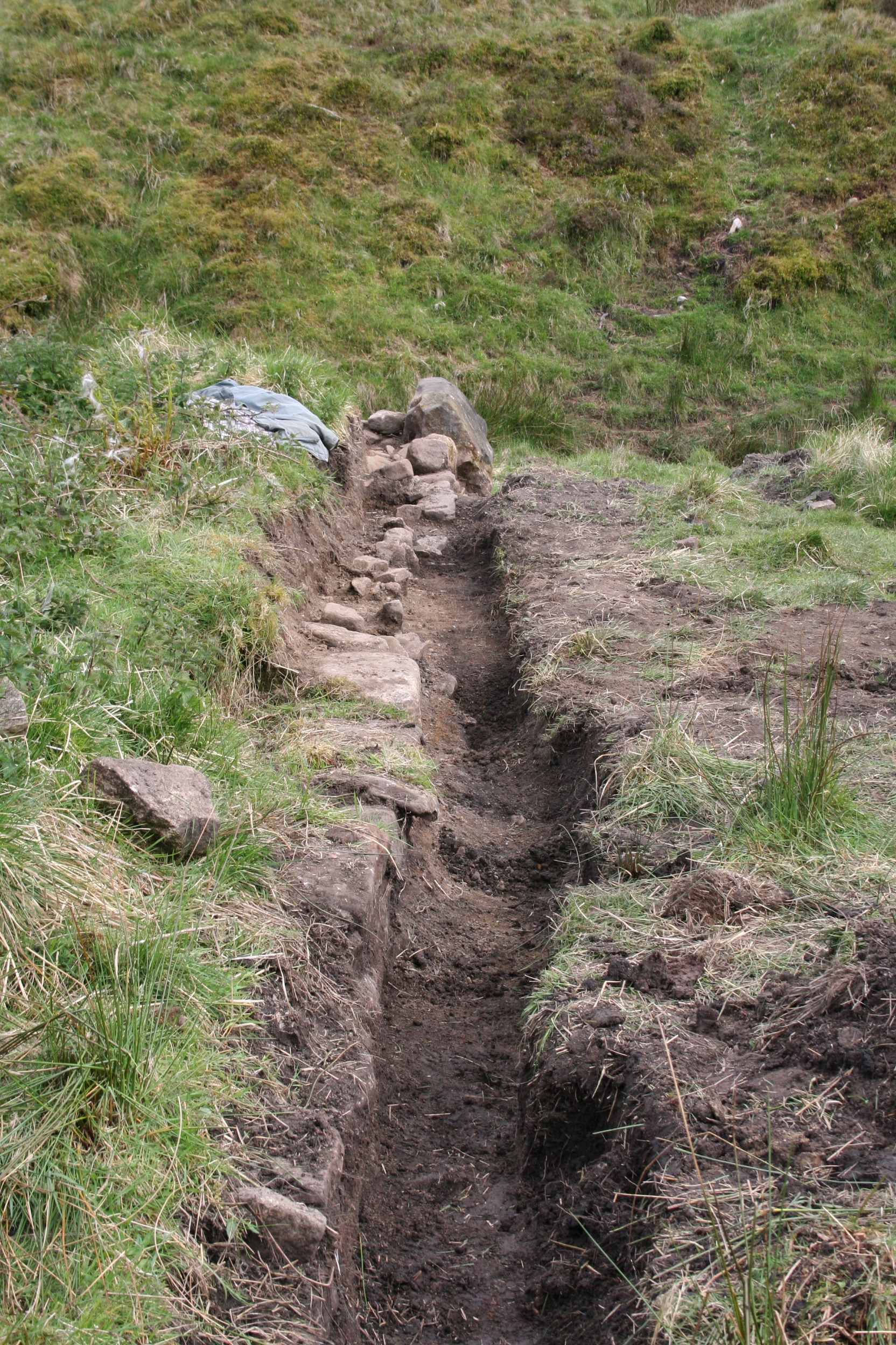
A negative feature has been exposed which appears to continue in a southerly direction. A trench was dug in order to try and track the feature, but it failed to materialise. Further investigations will be required to resolve this feature. Interestingly a shard of late 19th early 20th century pottery was uncovered at the bottom of the trench which gives food for thought as to when the surface south of the plateau was laid down. It is possible the shard was deposited by the river and covered by river action.
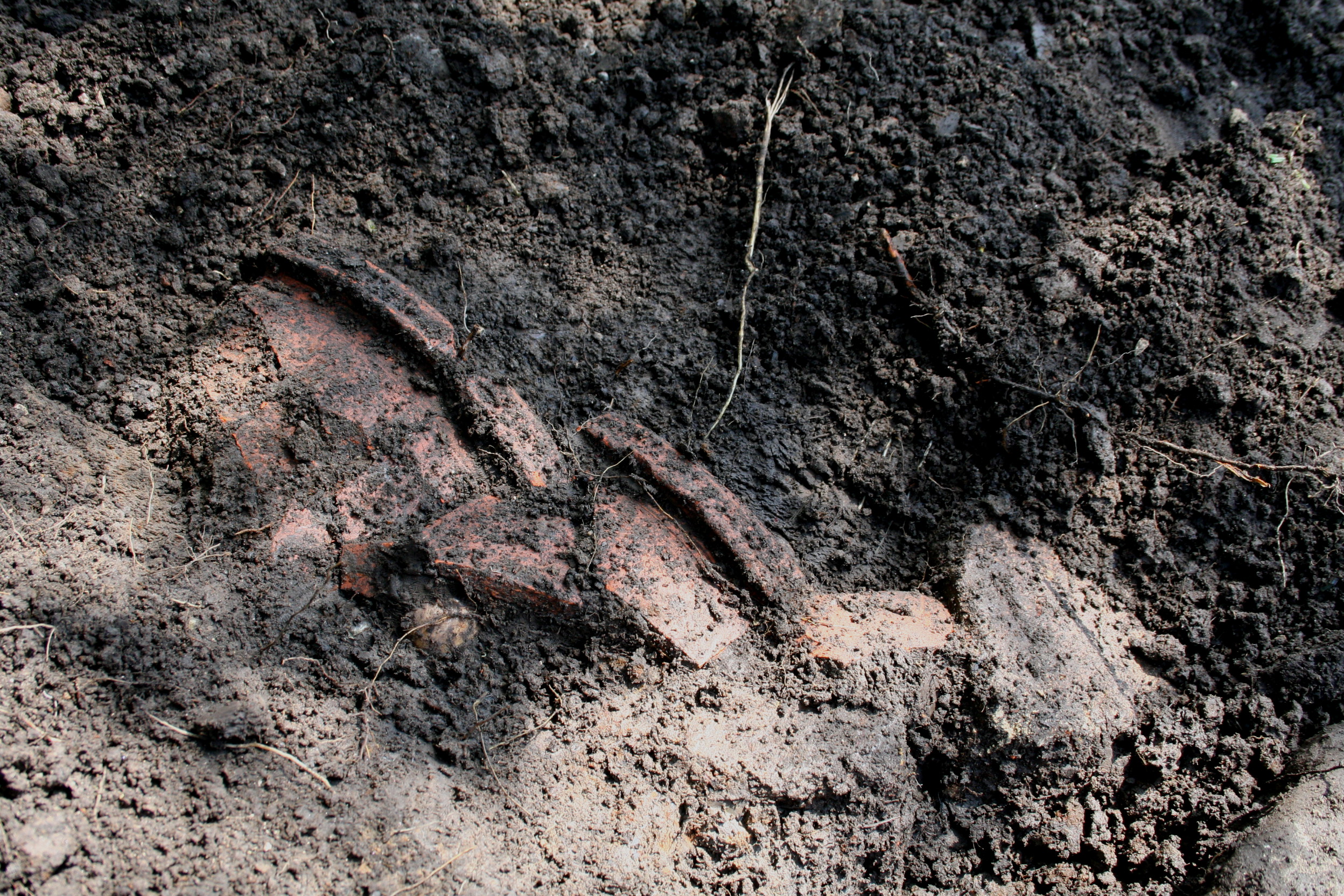
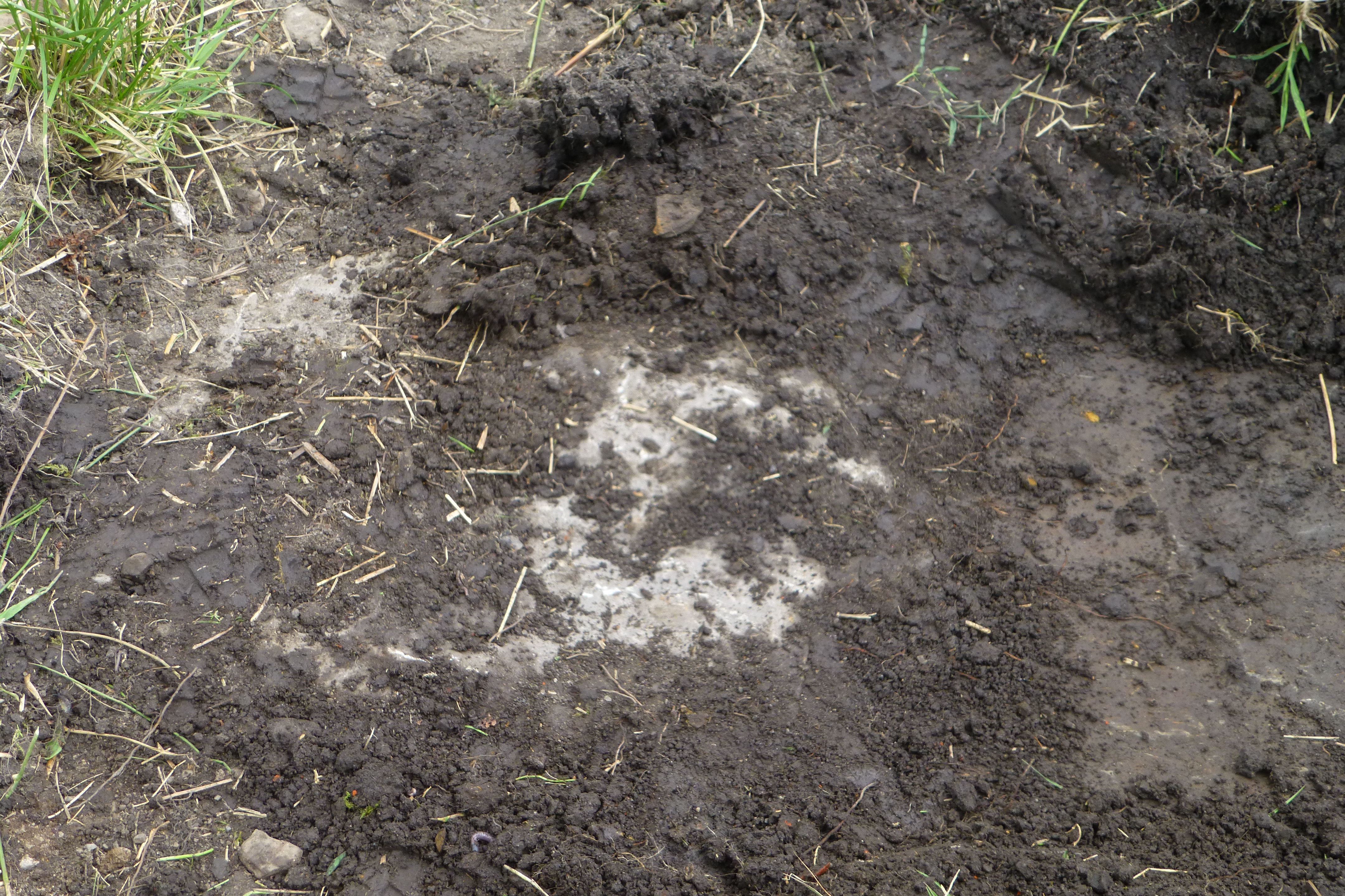
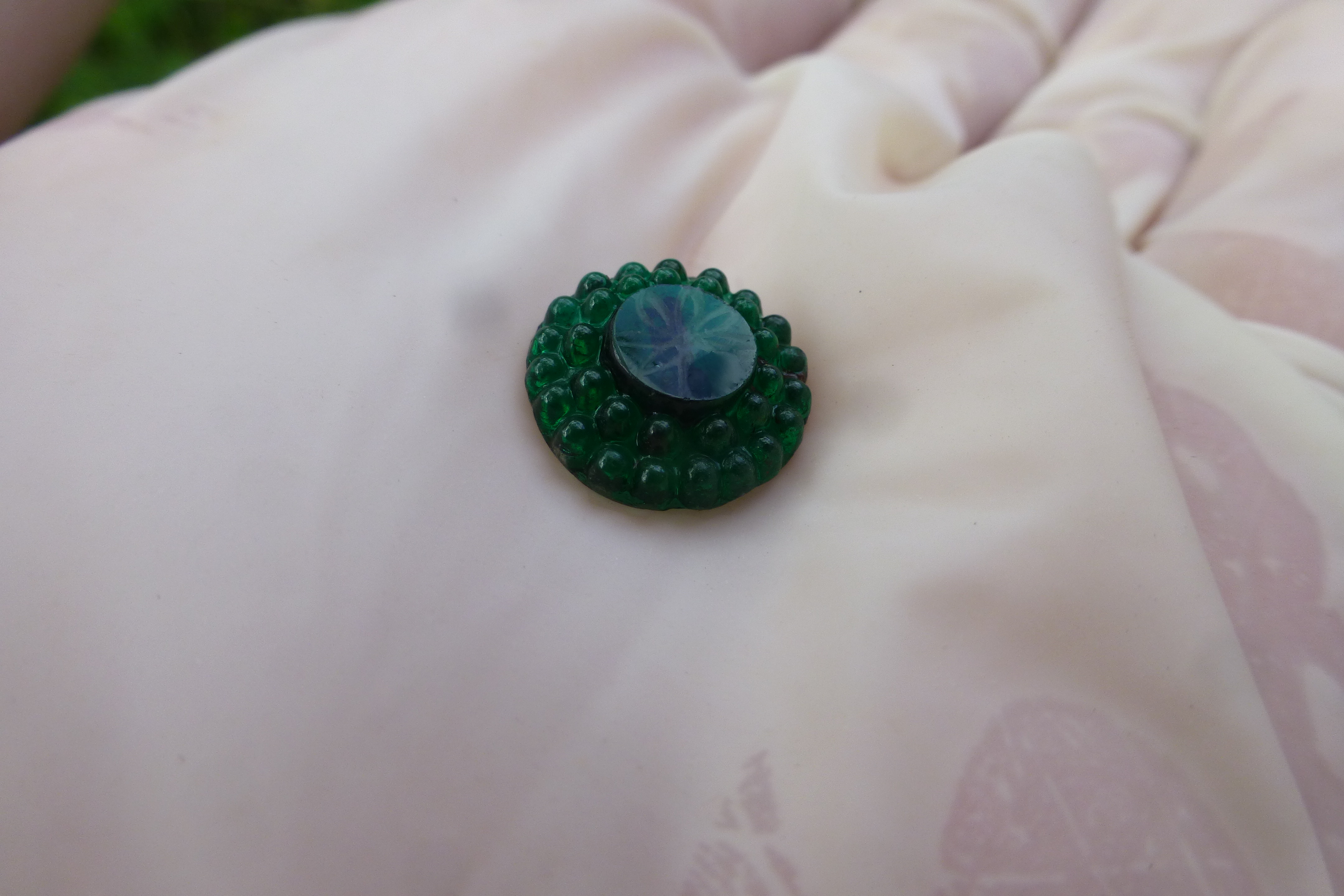
Commenced removal of top soil from recently de turfed area to expose the top of the cinder layer. Nice small glass button found. Photo 3. Neil completed recording the two west east running walls. All work in the west bay is now complete; area will be shut down and backfilled. Robin continued to work into bank working from west to east. Jumble of stones in bank was not of any significance, just a pile of stones. Photo 1. Commenced excavating the north face of the west east running wall stones. It would now appear that the entire wall is associated with the cottage phase of the site development. The half of the wall that was thought might be medieval just appears to have had the face stones robbed out. At the west end of the wall a flagged area extending southwards towards Red Brook was exposed. Much conjecture as to the purpose of this area. Photo 2.
Thursday’s dig cancelled due to adverse weather conditions – rain.
Continued clearing the top soils from the layer of compacted cinders underneath (Photo 1). Continued to uncover the areas to the west and east of the small flagged area uncovered on the 1st June. It is thought that this area of flags is one of the hot spots found in a geophysics scan of the area a few years ago. There is another hot spot some 6 metres away which will need to be located. Unfortunately, no position or orientation information was provided with the scan results, so the exact position of the 2nd hot spot is unknown. An arrangement of stones extending eastwards was excavated but they just appear to be a random deposit. A small slit trench was dug southwards to try and ascertain the extent of the cinder layer which the platform flags are lying on (Photo 2).
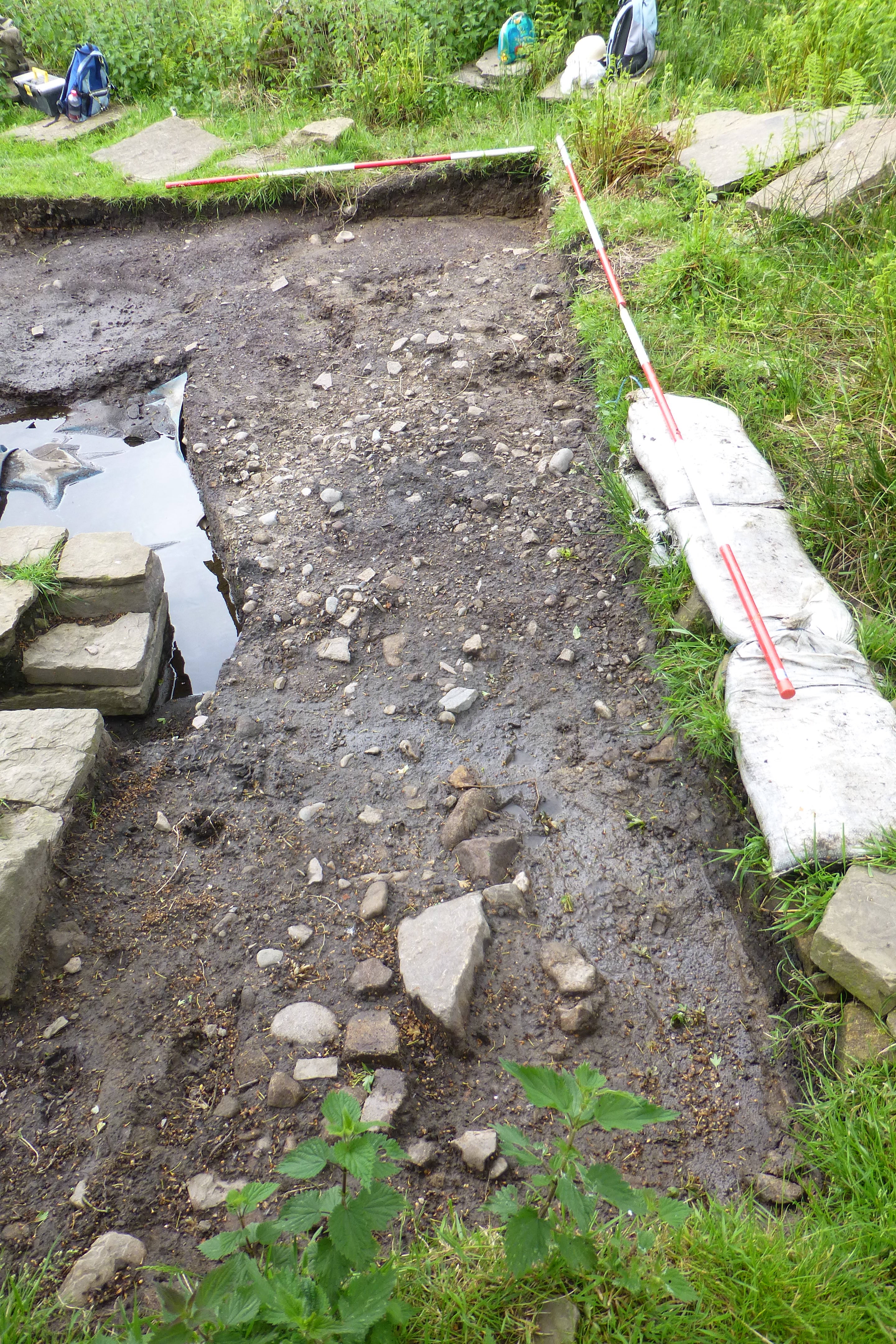
Continued clearing the top soils from the layer of compacted cinders underneath (Photo 2). Some nice large pieces of pottery were recovered from the top layer of the soil. Continued to excavate the wall line in a westerly direction. Unfortunately, the wall stones do not extend any further west past what could be a gate post for a path leading to the buildings. It was hoped following the wall line would reveal the 2nd hot spot. Unfortunately this did not occur, so a wider area will have to be excavated. (Photo 1).
Sunday dig was cancelled due to insufficient number of digging personnel.
Work continued removing the surface soil from the underlying ash layer. A large number of pottery shards were uncovered from the surface soil in the north west corner of the area. It is hoped that all the parts of a large vessel will have been recovered. Excavation of the area adjacent to the north wall of the annex recommenced. Work had originally started on this area at the beginning of the season. Two trenches were dug, one to the west of the flagged area and one to the south in an attempt to locate the 2nd hot spot showing on the geophysics scan. Unfortunately neither positions located any structure which could have accounted for the response. The south trench did, however, reveal some interesting coloured soil layers. (Photo 1)
The aftermath of two preceding days of rain had resulted in the excavations being filled with water. The continuous inflow of water from the higher ground would have made bailing of the excavations a waste of time, so decision was taken to cancel the dig session.
As for the last couple of digs in July, we had to cancel this session due to excessive rain. There was heavy rain throughout Wednesday 2nd August and it was still raining at 08:30hrs this morning so there was no option but to cancel the dig.
Although the day was fairly dry, heavy rain on previous days meant the site was heavily waterlogged. Consequently we were only able to carry out work on areas which were reasonably dry. Although Christine still had to dig a water diversion trench to redirect the water coming off the higher ground, around the area she was working on, before it was possible to work there. As most of the area was saturated, work could only be carried out on the northwest corner of the site and the area outside the north wall. With the help of the water diversion channel a reasonable amount of the surface soil and underlying clay substrate was removed, with a number of pottery sherds of various sizes being recovered. In contrast the trench area adjoining the outside of the north face of east/west running north wall was a lot drier and very compact. Work continued excavating this trench, with the ultimate intention being to expose the bottom of the wall stones. There is some speculation that an earlier structure may exist under the existing exposed annex structure. Robin spent the whole of the day ensconced in the pit. The small dimensions of the pit, together with the clay and stones in the bottom, makes excavation of this area very difficult. Surprisingly only a very few pottery sherds were recovered - one would have expected the shaft to have been used as a convenient dustbin. Due to the lying water and water entering the site from the higher ground none of the already excavated areas could be worked on. Barry uncovered a sufficient area to the west of the cinder layer in the vicinity of the flagged section to establish the extent of the cinder layer. He then opened an area to the east of the area adjacent to the large corner stone. Three different soil types were uncovered but nothing to indicate any possible activity. The narrow north/south running trench opened previously was extended southwards towards Red Brook, the purpose being to try and establish the extent of the cinder layer. The southern boundary was not identified by the time the digging session came to an end.
Weather wise it was not a good day. The first job of the day was to bail out the annex excavations. Once this was completed, excavation of the northwest corner of the site continued. The deep cinder layer evident just to the south of this area does not appear to extend to this area. Some flat stones were, however, unearthed butted up against the western wall of the annex; these will need investigating at a later stage. Work also started removing some of the thick ash layer in the western centre area of the site. This unfortunately had to be abandoned when water started to leach in from the adjacent excavated pit. A large number of broken clay pipe stems and pottery sherds were recovered from the two worked areas. Robin continued to work down t’ pit and a number of flat stones extending halfway in to the pit from the front wall were uncovered. Speculation is that these formed a platform to enable whoever built the front wall of the pit to stand on while working on the wall. (There is a new theory as to the purpose of the pit, see entry for 19/20th August.) Christine spent the morning fine trowelling the cinder layer to the west of the flagged area to expose the various context for Neil to record. A narrow trench was extended eastwards from the north south running trench through the centre of the area in an attempt to establish the eastern boundaries of the cinder layer. One theory is, as this cinder layer is so flat and compacted, it may have been covered with stone flags which have since been robbed out. About half way across the area an elongated north/south running pile of stones were uncovered. As the stones run in line with the tail race where it leaves the centre bay, it is possible they may form part of the tail race trench back fill. Shortly after 13:30hrs it started to rain so the dig was terminated for the day.
The weekend weather was reasonable so we were able to get in two days of digging. It was still necessary, however, to bail out the excavations around the west bay annex before work in this area could commence. Work in this area concentrated on removing the thick ash layer to the west of the stonework as well as continuing to remove the clay and earth from the north west corner of the area. As anticipated, a large number of pottery sherds, clay pipe stems and pieces of pipe bowl were found. Work continued on excavating the pit. At one stage the inner layer of stones forming the front wall started to work loose and these were removed on safety grounds. This had the added advantage of increasing the workspace inside the pit. At a depth in excess of 2 metres a large stone was encountered covering some ¾ of the floor space and this is unfortunately restricting further excavations. Once the inside of the pit has been recorded it may be possible to dismantle the front wall thereby allowing deeper access. This pit has always been an enigma; Neil has investigated other water wheel constructions and has not been able to find any example of an installation with a pit behind it. After some contemplation Neil has proposed a theory, which is very plausible. There are two disturbed areas on the wall separating the west and central bays, the southern most one has always been assumed to be the position where the wheel axle passed into the western bay to form part of the drive mechanism. This would allow for a 16ft wheel to operate and the back of the wheel would pass in front of the curved wall (excavated earlier in the season), which is an extension of the pit front wall. Neil’s theory is the water wheel was originally sited 1 metre further north and ran inside the pit. This is borne out by the northern disturbance area in the wall existing almost exactly where the axle shaft would be. There is also a vertical worn mark on the north wall of the pit covering two of the stone blocks, which could be indicative of the water wheel rim rubbing on the stone. The one question, which will never get answered, is, if this is indeed the case, why did they move the wheel? Investigation work started on the pile of stones found in the centre of the area by removing the stones and soil from the northern half of the pile to try and ascertain whether a cut exists in the natural soil layer. By the end of play on Saturday there appeared to be a cut but it was not well defined. On the Sunday it was decided to excavate an area in line and to the south of the rock pile where the ground drops away to make excavation easier. At the end of the day nothing resembling a backfilled area was located, so work ceased on this item. We did however locate what appears to be a surface drain section just to the west of the area worked on. This will be progressed at the next dig.
Very heavy rain in the morning made cancellation of the dig inevitable, although by 12:30hrs the sun was out, making the day very pleasant. Unfortunately by that time it was too late to reconvene.
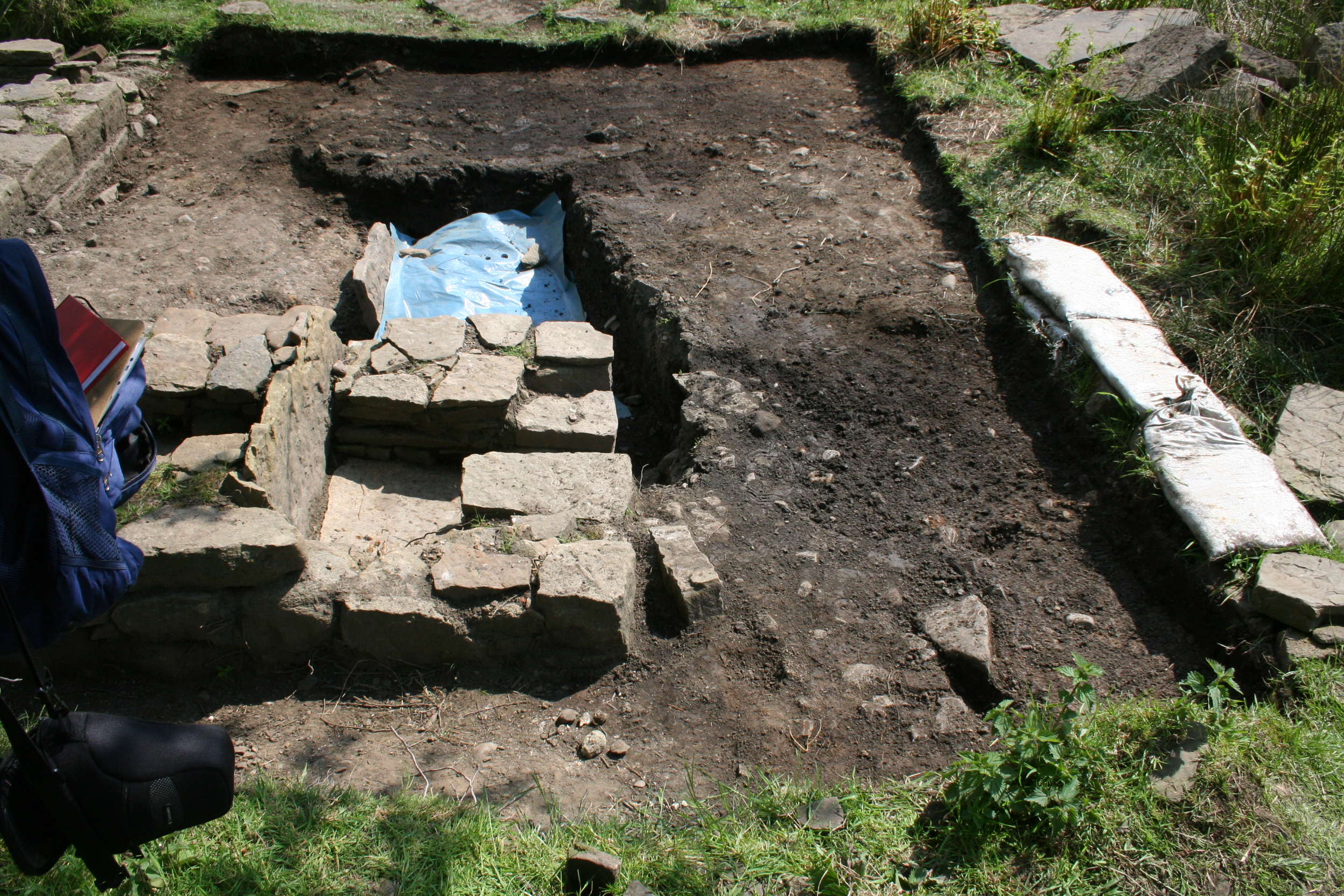
A good day for a change, sunny and hot. West Bay Annexe Area: Although this area was muddy, work continued removing the ash and clay layers in the west and northwest areas of the excavation area. The usual finds: pottery sherds, pipe stems and glass shards were removed from the areas. A couple of the pottery sherds appear to be late 17C. This will, however, need to be verified once the pieces have been cleaned. Centre Bay north wall pit: The whole day was spent cleaning then recording some of the inner walls of the pit; a long task in difficult conditions. Area south of plateau: Work started on laying out grids and recording the various excavated items. A large number of elevation readings were also taken. Once the recording work has been completed work can commence on the backfilling of the excavations to enable this area to be closed down. Work continued on excavating the stone structure which originally was assumed to be a drain section. As work progressed it became apparent that it was a far more interesting structure. The stones form a circle, broken at the southern end at the original river bank with a vertical stone across this gap. As there is no input to this structure from the surrounding ground it cannot be a drain.
Not a good day; overcast and threatening rain. As there were only three members present the work scope was somewhat limited. Area south of plateau: Work continued measuring and recording the area. Towards the end of the morning session Neil commenced removing some of the small stone cobbled surface just south of the assumed gate post packing stones. This revealed a second cobbled surface of larger stones. There is a strong possibility that this is a road surface leading to the ‘gate’. Work continued on the stone structure. When the tumble and top soil had been removed the revealed base of the structure was constructed mainly of rounded largish stones lain out in 4 rough lines running from the west to east. The vertical stone was found to have a rough semicircle cut out of it, possibly to form a drain of some sort. It started to rain shortly before twelve and, as it had not stopped by 13:00hrs, the decision was taken to stop the dig.
Cancelled due to rain.
West bay annexe area: Continued removing non cinder layers of soil to determine extent of cinder layer. Centre Bay north wall pit: Quatermass continues recording the interior walls of the pit. Area south of plateau: The area at the northwest section of the plateau, adjacent to the presumed gate post, was cleaned to determine the extent of the cobbled surface. The semi-circular stone construction was recorded in preparation to lifting the base stones and excavating the floor down to the natural layer. Started raining at approx. 12:40hrs, decision taken at 13:00hrs to abandon digging for the day.
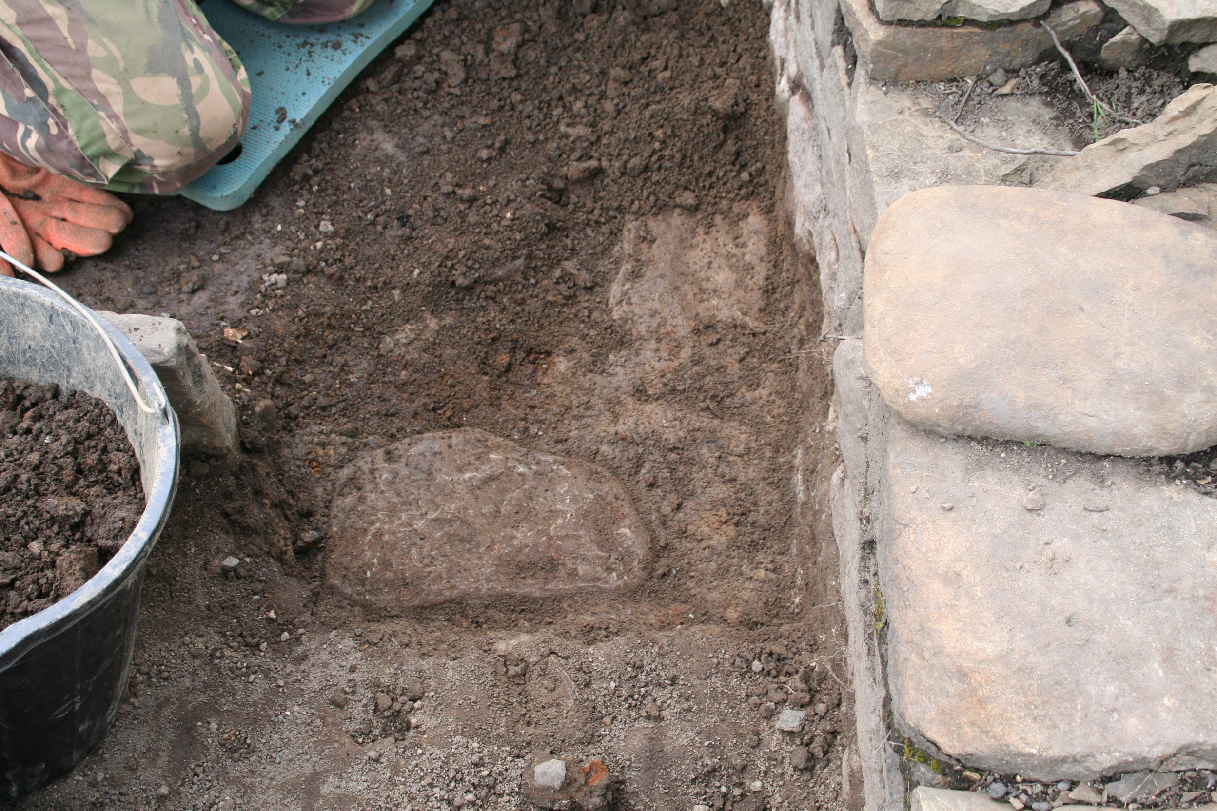
A decent day, sunny and dry. West Bay annexe area: First order of the day – bail out the excavations resulting from the previous day’s rain. Work concentrated on the eastern section of the annexe area adjacent to the west wall of the west bay. The work involved the removal of the pebble cobbled surface and sub soil to reach the flagged surface. Three flags were exposed which, from the laid pattern, appear to be drain covers. The construction is similar to the drain covers exposed outside the south end of the west and centre bays some two to three years ago. By the end of the day a top layer of flags was identified which would appear to continue westward under the cinder layer. There also appears to be a second layer under the first layer, which also extends in a westwards direction. It is anticipated that these flags may possibly extend to a line parallel to the front stone of the small enclosure just to the north. Centre Bay north wall pit: Work finally concluded on recording the interior walls of the pit. Considering the cramped conditions in the pit it was a job well done by Robin. Area south of plateau: After taking height measurements of the semi-circular stone construction, worked commenced removing the base stones to excavate the floor. Work uncovered a three-sided stone pit with the fourth, south face, being formed by the vertical stone with the semi-circle cut out of it. This small pit is approx. 12 inches deep with a single stone slab forming the base. The west and east walls sit on the stone slab while the north wall is butted up against it. There is a small opening in the northeast corner, at floor level, approx. 4 inches square. This aperture obviously forms a drain into the newly uncovered box section, but why it should be such a complicated arrangement for a drain gives much food for thought.
Unfortunately, the rain took control of the situation again causing the dig to be abandoned at lunch time. At least, however, some work was accomplished in the morning. West Bay annexe area: As on other occasions the first task of the morning was to bail out the trenches. Excavation continued mainly in the area around the eastern half of the southern section. Work concentrated on the clay layer to the north of the worked section. An attractive mid-18th century pottery sherd was recovered. North west corner of plateau: The cobbled surface was cut through to expose the contexts for recording. Area south of plateau: Work started excavating the front of the vertical slab. Prime objective was to establish the size of the vertical stone flag as well as to try and ascertain whether the arrangement could form the outlet from the water wheel tail race. Work was slow due to water ingress from under the horizontal flag stone.
Day was overcast and cool but luckily no rain. West Bay annexe area: Capping stones were lifted from the drain structure and the infill removed. This structure is more of a shallow gully than a drain; there are no stone walls or base and the gully is cut directly into the clay substraight. The gully initially runs roughly north west then curves to the west and goes under the large flags which extend westwards. From the initial inspection the flags may have been laid on an infilled pit. The large flags were recorder and photographed so they can be lifted on Sunday and the apparent pit investigated. Area south of plateau: Work continued removing the soil in front of the vertical flag. In order to deal with the accumulated water, it was necessary to dig a ditch to drain it away. Once the bottom of the vertical flag was exposed the flag was removed. The area under the horizontal flag was found to be packed with stones of varying sizes. Interestingly the west wall of the structure, which the horizontal flag sits on, is of a reasonable construction while the east wall is virtually non-existent. Initially it was hoped the area under the horizontal flag would have formed the tail race of the water wheel but unfortunately it now does not look as if this is the case.
West Bay annexe area: Again, the first task of the morning was to bail out the trenches. The large stone flags uncovered and recorded on Saturday were lifted to reveal a large dark roughly circular section. This area was excavated and no finds were located. From the number of old decaying tree roots found in this section it was concluded that the discoloured area was caused by the removal of a small tree, and the resulting hole filled with dark soil. This particular area was subsequently back filled and closed down.
East Bay: Work commenced levelling out the eastern bay and relaying the flag stones.
Area south of plateau: Continued to dig down in front of the stone structure. The job was constantly hampered by water ingress which had to be periodically bailed out. Unfortunately, no further architecture was found under the horizontal flag which may have indicated this was the tail race exit. Excavation in this area was subsequently abandoned. Area to be back filled in due course. Some excavation of the bank front adjacent to the stone structure was carried out. As only natural deposits were found, the area was also closed down.
West Bay annexe area: Heavy rain on the Wednesday meant this section of the dig had accumulated a sizeable amount of water which had to be bailed out. The last few small flagstones to the north of the area were removed revealing a thin layer of cinders over the natural. As there are no further areas left in this section to investigate, work will start on back filling the annexe area.
East Bay: Work completed on relaying the flags in this area.
Centre Bay: Work commenced on relaying the flags in this area. In order to investigate the disturbance areas in the west wall, where it is assumed the water wheel axle passed through, a small excavation was started alongside the wall. A coin of 28mm. diameter was unearthed. Unfortunately, due to heavy corrosion it was not possible to determine the denomination or era. Further work in this location may be carried out during the next dig on Thursday.
Area south of plateau: A ranging rod was inserted in the small aperture in the east corner of the stone arrangement to try and determine the source direction. Due to a blockage it was only possible to reach some six inches into the hole. The back fill behind the small wall the hole is in was excavated and the blockage traced to the top stone of the drain having collapsed. Although this was removed, there was a further blockage which prevented further investigations. Any further work on this item was abandoned to prevent possible damage to the structure. Work has now commenced on backfilling excavations on the plateau area.